
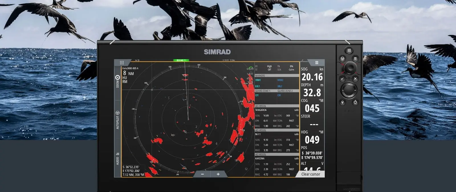
Putting chart markers into the radar view
Simrad Marine Electronics has announced a Navigation Aid feature for its recreational HALO radar family, bringing chart-derived symbols for navigational marks into the radar application. The company introduced the development on 27 October as a way to help boaters distinguish channel markers and special-purpose marks from other returns. The concept is straightforward: give the helmsman more context without requiring constant switching between chart and radar screens.
The function is intended as an additional aid to situational awareness, not as a substitute for interpreting radar properly. It is especially relevant when a crew is negotiating unfamiliar channels, but the accuracy of symbols will still depend on the underlying data and compatible equipment. Operators must continue to use visual observations, charts and normal navigation practices.
The difference between a mark and a target
A conventional radar view shows reflections from land, vessels and other objects, but an echo does not always identify what produced it. Simrad’s new feature overlays icons for fixed navigational marks using information from C-MAP premium cartography. By matching radar information with mapped context, the system aims to reduce the time spent deciding whether a return may be a marker or something that needs immediate attention.
It is important to separate recognition from certainty. A mapped symbol does not prove that the physical buoy is in exactly the expected position, nor does every radar return correspond neatly to a charted object. The feature should help the operator ask better questions of the available information rather than remove the need for judgement.
Working alongside AutoTrack
The development builds on Simrad’s AutoTrack capability, which identifies and follows certain radar targets. Navigation Aid adds a different kind of information: symbols drawn from navigation charts rather than only target tracking. The company says this should help users distinguish moving vessels, potential hazards and stationary marks within the same operational view.
That relationship matters because a busy display can become difficult to read when several data layers are active. Helmsmen should learn how each symbol is presented and what settings are appropriate in restricted visibility or at night. Familiarisation is a practical requirement, particularly when installing an update before the start of a boating trip.
Which displays are in line for support
Simrad identifies NSX, NSX ULTRAWIDE, NSS 4 and NSO 4 multifunction displays as compatible platforms for the forthcoming NEON OS 2.6 release. The company says the software is scheduled for the fourth quarter of 2026. The feature is also described for several B&G Zeus variants, reflecting the broader Navico Group electronics portfolio.
A model name alone is not sufficient to establish that an individual installation will work. Owners should check exact hardware compatibility, installed software and chart versions with the manufacturer or an authorised installer. A staged update is sensible for boats with several networked devices, and any installation should be checked before heading into demanding navigational conditions.
A C-MAP chart dependency
The release specifies compatible C-MAP DISCOVER X or REVEAL X charting as a requirement for Navigation Aid. That is a material detail for users who currently rely on another chart family or have older data. The radar antenna is only one part of the solution; chart licensing and suitable displays are also necessary.
Before upgrading, an owner should confirm the coverage required for the intended cruising area and whether a subscription, chart purchase or software update is involved. The availability of symbols can vary with the underlying data. The feature is most useful when the navigation system is configured as a coherent whole, with current charts and a crew that understands their limitations.
Controls and the option to switch it off
Simrad says the new overlay can be enabled or disabled through the Vessels and Targets menu on compatible displays. That flexibility is important because different operators prefer different presentation styles, and a cluttered screen can be less helpful than a simple one. The ability to choose the information shown is a core usability issue for modern multifunction displays.
The correct setup may also change between open water, a narrow channel and a crowded harbour. Users should test the feature in familiar conditions before relying on it during a more difficult passage. Training the crew to understand the display and to return quickly to a basic radar view is a useful precaution.
A step towards better-integrated information
The announcement reflects a wider shift in recreational electronics towards bringing sensor information and cartographic data together. When implemented well, that integration can reduce cognitive effort at the helm. It can also introduce new dependencies, as the usefulness of the combined picture rests on current data, software compatibility and correct configuration.
Simrad has not presented Navigation Aid as autonomous navigation, and boaters should avoid treating it that way. Its greatest value is likely to be providing a clearer visual reference for a human operator who remains responsible for interpreting the surrounding environment. The forthcoming NEON release will allow compatible owners to evaluate the feature in their own boats.