
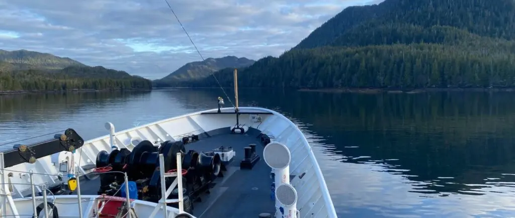
A new look at the Ketchikan approaches
NOAA Ship Fairweather has completed a hydrographic survey campaign in the approaches to Ketchikan, Alaska, replacing a patchwork of historic depth observations with modern seabed measurements. The work covers parts of Revillagigedo Channel, Dixon Entrance and the surrounding passages, waterways used by local boats as well as commercial traffic.
The Office of Coast Survey described the project in an update dated 7 October 2026, following work that began in April. This is a report about newly collected survey information, rather than an announcement that every electronic chart cell in the area has already been revised.
For boat owners visiting southeastern Alaska, that distinction is essential. Hydrographic measurements are the raw foundation for chart improvements, but an operator still needs the latest official chart, notices and local navigation guidance at the time of passage.
Fairweather is homeported at Ketchikan and is a dedicated NOAA hydrographic ship, a point independently confirmed by NOAA's Office of Marine and Aviation Operations. Its 2026 work began close to its home port before the vessel moved into other Alaskan survey assignments.
Why older soundings needed another examination
NOAA says substantial sections of the project area previously depended on surveys from the late nineteenth and early twentieth centuries, with another portion dating from the 1970s. Those records were useful to the mariners of their day, but a lead line or single-beam sounding describes a much smaller part of the seabed than comprehensive modern coverage.
The difference is not simply a matter of plotting more numbers onto a screen. In a rocky archipelago, isolated depth readings can leave unmeasured space between tracks, while an area-based survey can help identify features that older methods were unlikely to reveal.
One of the historical records highlighted by NOAA is a smooth sheet of Harry Bay surveyed in 1933. It makes the original surveyors' work visible and illustrates why a chart compiled from sparse measurements cannot automatically be treated as equivalent to contemporary full-bottom mapping.
Several generations of survey teams have contributed to this effort since the wider regional project began in 2020. Fairweather's latest phase continues work by NOAA vessels Rainier and Fairweather, bringing different field seasons together into a longer-term programme rather than a one-off inspection.
Where the modern survey reached
According to the Office of Coast Survey, Fairweather collected 2,617 linear nautical miles of survey tracks during the project. NOAA identifies Nichols Passage, the vicinity of Metlakatla and waters south of Duke Island among the areas receiving high-resolution bathymetric coverage.
That length is the sum of survey lines reported by the agency, not the length of a single continuous cruising route and not an area measurement. Readers should also avoid assuming that every adjacent cove or shore approach has been mapped to the same standard simply because the wider corridor was surveyed.
Bathymetric lidar formed a useful complement to multibeam sonar in nearshore conditions. NOAA reports that previously gathered airborne lidar data reached about ten metres below the surface in suitable conditions, allowing its small-boat survey teams to plan work with a better picture of potentially hazardous shallow ground.
Each method has limits, including water clarity, terrain, equipment geometry and the practical constraints of operating close to rocks. The value comes from combining evidence, cross-checking coverage and eventually translating reviewed survey information into products mariners can use reliably.
Why the passages matter to leisure boats
Ketchikan sits on the waterways linking communities along southeastern Alaska's Inside Passage. Ferries, fishing vessels, supply traffic and visiting recreational craft use related channels, although their drafts, handling and operating priorities differ considerably.
Metlakatla, in particular, has strong connections to fishing, seafood processing and marine transport. NOAA's team also visited the local high school during its fieldwork, illustrating the human side of a project that could otherwise be described only in soundings and equipment specifications.
For a small cruiser, additional seabed detail may ultimately support better judgement about route selection and the margins around shallow hazards. It does not replace the need to account for weather, tidal streams, visibility, marine traffic or the vessel's own depth beneath the keel.
Nor does a new bathymetric survey make unfamiliar water intrinsically safe for close inshore exploration. Skippers should still avoid treating a single sounding, a privately shared track or an out-of-date plotter display as a guarantee of sufficient clearance.
What a skipper should check before departure
Owners navigating toward Ketchikan should confirm that their electronic navigational charts are the current official editions and that relevant corrections have been applied. NOAA distinguishes critical corrections, which can be released rapidly, from routine updates that may take more time to compile into chart products.
Check the chart supplier's update procedure rather than assuming an onboard multifunction display has refreshed itself. Local notices, Coast Pilot information and advice from harbour authorities can add operational detail that is not conveyed by a bathymetry layer alone.
The October survey account should be read as an important improvement in the underlying knowledge of the region, not as a new permission to enter any particular channel or anchorage. Safe decisions depend on the published navigation information available when a voyage actually takes place.
NOAA's larger purpose is to strengthen charting for a demanding coastline while supporting the transport and fishing communities that depend on it. The measurable outcome for leisure boaters will emerge as the collected data is processed, assessed and reflected in official navigation products.