
New funding for information on the water
The National Fish and Wildlife Foundation and the US National Oceanic and Atmospheric Administration announced a new round of vessel-strike prevention funding on 18 November 2026. Their programme allocates $8.4 million to sixteen projects, with a further $1.2 million in matching contributions. The supported work covers acoustic monitoring, satellite analysis, detection software and the delivery of information to vessel operators.
For the recreational boating industry, a particularly relevant part of the announcement is a project examining smaller vessels that may not transmit their positions through the Automatic Identification System. Fishing boats and recreational craft are specifically among the vessels identified. A system that primarily reaches large commercial ships may not adequately inform these operators, even when they travel within the same coastal areas.
The announcement does not describe sixteen finished marine products available for purchase. It concerns grants intended to advance development, assessment and deployment. A small-boat owner should distinguish the future potential of the research from the information and navigational tools actually available during a forthcoming passage.
Where the interests of boats and wildlife overlap
The foundation identifies waters along the Atlantic coast where the movements of whales overlap with shipping and recreational boating activity. These include areas near major port entrances and locations used by whales for migration, feeding and calving. Small recreational craft may use some of the same routes as larger commercial vessels even though their operating patterns differ considerably.
A boater's ability to identify the location of an animal can depend on sea conditions, visibility, the position of the observer and the time the animal spends at the surface. Information obtained through another source may provide additional context, but it does not guarantee that an animal is visible or remains where it was previously detected.
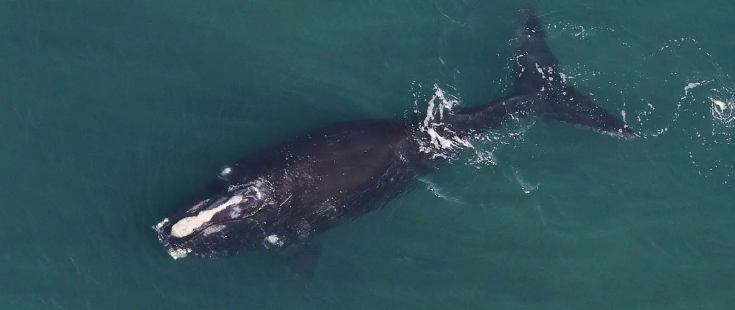
The North Atlantic right whale is among the species specifically identified by the grant programme. The official image accompanying this report shows such a whale at the surface and was taken under an identified research permit. It is an archival research photograph, not a recent sighting report that can be used to plan navigation. Recreational operators should not attempt to reproduce research approaches to protected wildlife.
Listening for whales rather than relying exclusively on sight
One of the funded initiatives involves Sofar Ocean Technologies. Its proposed PodCast project will examine a network of acoustic monitoring devices intended to provide information about whale presence at a regional scale. A separate Cornell University project will investigate whether existing fibre-optic infrastructure can contribute to detecting sounds, with computer analysis used to identify the relevant signals.
These approaches illustrate the distinction between detecting an animal and observing it directly from a boat. Acoustic data can potentially contribute information when an animal is not visible at the surface. The data still need to be interpreted correctly and related to a meaningful location and time. An animal that is not vocalising, for example, may not be represented by a particular acoustic detection system.
The announcement does not establish the effective detection range, false-alert rate or delivery latency of the resulting technology. Those characteristics will influence the practical usefulness of any future information service. It is premature to regard the research as an assurance that every whale within a monitored area can be detected.
Satellite imagery and the smaller vessel
Arizona State University will investigate computer models that analyse high-resolution imagery from satellites to improve whale detection. Another funded project led by Ocean Science Analytics will use satellite data to study vessels below 65 feet in length. The vessel population includes recreational craft and smaller commercial fishing boats.
This distinction is potentially important because participation in electronic identification networks varies among boats. A skipper operating a small craft may not have the same equipment as a professional ship's bridge. A traffic assessment that depends entirely on signals transmitted by vessels equipped with AIS can therefore omit part of the activity in a coastal region.
A satellite observation represents information gathered under particular conditions at a particular time. The results are not automatically equivalent to continuous tracking of every boat or animal. The frequency of observations, quality of imagery and means of interpreting it will affect what can be established.
The funded vessel research aims to inform the development of warnings that reach recreational mariners more effectively. It is not a new legal requirement to purchase AIS equipment, nor does the announcement establish the launch of a new mandatory boat-tracking service.
Getting information to a person operating a boat
Conserve.io will undertake work associated with the Whale Alert platform. The grant supports the integration of real-time detection information and improvements to the ways in which notifications reach operators. Increasing participation is also part of the proposed activity.
For a small-boat operator, an information service has to be considered in relation to the circumstances in which it will be used. A notification on a telephone may be helpful during preparation before departure. On the water, the device may be exposed to spray or poor connectivity, and the skipper may need both hands for other tasks. A useful alert must communicate its relevance without imposing an unreasonable distraction.
Not every recreational boat has a permanently installed multifunction display or a reliable connection to shore-based data. A service designed for this audience needs to take such variations into account. The November announcement identifies improved delivery as a project objective, but it does not give a schedule for particular application updates or guarantee compatibility with individual onboard devices.
An operator should continue to use established navigation practices and current official information. The presence or absence of a notification must not be treated as proof that the surrounding waters are clear of wildlife.
California research and the question of voluntary measures
A project led by the California Marine Sanctuary Foundation will examine the relationship between whale habitat and vessel traffic. The stated aim is to identify voluntary approaches that operators can use to reduce the risk of collision. This differs from the development of a new sensor or an automated warning device.
The value of such research may depend on how well its findings can be translated into practical information. A small boat may have different safe operating limits from a larger ship, particularly in changing weather. A suitable decision must account for the actual circumstances of the passage rather than depend on a generally applicable manoeuvre derived from a brief research description.
The November announcement does not itself create new speed limits, exclusion zones or legal duties. Applicable rules must be obtained from the competent authorities for the waters being navigated. A recreational operator should also distinguish guidance intended to prevent collisions from rules governing deliberate observation or approach to protected species.
Further research may provide a stronger basis for future advice, but existing obligations remain relevant while the projects are being developed.
Combining several types of information
The grants approach the issue from different directions because no single source of information necessarily answers every question relevant to a person making decisions on the water. Acoustic observation, interpretation of satellite imagery and a report from another operator can have different strengths and limitations. The time at which an observation was made is especially important when the subject is a moving animal.
A future system may be able to combine several such inputs, but it will also need to represent uncertainty in a manner that users can understand. The location of an observation should remain distinguishable from an inferred region in which an animal could now be present. A poorly understood alert can create misplaced confidence, even when its underlying research has been conducted carefully.
For equipment manufacturers, the announcement highlights the importance of designing information services around actual user needs. For sailing and boating organisations, it provides a subject to follow as future guidance and tools become available. The announcement does not validate the effectiveness of a particular consumer collision-warning product or demonstrate that the funded methods are ready for widespread installation.
The programme's second funding round
The Vessel Strike Avoidance Fund is administered through the partnership between the foundation and NOAA. Eight awards were announced in 2025. With the sixteen new grants, the organisations report a cumulative total of twenty-four awards, representing almost $12.3 million of grant funding and approximately $14.3 million when associated matching contributions are included.
Those figures describe financial commitments to projects rather than the value of products already delivered to the marine market. The practical outcomes will need to be assessed as the research progresses. A development that provides promising results in one geographical area may require further work before it can be used in another.
The significance for Leisure Boat Guide is the explicit recognition that smaller vessels and their operators form part of the problem that better information may help address. Recreational boating has requirements distinct from commercial shipping, and ensuring useful advice reaches these operators is itself an important technical and organisational challenge. The new grants offer a basis for following that work without assuming its eventual results. Skippers should continue to consult current official navigational and wildlife guidance for their intended waters.
Source and lead photograph
Official source: NFWF and NOAA announcement, 18 November 2026. Lead photograph: North Atlantic right whale — NOAA Fisheries/NEFSC, photographed under MMPA research permit #21371; archival agency photograph accompanying the announcement. Archival NOAA agency photograph, credited as supplied in the announcement. NOAA content reuse guidance; no NOAA endorsement implied.