
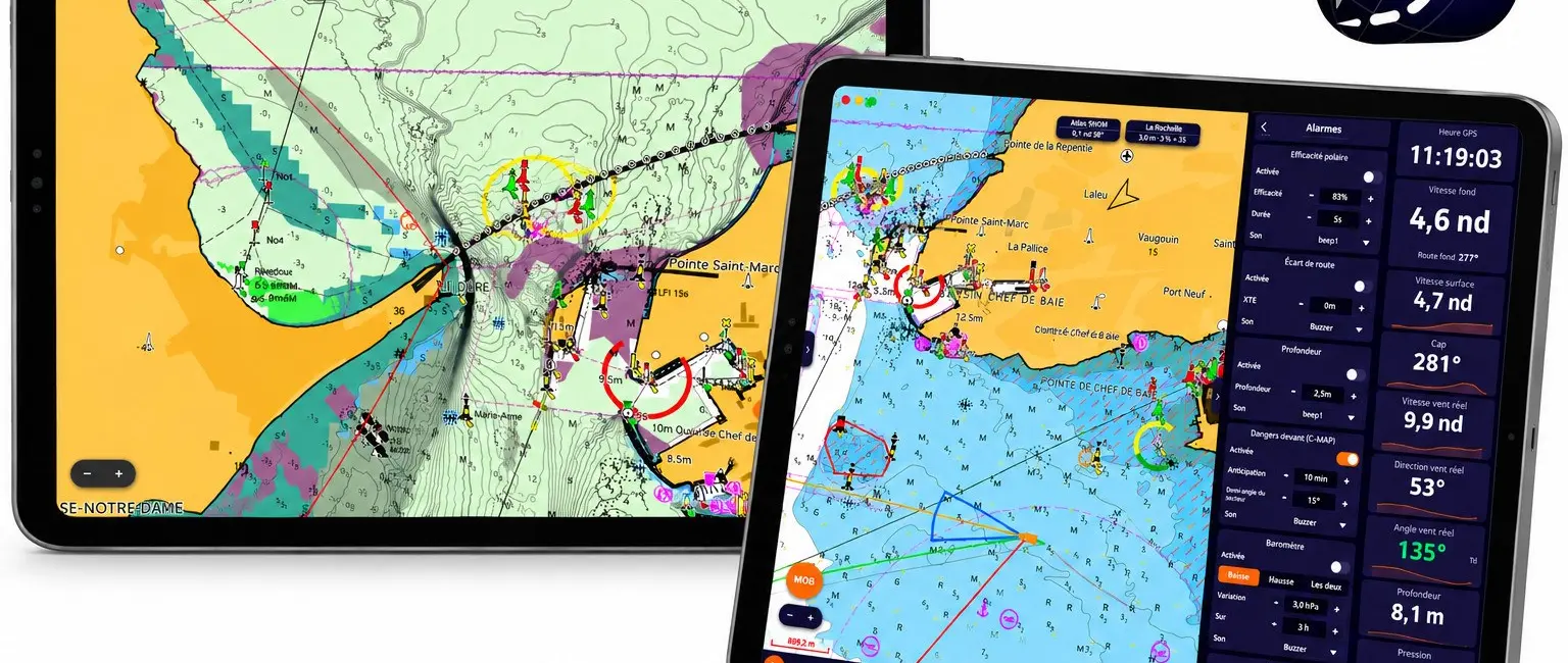
New chart options for a familiar navigation app
NavimetriX has added C-MAP DISCOVER X and REVEAL X chart options, giving recreational boaters a new way to combine detailed electronic cartography with the app's existing weather and passage-planning functions. Digital Yacht announced the integration on 22 October 2026, highlighting the closer connection between chart information, routing tools and instrument data.
The update matters because a practical navigation setup is rarely built around charts alone. Small-boat owners also need reliable weather context, awareness of depth and obstructions, and a way to check what their equipment is reporting, particularly when operating in unfamiliar coastal waters.
DISCOVER X and REVEAL X do different jobs
The new chart integration introduces details such as depth information, bathymetric mapping and a choice of chart display styles, including a night setting. According to Digital Yacht, users can download relevant charts for offline use, which is helpful for passages where mobile coverage is inconsistent or simply unavailable.
REVEAL X adds optional visual layers that can include high-resolution underwater contours, satellite imagery, shaded relief and information about seabed composition. Coverage can differ from one area to another, so a prudent skipper will confirm which features are available for the region being cruised before treating them as part of a trip plan.
Automatic routing needs a human check
The integration introduces C-MAP AutoRouting to support route creation between a vessel's position and a selected destination. Digital Yacht says the calculation can use inputs such as the boat's draft and air draft alongside charted hazards, restrictions, tidal information and navigation marks.
A Hazards Ahead alarm is also described as part of the new routing tools, adding another prompt when the planned track approaches a mapped danger. Neither feature removes the need to cross-check a route against current official navigation information, weather, local notices and the actual conditions seen from the helm.
Where the new approach may be useful
For a weekend cruiser entering a new harbour, the most immediate gain may be the ability to inspect possible shallow areas and restrictions while also consulting a forecast. A larger route can be broken into shorter sections, with particular attention to approaches, tidal windows and potential alternative stopping points.
Sailing crews will value the chance to review wind and wave forecasts alongside their charts, while fishing and coastal-cruising owners may look more closely at bathymetric detail. These are planning aids, however, and available information should always be checked for scale, currency, local coverage and its suitability for the boat.
Connecting the chart app with the boat
NavimetriX runs across iOS, Android, Windows and macOS, and the developer supports synchronisation of projects across compatible devices. Digital Yacht says the application can also display available GPS, NMEA and AIS information when connected to appropriate onboard hardware, so chart planning can sit beside live data.
Digital Yacht points to its NavLINK Wi-Fi interface as one example of how data from an NMEA 2000 network can be shared with compatible applications. Actual functionality will depend on the instruments, interfaces and network configuration installed on an individual boat, making compatibility checks worthwhile before purchasing additional hardware.
A sensible approach to upgrading
Owners interested in the new charting options should first verify the operating systems they use, chart coverage in their cruising grounds and the terms of the relevant C-MAP licence. Digital Yacht notes that charts can be available on more than one device under licence conditions, but that does not mean every account, chart area or device combination will be interchangeable.
The integration is best understood as another layer in a well-prepared navigation workflow rather than a replacement for seamanship or independent checks. Digital Yacht's announcement provides the product details; skippers should confirm current app versions, chart updates and equipment compatibility through the official providers before relying on the tools underway.