
Work is scheduled to begin at Havelock on 9 November
Port Marlborough has begun a major programme to restore the Havelock navigation channel and renew the adjoining marina infrastructure in New Zealand's Marlborough Sounds. The port's official announcement, dated 4 November 2026, states that Isaac Construction is scheduled to establish its worksite on Monday 9 November. The project addresses persistent sedimentation after the severe storms of 2021 and 2022 and is intended to keep access reliable for aquaculture vessels, local residents and recreational boats. The programme is a significant practical development for skippers who use the sheltered route into Havelock.
Worksite establishment is not the same as completing dredging or reopening a new jetty. Port Marlborough expects the combined project to be finished near the end of 2027. Boaters should check current notices while the work proceeds rather than interpret the start announcement as proof that the shallow channel has already been restored. The main story for small craft is that a long-running access problem now has an approved construction programme and identified funding.
Storm deposits changed the scale of dredging
Historically, maintaining the Havelock channel required the removal of approximately 1,500 cubic metres of sediment every five years. Port Marlborough now estimates around 20,000 cubic metres may need to be removed over a similar period following the 2021 and 2022 storms. That represents more than thirteen times the previous maintenance quantity. The comparison helps explain why ordinary periodic dredging was no longer regarded as a sustainable solution and why a larger channel reinstatement project has been planned.
The figures are estimates of material volume, not measurements of depth at every point along the route. A boat drawing half a metre and another drawing a metre can face very different restrictions as water levels change. Even a shallow-draft trailer boat may risk touching bottom when navigating outside the maintained channel or cutting a corner. Owners must continue using recent local depth and marking information until the work has been completed and surveyed.
The entire channel is in the project scope
The port proposes to reinstate the channel along its full length, covering areas inside and outside the marina boundary. The work is intended to establish a reliable route that can subsequently be maintained on a roughly five-year dredging cycle. A comprehensive approach matters because deepening only a marina basin would be of limited value if the connecting channel remained difficult to navigate. The route is the link between Havelock and the Pelorus and Kenepuru Sounds.
Reinstatement will not mean that every nearby shallow area becomes a safe passage. Dredging plans define specific channels, and the seabed beyond them retains natural hazards. Skippers should follow the latest marked navigation route, keep watch for work vessels and avoid taking shortcuts across areas of uncertain depth. Once the project is complete, a hydrographic survey and updated information will be more useful than any general claim that the entire harbour is now deep.
Marina piers D, E and F will be replaced
The redevelopment includes replacement of ageing timber jetties D, E and F with modern floating concrete pontoons. The new infrastructure is planned to provide improved water, electricity and communications connections for users. Such work can make a difference to owners of smaller cabin boats, who depend on reliable pontoons and shore services even when their vessels do not require the large berths associated with superyachts. Port Marlborough is also planning a new twenty-metre jetty for visitors and Sounds residents.
Modern pontoons can improve access and reduce some maintenance difficulties, but the design does not automatically grant a new berth to every local owner. Individual allocation, size limits, electrical specifications and commercial terms will be set by the operator. A visitor should confirm where to land and whether temporary facilities are open while construction is under way. The planned jetty is part of a future installation, not a dock available for immediate use on the announcement date.
A $9.9 million government loan helps finance the project
The reinstatement and marina works have financial support from a NZ$9.9 million loan through the Government's Regional Infrastructure Fund, administered by Kānoa. The wider project has been reported at approximately NZ$19.8 million. That means the loan is a substantial part of the financing but should not be described as the whole project budget or as a grant that never has to be repaid. Port Marlborough is responsible for managing the undertaking and its associated long-term obligations.
Financing arrangements are important because dredging is not a one-off activity in a sediment-prone harbour. Continued maintenance requires suitable equipment, survey information and money for future campaigns. A port can reopen a channel after a major project but still struggle if it cannot fund the work needed years later. The stated aim is to develop a more sustainable maintenance programme, though its practical success will only be evident after the works and subsequent surveys.
The channel supports regional services
Port Marlborough says approximately eighty percent of Marlborough's aquaculture production is landed through Havelock. The harbour is also described as an essential marine connection for around 950 permanent residents and 130 businesses in the Pelorus and Kenepuru Sounds. Those figures show why the channel cannot be judged solely as a recreational boating amenity. Commercial vessels, community transport and local services also rely on access to and from the waterfront.
Recreational skippers share responsibility for using the channel without obstructing workboats or commercial traffic. In confined waters, the navigation room available to a larger vessel may be limited, especially where dredging equipment occupies part of the route. Smaller motorboats should maintain a proper lookout and understand the local rules applicable to passing and overtaking. A busy working harbour needs patience and clear communications from all users.
Construction brings temporary access changes
The contractor's programme affects parts of the basin and the channel towards Cullen Point. Boating New Zealand reports that pier removals are scheduled during December and dredging of their basin is planned for January. Contractors expect to issue navigation notices, mark the works and communicate with port users. The article also states that the main marina road and public boat ramp are intended to remain open through the project, subject to operational circumstances.
Those assurances should be understood as the published plan, not a guarantee that there will never be a temporary restriction. Boats may need to wait while a dredger manoeuvres, and work zones can move as the project advances. A skipper should follow current harbourmaster instructions and avoid assuming that yesterday's track through the channel will still be available. Checking before departure is especially valuable for a small boat launched from a trailer, because the crew may have little time to reorganise a trip once afloat.
Shore parking works will be staged
Part of the marina edge and carpark is scheduled for raising and rock protection as the wider redevelopment proceeds. The public programme indicates a pause over the busy summer period, with certain parking areas reopening between 18 December and 9 February before works resume. These dates are planned staging arrangements and should be verified close to the time of a visit. Construction sites can change access arrangements when weather or engineering conditions require a revised programme.
Owners of smaller boats may be especially affected by land-based works because they often need space to load equipment, park a towing vehicle or collect passengers. A project that keeps the ramp technically open may still create congestion nearby. Visiting skippers should allow extra time and consult local notices on access and parking. The benefit of a new marina will ultimately depend on both the water route and the shore facilities functioning together.
Survey information should guide each trip
The port has acknowledged that the storms changed sediment movement significantly, making channel maintenance more demanding. Later reporting indicates that more frequent hydrographic surveys may be used to monitor the route. These measurements can help identify changing areas and support decisions about navigational marks and future dredging. For a skipper, recent official depth information is much more reliable than a memory of where the channel ran several years ago.
A boat's draught is not a fixed figure under every condition; load, trim and motor position can influence the clearance required. Tides and weather also affect available water. A conservative safety margin helps protect propellers, rudders and hulls from damage. Skippers should not attempt to interpret a general news report as a substitute for the latest charts and local navigation directions. The project's progress will need to be reflected in the information boaters actually use.
What the works mean for small-boat owners
The verified development is the start of a major Havelock Channel Reinstatement and Marina Redevelopment Project, with worksite establishment scheduled for 9 November 2026 and completion projected for late 2027. The plan addresses sedimentation, replaces several jetties and adds a visitor facility, supported partly by a NZ$9.9 million government loan. It is relevant to recreational craft well under twelve metres as well as to larger commercial vessels, because all depend on a navigable connection to the Sounds.
Until the channel and marina works are completed, prudent owners should use current official notices, maintain appropriate clearance from construction equipment and plan for possible changes in access. The project is designed to improve long-term reliability, but new infrastructure cannot remove every hazard of navigation in sheltered waters. Its value will be established when the reinstated route is measured, maintained and safely used by the communities and boaters who depend on it.
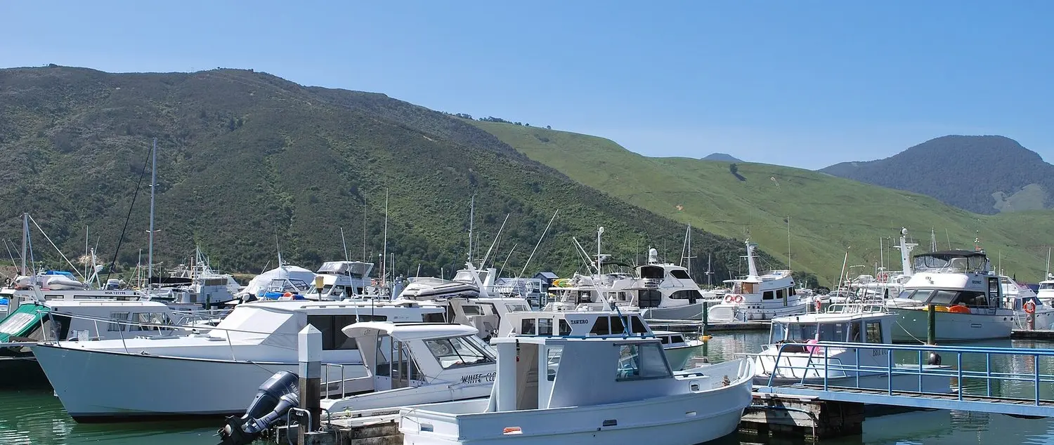
Sources: Port Marlborough official announcement, 4 November 2026 and Boating New Zealand construction information, 5 November. Photograph: Havelock Marina, New Zealand, by Mattinbgn, Wikimedia Commons, CC BY 3.0, resized. Archival view, not a construction-progress photograph.
