
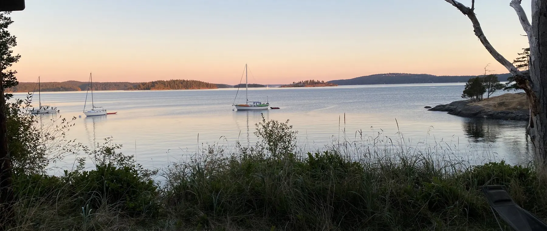
Two San Juan Islands docks are out of service for winter
Washington State Parks has confirmed that seasonal moorage docks at two boat-in destinations in the San Juan Islands have been removed for winter. An alert dated October 21, 2026 says the Doe Island Marine State Park dock is no longer in place, while a separate October 15 alert gives the same status for Jones Island Marine State Park. These are practical changes for small-boat skippers planning late-autumn trips, particularly those expecting to step directly from the boat onto a fixed or floating landing. A previous-season map or photograph should not be used as proof that a dock is currently available.
The two closures deserve their own place in a weekend cruising plan. At Doe Island, a park description still explains the usual north-side dock arrangement, but the active alert supersedes that general description for the winter period. At Jones Island, the park continues to describe moorage facilities and visitor activities while prominently flagging the dock's seasonal removal. The distinction between an amenity normally provided and one presently available is exactly why operators should check live park notices before departing.
These changes are different from the ongoing dock and pumpout construction at Stuart and Sucia islands, which Washington State Parks separately announced for autumn 2026. A crew planning a multi-island itinerary should look at each location individually, rather than assuming the same service disruptions or restrictions apply throughout the archipelago. This update focuses on the immediate docking implications at Doe and Jones, where the October seasonal notices are clear.
Doe Island: no public park buoy as a fallback
Doe Island's published boating information describes a dock on the island's north side and two smaller coves used by kayakers on the south side. It also states that the park has no Washington State Parks moorage buoys, and that buoys in the area are privately owned. When the public dock is removed, skippers must not assume an otherwise empty-looking private buoy is available for recreational use. Whether suitable legal anchoring is practical depends on the boat, bottom, tide, exposure and current rules, all of which need assessment on the day.
The island remains attractive to visitors for its compact loop trail and wooded scenery, but an attractive destination is not in itself a safe or lawful landing plan. Small boats should avoid attempting to land on an unsuitable shore simply to reach a campsite or walking trail. Wave action, rocks, slippery ground and changing tides can quickly make disembarkation difficult, particularly for families or passengers with reduced mobility. If the available access cannot be confirmed, choosing another destination is a prudent and entirely reasonable decision.
Operators should also distinguish a private mooring field from a state-managed moorage site. The park explicitly tells visitors to respect private property, and the absence of state buoys removes a familiar alternative during dock closures. A boater planning an overnight stop should therefore make a firm alternate arrangement well before sunset. Do not count on arriving after dark and discovering an available tie-up by chance.
Jones Island: check buoys, limits and water availability
Jones Island Marine State Park differs from Doe in that its published amenities include moorage buoys, but the October 15 notice still means the seasonal dock should not be expected for winter visits. Washington State Parks describes the park as boat-in only and lists anchorages in the north and south coves, each exposed to different wind directions. Its boating notes caution about charted and uncharted rocks, as well as boat wakes. A skipper should review the current chart and make a weather-based choice instead of simply heading for the cove used on a previous summer trip.
There is also a water-supply issue. A June 26, 2026 park alert says drinking water is unavailable at Jones Island until further notice because of a leak, and the park directs visitors to bring their own. This is particularly important for overnight camping parties and for smaller boats that do not carry generous freshwater reserves. The dock removal and the potable-water closure are separate constraints that should be checked individually before departure.
State Parks rules limit the use of its moorage buoys to vessels no longer than 45 feet overall, with potentially smaller posted limits at specific parks. Buoys are first come, first served, and rafting to a buoy is not permitted. Owners of larger boats should not interpret the presence of a buoy symbol as confirmation that they may legally use one. Even a qualifying boat needs to inspect conditions, pay any applicable fees and have a backup plan if the available moorings are occupied.
What the seasonal changes mean for a weekend route
Autumn itineraries often rely on shorter daylight, variable winds and fewer support services than a midsummer San Juan Islands cruise. With the Doe and Jones docks out of service, even a modest daytrip should have an agreed return point that does not depend on a particular island landing. The skipper should identify a suitable launch or marina, confirm any nearby protected anchorage and ensure the fuel reserve covers a safe diversion if conditions change. A chartplotter route is helpful, but it cannot create a usable dock where one has been removed.
For visitors who were hoping to hike or camp, access becomes the crucial question. Some paddlers may be able to use shore approaches that are inappropriate for motorboats, but that does not give a powered craft permission to beach at the same location. The safest choice depends on the vessel’s draft, water depth, wave conditions and posted access rules. A captain should contact the park if there is uncertainty about the current landing arrangements rather than relying on recollections from previous visits.
Moorage charges and registration rules still apply where a valid public facility is used. Washington State Parks states that moorage fees normally apply from 1 p.m. through 8 a.m., that sites are generally first come, first served and that visitors must register as required. It also limits stays at an individual park to three consecutive nights. Those rules do not override an active closure notice: paying a fee or holding an annual moorage permit does not restore an unavailable dock.
Safety considerations around island approaches
The San Juan Islands require attention to currents, wind funnels, rocks and changing visibility. Near Jones Island, State Parks notes a reef at the northeast entrance to North Cove and charted rocks along the southeastern shore, as well as weather-related differences between North and South coves. That local detail underscores why a general island map is not enough for navigation. A small motorboat should approach cautiously with current chart information, working depth sounder and a lookout, and should never follow another craft blindly into shallow water.
Late-season outings also call for conservative passenger management. Make sure everyone has suitable flotation and warm clothing, and establish a clear plan for an early return if rain, gusts or sea conditions make a shoreline transfer uncomfortable. A useful briefing includes what to do if the planned stop cannot be made, how to contact the boat if a group goes ashore and where the nearest sensible alternative lies. A scenic visit should never become a test of whether passengers can leap from a moving bow onto a slippery rock.
Boaters should keep fuel, communications and lighting margins for unexpected delays. A dockless landing is a particularly poor place to improvise as daylight disappears, and even a short crossing can feel longer in worsening conditions. When uncertainty remains, enjoy the islands from suitable navigable water and return to a confirmed harbor berth. That restraint is often the difference between an enjoyable autumn cruise and an avoidable emergency.
Where to check before setting off
The most useful primary source is Washington State Parks' live alerts page, which lists the dated Doe Island and Jones Island seasonal notices. Each park's individual page provides additional context on usual facilities, boat access and any current closure notices. The rules and moorage-fee pages explain how public buoy and dock use is managed where facilities remain open. Reading those resources together helps prevent outdated infrastructure descriptions from being mistaken for present availability.
Boat owners should also consult a current marine weather forecast, local navigation notices and the latest charts before selecting a San Juan Islands route. Check the operating status of marinas and launches at the start and end of the journey, particularly in the shoulder season. Visitors to Jones should bring adequate drinking water while its supply alert remains in force, and visitors to Doe should not depend on a public park buoy that the park says does not exist.
The essential news is simple: the dock at Jones Island was removed for winter according to the October 15 alert, and Doe Island followed according to the October 21 notice. The islands remain notable boating destinations, but these specific facilities cannot be used as normal dock stops while the seasonal removal remains in effect. Before any visit, verify the live notice and make a route that works even if the planned island landing is unavailable.