
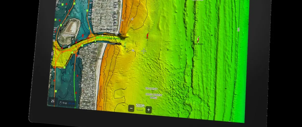
Detailed mapping arrives on Axiom 2
Raymarine has added support for CMOR NEX GEN charts across its Axiom 2 range. The mapping combines high-resolution bathymetry with navigation information and satellite imagery for boaters who want more detail than a conventional base chart provides.
Compatibility applies to Axiom 2 displays running LightHouse version 4.11 or later. The first releases cover South and West Florida, with a broader 13-region catalogue planned as the mapping programme expands.
Built for fishing and route planning
CMOR's detailed seabed information is aimed particularly at anglers looking for structure, wrecks and contour changes. Named wrecks and reefs can make it easier to identify promising fishing areas without manually interpreting a coarse depth grid.
The same information can support route and course planning when crews want a clearer picture of underwater terrain. Marina details, bridge information and other navigation content keep the charts relevant outside specialist fishing use.
Satellite imagery adds another layer
Satellite imagery gives users a visual reference for coastlines, inlets and shoreline features. When combined with bathymetry, it can make unfamiliar areas easier to understand before the boat reaches them.
The display is designed to adapt as users zoom in and out, limiting clutter while preserving useful detail. That matters on smaller screens where excessive information can quickly make a chart harder rather than easier to read.
A growing choice of chart sources
Raymarine continues to support its own LightHouse Charts while also integrating specialist providers such as CMOR. Giving owners a choice lets them select mapping that suits cruising, fishing or the waters they use most often.
For Axiom 2 owners in covered regions, CMOR NEX GEN adds a highly detailed option without replacing the whole navigation system. The value will be greatest for boaters who regularly fish structure or explore coastal waters where detailed seabed information improves planning.