
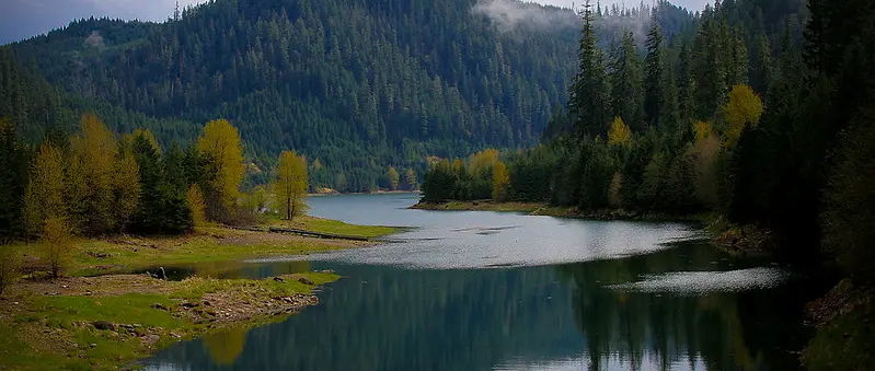
October access report closes both main launch points
Oregon's State Marine Board says Blue River Reservoir in Lane County is at 10% of water capacity and identifies both Saddle Dam Boat Launch and Lookout Boat Launch as closed. The update appears in the board's 21 October 2026 Opportunities and Access Report, making the situation relevant to anyone considering a late-October trailered boat trip. The published information is a facility-status warning, rather than a forecast for when the water will rise.
The two closures matter together because they are the reservoir access points most frequently identified by federal recreation authorities. A driver towing a motorboat cannot assume that finding one ramp inaccessible will leave the other as a practical fallback. The sound decision is to verify current conditions with the managing agencies before travelling, not to reach the water's edge and search for an unofficial launch.
A familiar seasonal pattern, but a specific current warning
Blue River Reservoir is used for both recreation and water management, with water levels changing substantially through the year. Travel Oregon's official visitor information notes that late-summer drawdown can leave the developed launches unusable until the reservoir recovers. That general seasonal pattern helps explain why autumn boating plans require closer checking at this location than at a lake with steadier operating levels.
However, the October 2026 report provides a distinct snapshot: the reservoir is at 10% capacity and both named launch sites are closed. Ten percent capacity is not the same as a statement that the entire reservoir is dry, and it does not establish a water depth at every location. Nor does an historic normal closure date guarantee a reopening date. The access advisory should be treated as the governing practical information for this visit.
Why the two facilities are important
The U.S. Army Corps of Engineers describes Blue River Dam as part of the Willamette Valley system and identifies U.S. Forest Service operation of Mona Campground, Lookout Creek Boat Ramp and Park, and Saddle Dam Boat Launch. These facilities normally connect visitors to water-based recreation in the forested McKenzie River corridor. They are recognised destinations rather than improvised roadside entry points.
Lookout is associated with a paved launch area, dock and campground infrastructure, while Saddle Dam is a distinct access route at the reservoir. The availability of those facilities depends on site conditions, including the position of the water relative to the usable ramp. A web directory that still describes normal summer facilities is not evidence that the ramp is open on a particular autumn morning.
What a closure means for a trailered boat
A closed ramp should be regarded as unavailable for launching and retrieval, even if an access road appears passable or the shore is visible. Low-water shorelines can hide soft ground, abrupt slopes, boulders and debris. Attempting to float a trailer boat from unapproved ground risks trapping the tow vehicle and may damage propellers or hulls before a crew is clear of shore.
Retrieval deserves as much attention as launching. A boat put onto water from an improvised spot may have no safe return route if the wind freshens, the shoreline changes or visibility fades. No one should assume a closure can be bypassed simply because a small craft needs less depth than a powerboat. Any carry-in access elsewhere must be independently confirmed as lawful and safe with the responsible land manager.
Small paddling craft are not automatically exempt
Travel Oregon notes that very low water can sometimes still permit hand-launched non-motorised craft at suitable locations, but this is general information rather than permission to use a closed ramp. Kayaks and canoes do not require a deep launch lane, yet they face different exposure to a reservoir's shifting shoreline, wind and cold-water conditions. A portage that looks short from a map may be difficult over mud or loose rocks.
Prospective paddlers should check the site-specific status and any restrictions affecting access before carrying equipment down. They should also assess the distance from parking to a legal entry point and how they would return in worsening weather. A buoyancy aid, communications plan and conservative route choice are sensible measures, particularly where changing water levels expose obstacles that were submerged during the summer.
The McKenzie corridor still has other attractions
The reservoir lies east of the Eugene and Springfield area, within a landscape known for forests, trails and scenic driving. Recreation.gov describes nearby hiking options, while federal information lists a range of recreation opportunities around Blue River. A cancelled boating trip may still be converted into an appropriate land-based outing, subject to checking road, trail, fire and facility status separately.
That is not a recommendation to redirect boats to another lake without planning. Each nearby reservoir has its own level, launch geometry, rules and possible closures, some of which also change during autumn. Trailer drivers should confirm a suitable authorised ramp and parking space at an alternative before leaving home. An attractive body of water on a map does not prove it is accessible today.
Avoid treating directories as real-time status boards
The Marine Board's 21 October report explicitly records the 10% level and the two closures. The Army Corps of Engineers Willamette Valley recreation guide explains how the sites are managed, and the Travel Oregon Lookout information describes their vulnerability to seasonal drawdown. Each source contributes a different piece of the access picture.
Campground listings and tourism descriptions often retain amenity text when a ramp is seasonally unusable. Before relying on a facility entry, look for a dated status report and, if necessary, contact the appropriate land-management office. Keep the date in view: a July campsite description, an October boating access notice and an hourly water gauge answer different questions and should not be treated as interchangeable.
Low-water precautions extend beyond the ramp
When reservoirs drop, normally submerged timber, shelves and objects may become exposed or lie just below the surface. That changes the risk for any vessel lawfully operating on accessible parts of the water. The absence of a clear lane or a known route should prompt slower navigation and a willingness to abandon the trip rather than pressing into shallow water to reach a favourite fishing spot.
A 10% capacity figure alone cannot tell a skipper where the deepest channel lies or whether underwater hazards have moved. It is also possible for shoreline wind conditions to make a seemingly sheltered location hazardous for a small craft. Planning should include weather, suitable personal flotation, sufficient daylight, a reliable means of calling for help and a return strategy that does not depend on an unavailable public ramp.
What to check before your next outing
For 25 October 2026, the latest identified Marine Board report says both Lookout and Saddle Dam launches are closed. There is no published reopening date in that notice. Boaters should check the state's current access report again before travel, consult managing-agency updates and use only authorised facilities confirmed open. The current closure message is straightforward even if the reasons for low water vary over the year.
Anyone planning a future visit can monitor the situation rather than assuming today's closure is permanent. Water-management and recreation conditions change with rainfall, storage needs and facility readiness, so the restoration of usable launch depth does not by itself mean a ramp is officially reopened. Confirm permission and safe operating conditions on the day, and choose a different outing if those cannot be established.