
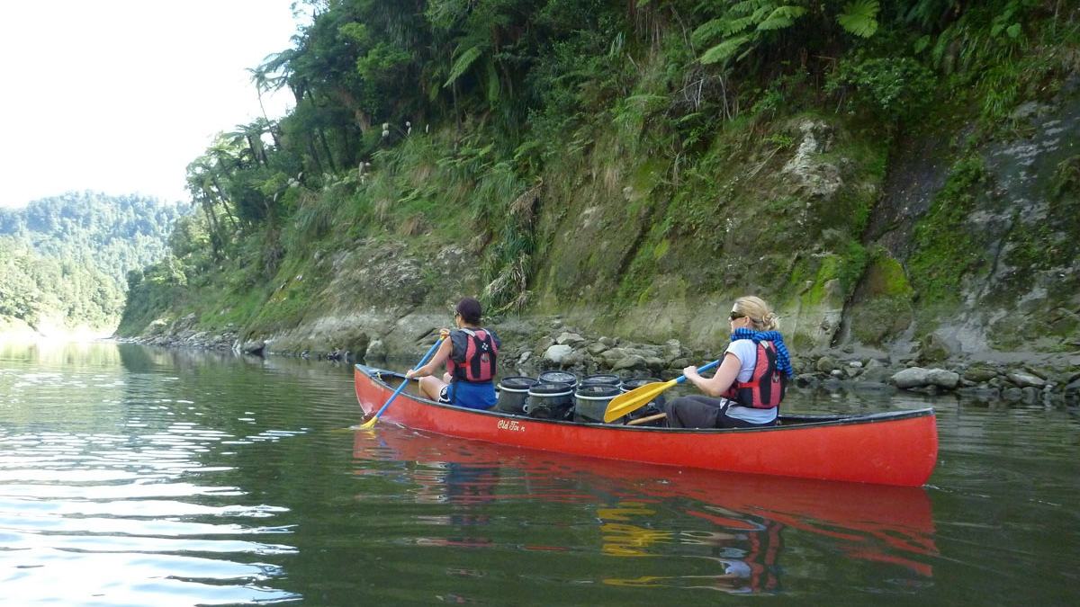
The Whanganui Journey combines forest gorges, river culture and nights at established huts or campsites. Choosing a guided or independent trip starts with the party’s skills and the time available.
Choose the river journey that fits your party
The Whanganui Journey exchanges the usual walking track for a canoe, carrying paddlers through the central North Island’s forested river country. The full route runs 145 kilometres from Taumarunui to Pipiriki and takes an average of five days. Its appeal lies in spending several successive days within the river landscape, rather than collecting a succession of roadside viewpoints.
A shorter version covers 88 kilometres from Whakahoro to Pipiriki, averaging three days according to the Department of Conservation. Businesses also offer shorter excursions and jet-boat trips, providing different ways to experience parts of the river. Those options should be chosen around the party’s actual time, fitness and paddling experience, rather than assuming the shortest advertised trip is effortless.
Decide early between guided and independent paddling
DOC strongly recommends a guided trip for less experienced paddlers and people travelling alone. Independent canoe hire is intended for people who already have canoeing skills and experience, including confident swimming and the fitness for sustained paddling. A scenic photograph should not be mistaken for evidence that the journey is suitable for complete beginners.
The published guidance calls for an independent group of at least two, with enough adults to look after children and teenagers if difficulties arise. It also describes days of six to seven hours of paddling, potentially longer in low flows. These requirements are worth discussing with the group before booking transport and overnight stops.
Watch the landscape close around the river
The upper journey begins amid a mixture of farmland and native bush, with rapids interrupting the passage. Farther downstream, farms become less frequent and forested hills increasingly define the view. The change makes the approach part of the experience, allowing the river corridor to become progressively more remote rather than appearing all at once.
DOC explains that soft sandstone and mudstone have been eroded into steep cliffs, gorges and sharp ridges. Tree ferns and plants occupy the riverbanks, while broadleaf and podocarp forest covers the surrounding land. Looking carefully at those changes gives quiet stretches of paddling their own interest between the more demanding sections.
Whakahoro marks a practical turning point
Whakahoro is the last road access point before the journey ends at Pipiriki. Paddlers starting there enter a section known for tall gorges, moss, ferns and stretches of reflected forest, interspersed with rapids. The combination explains the popularity of the shorter route without making it a sheltered lake excursion.
John Coull Hut and Campsite provide an established overnight stop farther downstream. DOC describes possible sightings of long-tailed bats around dusk, offering a reason to notice the riverside after the paddles are put away. Wildlife encounters remain possibilities, so they should add interest to an evening rather than become promised elements of a booking.
Approach the awa as a cultural landscape
DOC encourages visitors to learn about Te Awa Tupua, the Whanganui River as a living being that sustains land and people physically and spiritually. The river’s significance extends beyond scenery and recreation. Understanding that relationship changes how a visitor approaches a campsite, a bend in the river or a place identified as sacred.
Tīeke Kāinga is a functioning marae as well as a hut, with tikanga that visitors should read before arriving. Tamatea’s Cave is identified as wāhi tapu and must not be entered. These are specific responsibilities within the journey, not interchangeable sightseeing stops that can be approached without regard for the people and traditions associated with them.
Leave time for the Bridge to Nowhere
The side trip from Mangapurua Landing leads to the Bridge to Nowhere, a surviving reminder of the valley’s former farm settlement. DOC gives the walk as three kilometres and about ninety minutes return, with shared use by cyclists. It therefore needs a deliberate allowance in the day’s plan rather than being treated as a quick photo stop.
The landing can be slippery when wet and busy with canoes and boats. Once ashore, the bridge offers a different perspective on the country the river has carried visitors through. It is a walking excursion from the landing, and the published information does not establish a road transfer that removes the return walk.
Listen as well as look for wildlife
The park’s forest supports birds including tūī, kererū, fantails, robins, grey warblers and tomtits. DOC also notes that brown kiwi may be heard at night. These details invite attention to calls and movement around the forest edge, allowing a journey to include observation without requiring a separate wildlife tour.
The river itself supports eels, lamprey, native galaxiid fish and freshwater crayfish among its species. Visitors should enjoy native plants and animals without disturbing them. The value of the setting comes partly from what continues around the canoe, rather than from collecting an encounter or approaching every animal closely.
Plan the nights as carefully as the paddling
Bookings for the 2026/27 season are open, and DOC requires hut or campsite bookings during the Great Walks season. An open booking system does not guarantee space on particular dates. Accommodation choices and the planned daily distances need to work together before transport to the starting point is fixed.
Food cannot be bought at the huts and campsites, and DOC does not provide emergency meals. Paddlers must carry their supplies, including extra food for delays, and be equipped to treat or boil untreated water. Dry storage and a separate dry set of clothing turn those practical arrangements into a more comfortable evening.
Give the river conditions room to change
DOC advises against canoeing when the river is flooding, rising or forecast to flood. It also warns that very low flows can expose obstacles and make paddling harder, while wind can slow progress. The published average duration is therefore a planning guide rather than a timetable that overrides conditions.
The river is shared with jet boats, so paddlers should read DOC’s specific guidance before departure. A distress beacon is part of the recommended preparation because mobile reception is unavailable on the journey. Staying within the group’s capabilities and allowing time for daylight arrivals support the experience described in the itinerary.
Travel lightly through the valley
DOC asks visitors to camp only at designated sites, remove rubbish, use the toilets provided and keep soap and detergent out of the water. Dogs and other animals should be left at home. Respect for the awa also includes avoiding alcohol and smoking at the places identified in the park’s guidance.
The official Whanganui Journey guide brings together current planning information and cultural protocols. Photograph: Department of Conservation (NZ), CC BY 4.0, showing canoeing on the Whanganui Journey.