
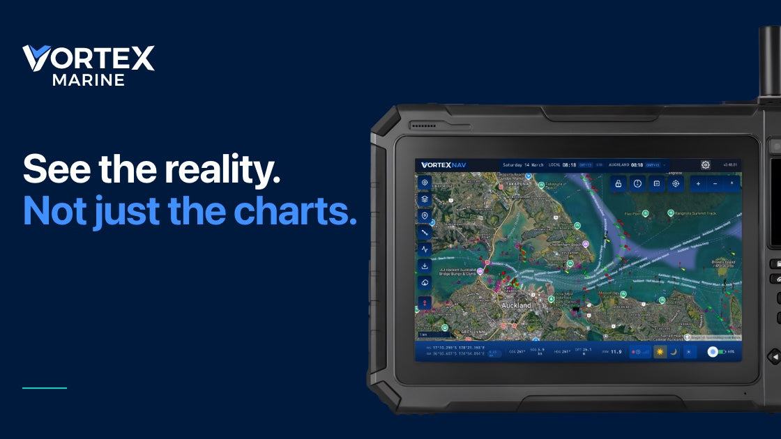
Vortex Marine's portable Scout promises a combined view of electronic charts, satellite imagery and boat data. Our practical review of its published features explains its uses and limits.
A new kind of companion at the helm
A growing number of boat owners carry a chartplotter, a tablet and a smartphone because each answers a different question on the water. New Zealand company Vortex Marine is proposing a more integrated approach with Scout, a rugged 10.1-inch portable navigator designed to combine electronic charts, satellite imagery, weather information and selected vessel data. The device, presented to the marine market in October 2026, is aimed particularly at cruising sailors who visit anchorages and reef-fringed waters where older surveys can leave important gaps.
The strongest part of the proposition is not the claim that one screen can do everything. It is the ability to compare different sources of spatial information while standing at the helm or planning a route below decks. Vortex describes a slider that blends an electronic navigation chart with satellite imagery of the same area. That makes the new device worth examining for its workflow, while keeping a clear separation between a useful visual aid and the approved navigational information on which safe passage planning depends.
How the chart-and-satellite approach works
On a conventional electronic chart, a skipper might see depths, contours, aids to navigation and symbols drawn from survey data. A satellite view can supply another layer of context by revealing the shape of reefs, beaches and passes, especially where the underlying survey is old or sparse. Scout puts the two representations in one view, letting a user move between them with a control rather than juggling several separate applications.
The distinction matters because a picture of a reef is not the same thing as a depth survey. Image colour depends on sunlight, clouds, water clarity, seabed type and the age of the capture; it cannot by itself establish safe clearance below a keel. Vortex itself discusses the risks of historical chart information in the Pacific, but boaters must still verify their route using up-to-date authoritative charts, current notices, tide data, a lookout and appropriate depth measurements.
Used carefully, satellite imagery can help a crew ask better questions before approaching a remote anchorage. Is a pass where the electronic chart appears to show it, and is the outline of the reef consistent with the chosen route? If the layers disagree, the answer is not to favour whichever one looks more attractive: it is to slow down, investigate the discrepancy and choose a conservative approach, or avoid the passage altogether.
Hardware designed to move around a boat
Vortex publishes a full-HD 1920-by-1200 display specification for Scout, with a stated brightness of 1,000 nits. The company also lists 8GB of memory, 128GB of internal storage, microSD expansion and a 14,600mAh internal battery. Those figures explain its positioning as a dedicated marine instrument rather than an ordinary handheld screen, although actual readability and endurance in a particular installation should be assessed directly.
The case is rated IP65 for resistance to dust and water jets when its ports are properly closed, according to the manufacturer. That rating does not mean the tablet can be submerged or left unsecured in a breaking wave, and owners should pay close attention to mounting, power connections and physical protection. The stated aim is to let Scout operate at a helm, move below decks for route planning or travel aboard a tender when appropriate.
A mobile instrument introduces practical benefits but also a new responsibility: it needs a reliable place to live. Before purchasing, consider whether its mount can be reached from the normal steering position, whether glare affects the chosen location and how the device will be charged and stowed. A tablet carried into a tender is no substitute for the tender's own safe navigation arrangements or the knowledge needed to return in deteriorating conditions.
Weather, boat data and subscription boundaries
Scout's Polaris operating system is designed to show weather alongside its navigation layers and can use information from models named by Vortex, including GFS, ECMWF and WaveWatch III. The manufacturer also describes local tide functions, route-planning tools and the ability to read data from a boat's NMEA 2000 network through a suitable wireless connection. That can simplify the display of information already generated by instruments aboard, rather than creating new sensor measurements.
Some of the more elaborate software functions are not part of the basic package. Vortex says its Polaris+ subscription unlocks features such as expanded satellite imagery, advanced AIS displays and the VortexAnchor monitoring tool; the precise inclusion of features depends on the tier. The public product information describes core navigation without a required subscription, with additional options for deeper zoom and downloads, so buyers should review the current feature matrix rather than assuming every illustration reflects the standard purchase.
The company promotes offline use for passage-making, subject to preparing authorised data in advance. That caveat is important: coastal communications can disappear precisely when a crew needs information most, and a beautiful screen without downloaded charts or weather becomes a much less capable tool. Check coverage, storage, charts, permissions and the latest available forecast before leaving reliable connectivity behind.
AIS and anchor watch are aids, not a replacement for seamanship
For users on an appropriate subscription tier, the product page describes the overlay of AIS targets and calculations such as closest point of approach. These functions may improve situational awareness by placing vessel information alongside chart and satellite context, but AIS does not display every boat, floating object or hazard. Target data can be late or absent, so a proper lookout and the collision-prevention rules continue to matter.
The advertised anchor-monitoring functions draw a swing circle and plot movement history, with settings designed to resist accidental silencing. The concept is appealing for a crew sleeping in a crowded anchorage, particularly when combined with local depth and weather information. Even so, no electronic anchor alarm can guarantee that a vessel will remain secure; correct anchoring technique, ground tackle, nearby boats and changes in wind and tide need independent attention.
The same principle applies to satellite photographs. Digital tools can reduce the work of comparing information, but every extra layer can also create false confidence if its limitations are forgotten. Scout should be assessed as one part of a navigation system that continues to include a primary plotter or chart, suitable backups, a sounder, communications and people who understand the passage.
Who should consider a portable marine navigator?
The most obvious audience is a cruising crew that routinely compares electronic charts with visual imagery, or an owner who wants vessel and weather information available in more than one part of the boat. A day-boat skipper who seldom leaves a well-charted local area may obtain less benefit from the additional functions. What matters is the size of the real navigation problem the device solves, not the length of its feature list.
Before buying, ask to see the unit outdoors in strong light, inspect the mounting and power arrangement, and determine which charts and subscriptions are needed for the intended cruising grounds. Check how data gets onto the device, what continues working when disconnected and how any wireless instrument connection behaves if the network fails. These questions reveal more about practical suitability than marketing descriptions alone.
Vortex Marine's Scout is an interesting example of how navigation technology is moving from single-purpose displays toward integrated, portable workstations. Its blend of charts, imagery and boat data has clear appeal, provided users treat each layer for what it can genuinely show. The safest navigator remains the skipper who checks conflicting evidence, keeps a lookout and knows when to wait for better information.
Source
Vortex Marine