
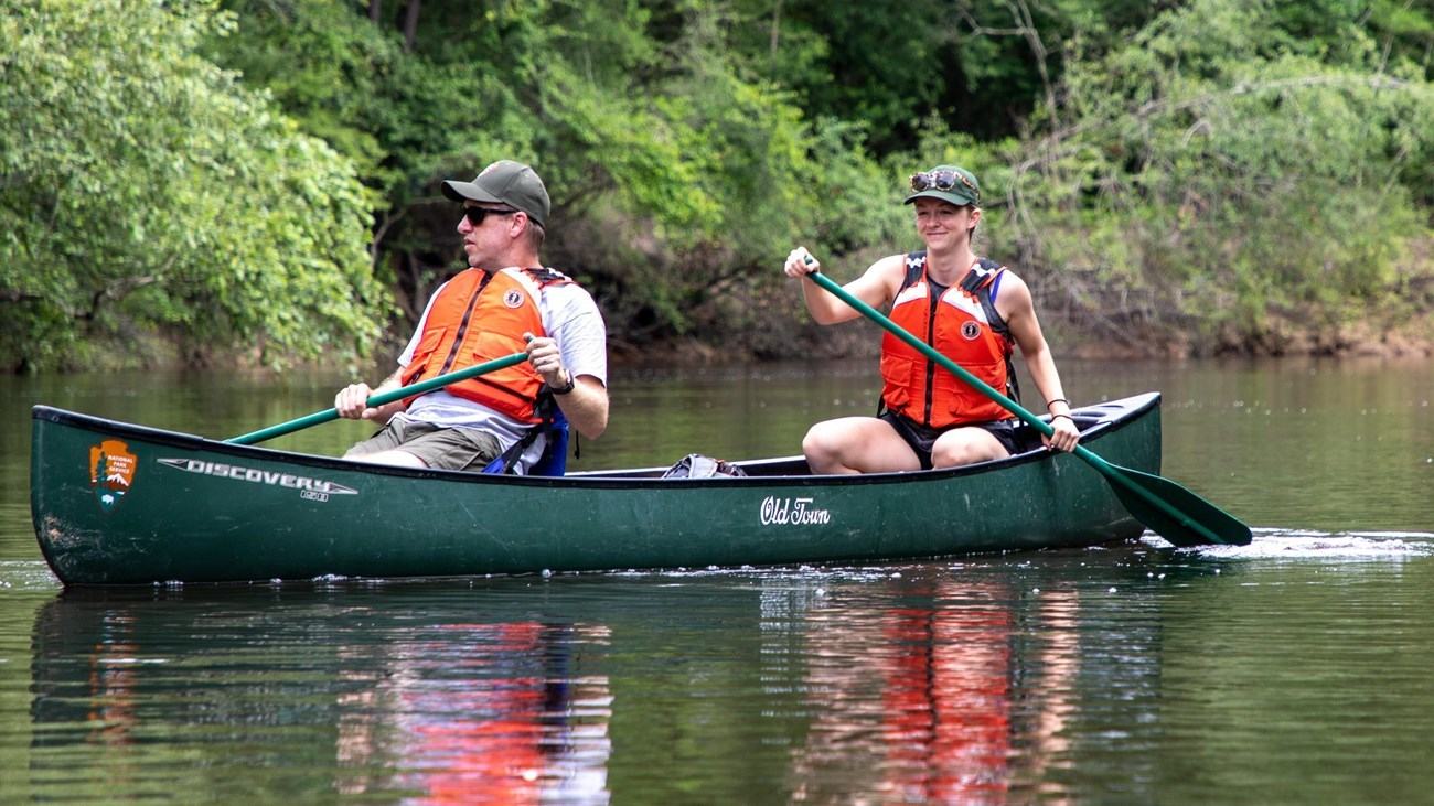
Village Creek offers a 2.1-mile short canoe outing through forest and white sandbars in Big Thicket. Its easy appearance should still be balanced against changing stream levels.
A short stretch of a much longer water trail
Village Creek flows through part of Texas’s Big Thicket National Preserve, a place where forest, sandbars and slow-moving channels offer a notably different kind of recreation from a powerboat lake. The National Park Service maps a twenty-one-mile paddling trail, but its most manageable section is much shorter. A trip from the TX 327 public boat ramp downstream to Baby Galvez Road covers about 2.1 miles, making it an inviting option for families or people building canoe skills.
The route is described as taking less than three hours in ordinary conditions, although a relaxed crew may spend longer enjoying the wooded corridor. Bald cypress, river birch and white sand along the banks give Village Creek its character. Paddlers can stop at suitable sandbars when conditions permit, but should not assume every bank is public or safe to land on. The best itinerary gives time to travel gently and leaves a clear margin for the arranged pickup.
Village Creek has a series of other access points at FM 418, US 96 and Village Creek State Park, allowing stronger crews to make longer journeys. Distances vary considerably between these landings. A newcomer should start by identifying the exact launch and take-out before selecting a boat or arranging transport. A short section can deliver the essence of the creek without turning the outing into an endurance test or requiring a multi-day camp.
Free-flowing water changes the challenge
Despite its often calm appearance, Village Creek is not an artificial channel controlled for recreational convenience. It has no dams holding its level steady, and rainfall can alter depth and speed substantially. The park warns that at low levels, exposed sandbars and logs can require careful navigation or carrying a craft through shallow patches. Higher water may cover familiar beaches but introduce stronger currents, floating debris and less forgiving obstacles.
The NPS guidance identifies conditions below roughly three feet as likely to expose obstructions, while levels at ten feet and above can produce dangerous fast water. These figures are a prompt to consult the recommended current stream gauge and the park’s latest advice, not permission to launch at every intermediate reading. A river can become hazardous because of fallen timber or local conditions even when a single gauge value seems acceptable.
A tree across the channel can trap a kayak or canoe, and the water pushing against branches can make recovery difficult. Scout unfamiliar obstructions from a safe place and take a conservative route around them when possible. Do not try to force a boat through a narrowing gap simply because other paddlers may have passed there recently. If river conditions exceed the group’s confidence, postpone the outing or use a properly guided alternative.
The shuttle is part of the day
Because the creek flows one way, a comfortable float from TX 327 to Baby Galvez Road needs an organised return to the original vehicle. The National Park Service says it does not rent boats or provide shuttles for this route. Independent paddlers must therefore arrange a second car or a reputable local service and confirm the precise pickup location before launching. Leaving the logistics unresolved risks creating a difficult problem at the end of an otherwise pleasant journey.
Even on a short trip, take a map, drinking water and enough provisions for a delay. Everyone should wear a properly fitted life jacket, and footwear should cope with uneven sand and submerged debris. Secure loose items before paddling; retrieving a drifting phone or dry bag from swift water can cause a preventable accident. For children, choose stable craft and an adult supervision arrangement appropriate to the water, not merely to the distance.
The NPS indicates that ordinary use of Village Creek does not require a booking or activity fee, although private boat rental and shuttle services can charge separately. Launch access may still be affected by local weather or maintenance. Confirm present facilities and any parking rules at both ends. If a pet accompanies the group, use appropriate flotation for the animal and keep it leashed on shore according to park regulations.
Enjoy the forest without leaving a mark
The creek is a particularly appealing place to observe changing vegetation at water level. A slow paddle can reveal the structure of cypress roots, the shape of high sandy banks and the calls of birds beyond the nearest bend. Do not land on fragile vegetation to get a better photograph. Use durable sand surfaces where stopping is allowed, carry out waste and keep unnecessary noise low so other visitors can also enjoy a quiet stretch.
A longer excursion can include overnight camping on permitted sandbars, but that introduces a separate set of rules and the need for an appropriate free backcountry permit. A family day trip on the 2.1-mile section should not assume it has the time or gear for camping simply because the trail continues downstream. Keep the plan honest about daylight, ability and the work of returning to the car. There is satisfaction in completing a modest river route well.
Village Creek is an example of how a short float can feel far removed from the road. The combination of forest shade, bright sand and gentle water is attractive, but its true character depends on the day’s level. Check the gauge, arrange the shuttle and select a stretch that matches the crew. When the conditions are right, an unhurried canoe trip here provides a rewarding introduction to the waterways of the Big Thicket.
Primary planning source: National Park Service Paddle Village Creek route and safety guidance. Consult the original National Park Service guidance and current notices before departure.