
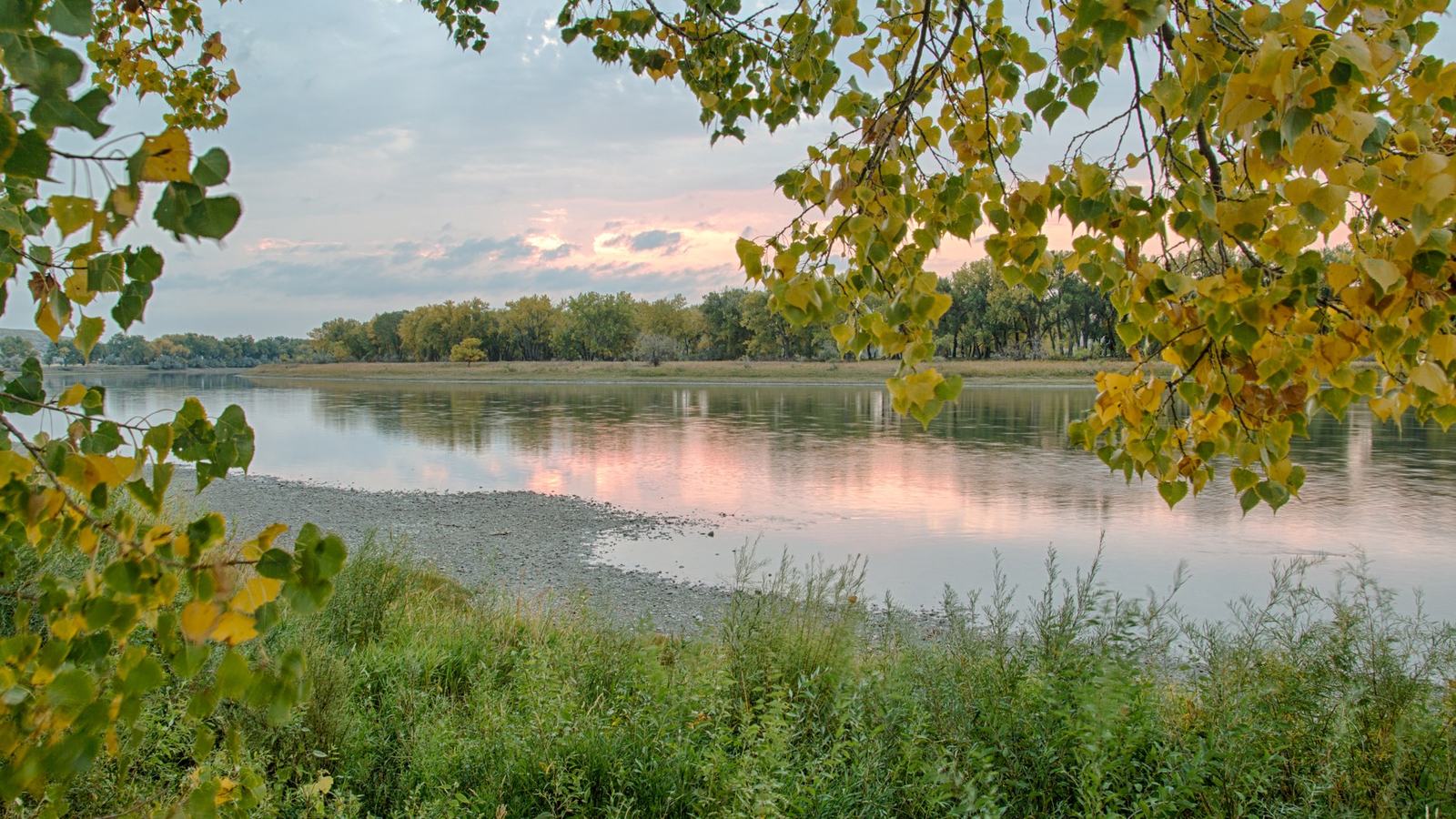
Montana's Upper Missouri River Breaks National Monument rewards a carefully planned canoe or kayak journey with dramatic White Cliffs scenery and remote overnight camps. Our Bureau of Land Management-sourced guide covers launch points, seasonal motorboat restrictions, water supplies, weather hazards and the practical choices that make a multi-day float successful.
An extraordinary river journey through Montana
The Upper Missouri River Breaks National Monument in Montana offers a boating holiday on a remarkable scale: a broad, winding river passing white cliffs, cottonwood bottoms and remote prairie country. The route has a genuine sense of distance, yet it can be explored from a comparatively modest canoe or kayak when conditions and the group's skills are appropriate. For small-boat travellers, the appeal is the chance to experience a historic American river at the slow pace of the water itself.
The Bureau of Land Management manages the visitor information for the Upper Missouri National Wild and Scenic River, whose designated route extends about 149 river miles. Public access points allow visitors to plan anything from a shorter outing to a multi-day float, but distances and the scarcity of services demand careful attention. Unlike an ordinary resort lake, much of this corridor cannot be reached by a conventional roadside stop.
The most popular trip takes in the scenic White Cliffs area, which BLM describes as a two-night float with a take-out on the third day. That is a broad planning example rather than a guaranteed schedule for every group. A paddler should confirm current flow, weather, exact access points and the availability of transport before committing to any date.
Choosing a stretch of river
BLM identifies several principal public launches, including Fort Benton Canoe Launch at river mile zero, Wood Bottom around mile 20, Coal Banks Landing at mile 41.5, Judith Landing at mile 88.5 and James Kipp Recreation Area at mile 149. These locations divide the corridor into practical sections with distinct scenery and travel requirements. The relevant official boater guide should be carried alongside a suitable navigation plan.
Coal Banks Landing is especially significant because it serves as a popular starting point for the White Cliffs float. A crew beginning there can concentrate on a relatively remote section rather than spending the first part of the holiday paddling out of Fort Benton. Choosing where to finish is just as important, because road access is limited and a vehicle shuttle may involve considerable driving.
The BLM offers separate boater guides for Fort Benton to Judith Landing and for Judith Landing to James Kipp, together with maps showing land ownership, camps and access. These are the documents that should determine the precise itinerary. A scenic social-media photograph cannot tell you whether the gravel road to a launch remains usable after rain.
The White Cliffs experience
The White Cliffs landscape gives the Upper Missouri much of its reputation among paddlers. Pale formations rise above dark water and greener riverside vegetation, creating a memorable sequence of shapes and colours as the boat rounds each bend. The scene invites a different approach from a crowded dayboat destination: leave enough time to watch the changing light rather than racing to a distant camp.
BLM describes developed boat camps in the popular White Cliffs section, with facilities such as vault toilets, fire rings and opportunities for walking on public land. These amenities help organise a multi-day trip without turning the river into a fully serviced holiday park. Visitors should still verify the exact facilities at the sites they intend to use and bring the equipment necessary for remote camping.
The landscape is also part of a living and historically layered corridor. The Missouri has carried people through this region for generations, and the monument's setting encourages visitors to approach it with curiosity and restraint. Exploring a side trail can enrich a float, but the correct practice is to identify public land and respect the boundaries of neighbouring private property.
A canoe is often the sensible choice
BLM recommends canoes or kayaks as the preferred non-motorised craft and suggests that an average floater may cover around 15 to 20 miles per day. That estimate depends on group fitness, wind, flow and time spent ashore, so it should not be treated as a promised speed. A raft or drift boat can be less appealing in the generally slow current when strong upriver winds make progress difficult.
Motorised small boats are permitted on parts of the river, but they face specific seasonal rules in the designated wild and scenic corridor. Jetboats and other shallow-draft craft are better suited to many reaches than deep-draft vessels because the water contains gravel and mud bars, while visibility below the surface may be poor. An owner unfamiliar with the river should contact BLM before attempting a motorised passage.
From 15 June to 15 September, BLM sets downstream-only no-wake restrictions on the Pilot Rock to Deadman's Rapids section; another section between Holmes Council Island and Fred Robinson Bridge has certain days without motorised travel and other days with downstream-only no-wake movement. Those regulations do not apply identically along the entire route and may be updated, so boaters must use the official guidance for the exact segment and dates.
Remote travel changes the packing list
Approved personal flotation devices are required for everyone boating on the Upper Missouri, while children under 12 must wear a life vest. Paddlers should fit the equipment before departure and keep it on while afloat. The BLM also recommends layered clothing, rain protection, sun protection and equipment capable of coping with abrupt temperature changes.
Drinking water deserves special attention. BLM suggests planning about one gallon of water per person per day and notes potable water at Coal Banks Landing, but not other public-land sources along the river corridor. Filters and chemical treatment may not remove agricultural or industrial contaminants, so travellers should not assume river water can safely replace a proper drinking-water supply.
For an overnight float, portable toilets are mandatory under the published BLM rules. The allowed systems have specific requirements for carrying waste out for proper disposal, and camping groups should arrange them before launching. This is a practical part of protecting the remote valley and the experience of the next crew, not an optional courtesy.
Weather, current and boat handling
The agency characterises the Upper Missouri as generally an easy Class I river, with riffles and small waves, but cautions about submerged rocks, snags and occasional strong undertows. The apparent calm of a broad river is not a reason to ignore moving-water techniques. Ferry crossings require particular care because cables may hang low and currents around the structures can be dangerous.
Upriver winds can dramatically slow a paddling group, even when the current is helping it downstream. BLM says temperatures in the floating season can range widely, and sudden storms may bring wind, hail or flash flooding. A forecast should be checked before departure and re-evaluated as the crew progresses, with conservative decisions whenever conditions begin to deteriorate.
Mobile service is poor along much of the monument, and BLM recommends a device capable of satellite communication. A responsible contact should know the intended launch, camps, take-out and overdue procedure. A remote holiday is most enjoyable when the crew has enough time, communication options and spare supplies to handle a modest delay without turning it into an emergency.
A river corridor with rules for every visitor
Public and private lands are intermingled along the Upper Missouri, so a boat crew must understand where it may hike, camp or land. BLM guidance permits use of the river up to the ordinary high-water mark but does not authorise crossing or camping on private property without permission. A current map and a respectful attitude make it easier to enjoy the shore without disturbing residents or ranch operations.
At busy launches, prepare equipment before occupying a ramp, leave space for others and keep the party organised. The BLM asks floating crews to work with powered users in narrow channels and asks motorboaters to give docks and landings a wide berth at slow speed. Courtesy matters because a quiet river can suddenly become a constrained working space where everyone needs room to manoeuvre.
Wildlife and the terrain call for restraint too. Rattlesnakes, loose sandstone and slippery banks deserve attention during shore walks, while camping areas must be selected with wind and flash flooding in mind. The remote setting is the principal luxury here, and protecting it is part of being a good visitor.
When to go and how to make it memorable
BLM identifies May through September as the most favourable general boating period, with other forms of outdoor recreation becoming more prominent in the shoulder seasons. That makes an October article especially useful as a planning resource for a later trip. Conditions, restrictions and access can change before next season, so final arrangements should be checked again with the relevant land-management office.
A thoughtful itinerary might begin at Coal Banks Landing, follow the cliffs over several unhurried days and end at an agreed public take-out with a shuttle already arranged. Time ashore could be spent watching the light shift on the formations or exploring a permitted route on public land. Nothing about this journey requires a long or expensive boat, but it does demand suitable gear and a realistic understanding of remote conditions.
The Upper Missouri offers a strong reminder of why small craft remain such compelling travel tools. A canoe gives its occupants access to a broad landscape without insulating them from the sound of the water or the scale of the cliffs. Plan carefully, respect the rules and let the pace of the river determine the rhythm of the holiday.
Official sources and photo provenance
Route, safety and boating-rule information is based on the Bureau of Land Management's Upper Missouri River Breaks visitor-planning guidance and its Wild and Scenic River overview. The landscape photograph is from the BLM's official planning page and is credited to Bob Wick/BLM, whose federal-agency photo work is publicly available; it is not a generated or generic stock replacement.