
A practical Table Rock Lake guide explaining state-park and Corps-managed ramps, marina facilities, the 2026 lake map, sheltered routes and shore excursions.
Table Rock is more than a view from Branson
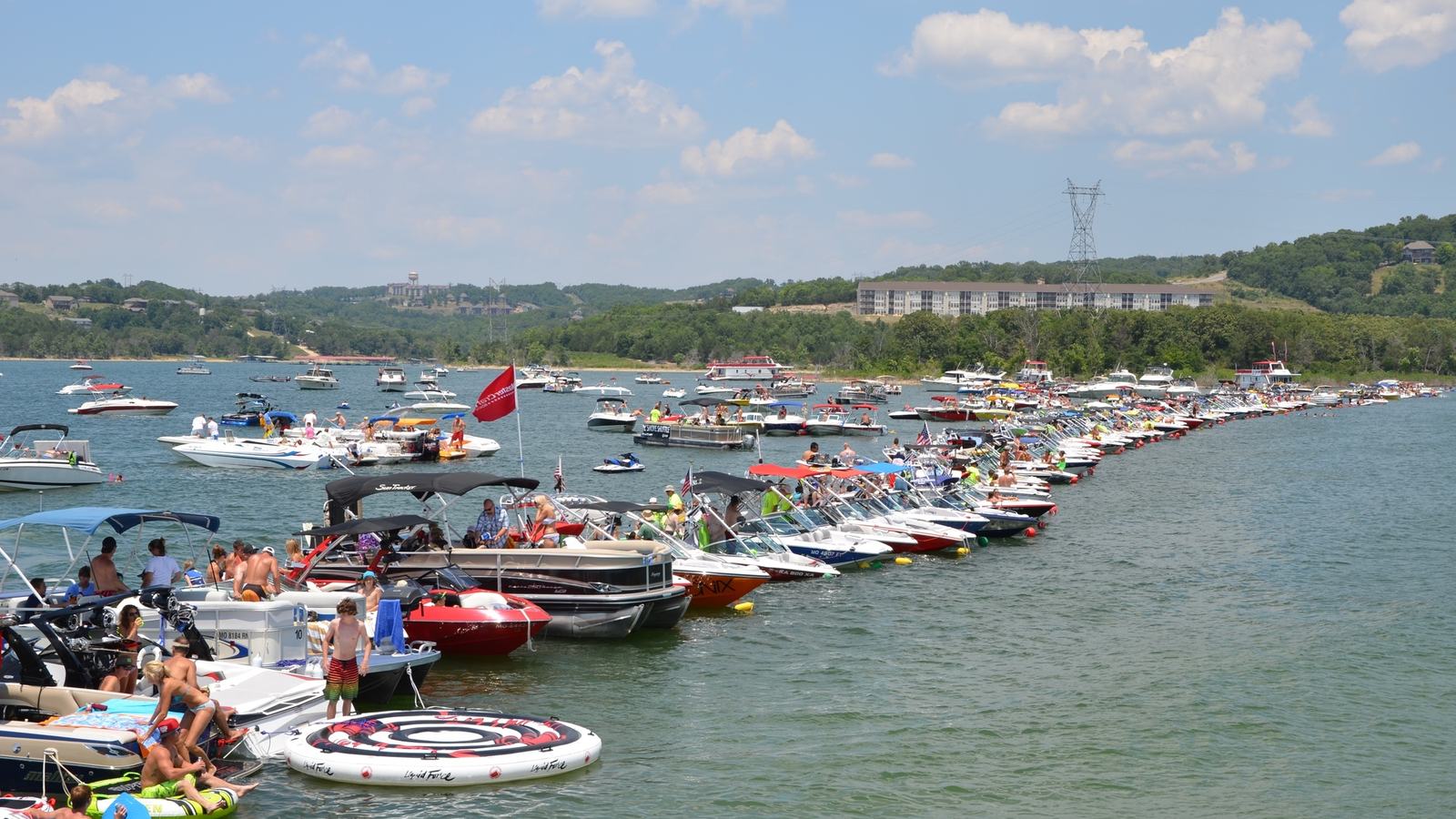
Table Rock Lake stretches through the Missouri Ozarks towards the Arkansas border, offering wooded shorelines, sheltered branches and very different experiences for paddlers and motorboat crews. It is close enough to Branson to combine entertainment ashore with a quiet day on the water, yet it has the scale and changing conditions of a substantial reservoir. A good trip starts by selecting the appropriate launch and one manageable part of the lake.
The U.S. Army Corps of Engineers manages extensive recreational facilities around Table Rock and publishes a facility map for 2026. That map is a particularly useful planning document because it distinguishes launch ramps, marinas, campgrounds, courtesy docks and visitor facilities across different sections of the reservoir. It does not, however, replace current local notices or a skipper’s responsibility to identify water depths and obstacles.
The state park ramp and marina
Missouri State Parks provides one of the easiest introductions at Table Rock State Park. Its official boating page says the park’s launch ramp is near the picnic shelter and park office and is surfaced in concrete or asphalt. It also says no launch fee is charged at this particular state-park ramp, an important detail when comparing the many separately managed access locations around the lake.
State Park Marina adds possibilities for families without their own craft. Missouri State Parks lists rental pontoons, personal watercraft, paddleboards, kayaks and other boats, while the marina also offers excursions and overnight slip options. An advance booking is the sensible approach for a popular holiday period; a website description is not a guarantee that the vessel or berth a family needs will be available on arrival.
A marina stop should be treated as part of the route rather than an afterthought. Allow time for a slow approach, confirm how to call the staff, prepare suitable fenders and lines, and keep children well back from a busy boarding area. The park’s easy access to land-based amenities makes it an attractive start or finish for a short cruising itinerary.
Different operators, different fees
One potential trap for newcomers is assuming that every public ramp on Table Rock operates under the same fee policy. The Missouri State Parks ramp described above is free, but the Corps’ frequently asked questions explain that developed federal recreation areas can have separate day-use fees. A boater moving from one access area to another therefore needs to check the specific operator and present-day conditions, rather than rely on a single rule for the whole lake.
Campers and marina customers may be treated differently from day-use visitors at some Corps locations, and accepted passes may affect charges. The fairest way to plan a multi-day visit is to identify the particular launch, campsite or marina on the official 2026 map and then confirm its fee policy and hours directly. Keeping parking and ramp fees in the budget avoids unwelcome surprises after a long drive with a boat trailer.
The Corps’ online recreation list identifies well-known access names such as Aunts Creek, Baxter, Campbell Point, Cape Fair and Cricket Creek. These are useful route-planning anchors, not promises about the depth, capacity or condition of every ramp on a given day. If your boat is large or draws more water than a typical runabout, speak to the relevant operator before committing to a launch.
Why the 2026 lake map deserves attention
The Corps’ March 2026 Table Rock Lake map includes a clear caution about submerged or exposed points and hazards that may change with reservoir water levels. That warning should shape a skipper’s behaviour before the first mile is travelled. A safe line on last season’s plotter image may not account for shifting shoreline exposure, a shallower ramp approach or local obstructions.
Print or save the map for an overview of recreational facilities, but navigate with current marine information appropriate to the vessel. Keep a safe distance from visible points and banks, and slow down if marks or depths are uncertain. The Corps also cautions boaters about open water in strong winds, reinforcing the value of a short, sheltered fallback route on days when conditions are less settled.
Table Rock’s many branching arms can make navigation interesting even on an apparently calm afternoon. Before leaving the ramp, explain the intended route to everyone aboard, identify the next two possible turn-back locations, and set a practical latest-return time. The most enjoyable boat day is one in which every optional diversion can be abandoned without leaving the crew short of fuel, daylight or patience.
A quieter loop through the Ozark shore
An attractive small-boat outing can be built around one creek arm and a single planned stop rather than a hurried tour of the reservoir. Wooded points, small coves and reflections from the Ozark hills supply the scenery, while a slower pace gives passengers time to notice fishing activity and shoreline birds. Choose any anchoring position on the basis of local permission, holding, depth and forecast wind, not simply on the colour of the water.
The lake accommodates a mixture of fishing boats, rental pontoons, larger cruisers and paddlers, sometimes within a short stretch. Avoid using a narrow creek entrance as a high-speed shortcut, and keep wake down near docks or small craft. An observant passenger can be invaluable when looking for anglers, floating debris and shallow areas while the skipper remains focused on steering.
Children often remember the pauses more vividly than the distance covered. A packed lunch aboard, a short lawful shore walk and an early return for another activity can make a better holiday day than an ambitious crossing with a rushed final hour. Weather, crew comfort and the boat’s range should decide the trip, not an arbitrary target on a map.
The Dewey Short Visitor Center
Near Table Rock Dam, the Corps operates the Dewey Short Visitor Center with exhibits about the lake and watershed. Its official information includes maps, displays and a scenic overlook, providing an excellent alternative when wind makes an afternoon on the water less appealing. A boating holiday benefits from such choices because it keeps the day rewarding even when conditions demand caution.
Operating hours are seasonal, and the Corps shows a different pattern outside the busiest summer months. Visiting families should check the current schedule before planning a trip ashore, particularly in late October. The overlook and displays can also help new boaters understand why the lake’s water levels, public facilities and managed shoreline require more preparation than a casual glance at a brochure suggests.
Missouri State Parks also offers land-based trails and picnic opportunities around the state park. Keep boating shoes and clothing suitable for a walk close at hand, but make sure a secure, permitted place for the boat has been arranged before leaving it unattended. An informal bank landing must not be mistaken for an approved public mooring.
Fishing habitat is an asset and a responsibility
Table Rock has a strong reputation among bass anglers, and the Missouri Department of Conservation reported new and renewed fish habitat work in 2026. State and federal partners placed woody structures in parts of the lake to improve shelter and spawning areas for fish. That is good news for the fishery, while also reminding a cruising skipper that nearshore water may contain structures or submerged material not readily visible from the helm.
Fishing boats can gather near promising banks and points, so a recreational cruiser should pass well clear of people casting or working a trolling motor close to shore. Do not assume a craft that is apparently stationary will remain there, and allow room for it to change direction. Responsible sharing of the water matters as much on a gentle lake outing as it does in a crowded harbour.
Anyone fishing needs to check current Missouri and Arkansas rules as appropriate to their location. The state conservation department maintains Table Rock’s specific fishery regulations, which should take precedence over an old guidebook or an informal remark at the ramp. This editorial itinerary focuses on safe boating and scenery, not on making claims about catch prospects or guaranteed fishing results.
A weekend plan that bends with the weather
On the first day, launch from the state park or another officially confirmed ramp and explore a modest area close to the departure point. Return with spare time for a marina visit or the visitor center rather than approaching dusk on unfamiliar water. This is especially sensible when the crew includes children or anyone still becoming comfortable in a boat.
For a second outing, use the Corps facility map to choose a different accessible section of the lake, but only after confirming the operator, launch fee and current ramp status. Moving the trailer by road may save a long exposed water passage and make a more distant part of the reservoir enjoyable at a relaxed pace. There is no need to cross the entire lake to say that you have experienced Table Rock.
Before each departure, check forecast wind, flotation equipment, the fuel reserve, the communication plan and the intended return time. Be prepared to replace a boat outing with a park walk or visitor-center stop whenever conditions make that the better choice. A good Table Rock holiday is defined by the quality of its time on and around the water, not the number of miles shown on the plotter.
Official sources for current planning
Use the Missouri State Parks Table Rock boating page for its launch and marina information, the U.S. Army Corps of Engineers recreation guide for federally managed facilities, and the 2026 Table Rock Lake facilities map for a current overview. The Missouri Department of Conservation’s 2026 habitat announcement adds context for angling and care around shore structures. Review live notices and posted rules before launching.