
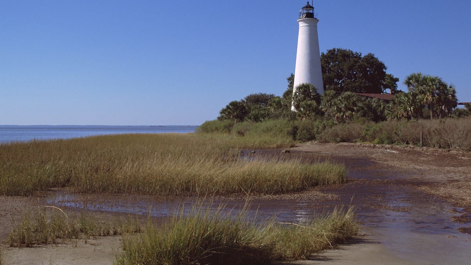
Plan an informed small-boat visit to Florida's St. Marks National Wildlife Refuge: Apalachee Bay, historic lighthouse views, public launches, quiet wildlife encounters and seasonal boating restrictions.
A different way to approach Florida’s Big Bend
Florida's Big Bend coastline rewards boaters who are comfortable with quiet water, broad horizons and unhurried decisions. Around St. Marks National Wildlife Refuge, the appeal comes from tidal creeks, low islands and expansive marsh rather than a busy promenade of waterfront businesses. A small boat gives visitors a fine vantage point, but the best experience starts with a conservative route, a daylight return plan and respect for habitat that looks empty only from a distance.
The meeting of the St. Marks and Wakulla rivers with Apalachee Bay creates several very different outings within a relatively compact part of north Florida. One day might centre on watching birds from a protected creek while another focuses on the working-waterfront character of St. Marks and the lighthouse on the refuge shore. These are not interchangeable destinations for every craft: shallow draft, tide, wind direction and launch access should shape the choice before the boat leaves its trailer.
Begin with the refuge’s own access map
The U.S. Fish and Wildlife Service identifies separate visitor areas rather than a single continuous public boating park. Its main St. Marks Unit has coastal scenery and a saltwater launch, while the Wakulla Unit has an access point to tidal waters and the Panacea Unit includes Otter Lake. The Aucilla River Unit has a public ramp that is operated under a cooperative arrangement with local authorities. These distinctions matter because a launch on a refuge map does not automatically mean the same fees or operating restrictions apply.
Before travelling, find the precise ramp and its managing body, then telephone the refuge if conditions or permissible craft are unclear. A suggested route should be treated as a planning concept, not a substitute for charts, current notices, depth information or on-the-day local advice. The refuge asks visitors to check for closures linked to prescribed burning and sensitive wildlife events; conditions on land can change independently of the weather forecast out on the bay.
The lighthouse as a landmark, not a landing promise
St. Marks Lighthouse makes a natural visual anchor for a gentle coastal excursion. Historic structures carry a special sense of place when approached from the water: the tower is part of a working landscape of channels, salt marsh and migratory habitat. The refuge describes the lighthouse as one of its cultural features, and a short shore-based visit can add context to an outing if access and opening arrangements are confirmed in advance.
Seeing the lighthouse from a boat should never be interpreted as permission to beach wherever the coastline looks inviting. Much of the adjoining terrain is protected or environmentally sensitive, and a shallow patch on an aerial photograph may be mud or submerged vegetation rather than a safe place to step ashore. Plan any walk as a separate, authorised land visit with parking, daylight and visitor-centre guidance already arranged.
Aucilla River and the quieter launch alternative
For owners who prefer river scenery before considering more exposed water, the Aucilla River Unit offers a different setting. Fish and Wildlife Service visitor guidance identifies a boat ramp and fishing opportunities here, with access managed by Taylor County through an agreement with the refuge. It also notes a county user fee at the Aucilla River and Mandalay launch. Confirm the current arrangement directly rather than assuming a national wildlife refuge has a single nationwide entrance policy.
An inland approach can be attractive on a day when bay conditions are unfavourable, but river navigation has its own demands. Bends can conceal oncoming traffic, water levels alter the usable channel and fallen timber may emerge after storms. The sensible leisure route is one that allows ample time to return without racing fading light. Carry a paper or downloaded reference even when a phone appears to have a strong signal at the ramp.
Wakulla Unit and tidal-marsh paddling
The Wakulla Unit offers forests, palm hammocks and marsh opening toward Apalachee Bay. According to the refuge, a small-boat launch provides access throughout the year, with no facilities at the site. That last detail is particularly important: an early start still requires enough drinking water, shade protection, first-aid essentials and a reliable way to get the craft home. A launch suited to a paddleboard or kayak might be unsuitable for a heavier powered boat.
Plan tidal movement as carefully as the route on the map. Outgoing water can leave a shallow creek difficult to navigate, while a strong afternoon breeze may make the return leg much harder than the outward trip. Wildlife observation is most satisfying when the group accepts the landscape's pace. Drift where doing so is safe, keep a considerate distance from nesting and resting birds, and resist the temptation to push through marsh vegetation for a closer photograph.
Otter Lake is a separate boating experience
The Panacea Unit's Otter Lake Recreation Area is a useful reminder that the refuge is not exclusively salt water. The Fish and Wildlife Service lists picnic facilities, restrooms and a small-boat launch at Otter Lake, with a motor-power limit stated in its visitor guidance. This makes it a possible alternative for a family that wants to enjoy a protected-water excursion without taking a small craft into the more open reaches of the bay.
Lake rules should not be inferred from the conditions of a nearby coastal launch. The refuge's general policy specifically limits boating in refuge pools by season and type of propulsion, while its visitor pages describe certain lakes separately. Ask staff which specific water body your trip uses, what motor or electric-drive limits currently apply, and whether the chosen date is inside a permitted operating period. The distinction is more valuable than any attractive photograph of calm water.
An important seasonal rule in late October
At the time of this article, in late October, the refuge's posted rules are especially relevant. The agency states that boating in refuge pools is allowed from 15 March through 15 October, and that only non-motorised craft or boats using electric motors may enter those pools. That date range has ended for the current year. It does not describe every river or bay route, so owners should verify the specific area rather than treating the refuge as uniformly closed or uniformly open.
The Fish and Wildlife Service also prohibits swimming in the refuge and bans drone flights. It advises visitors not to collect natural objects or disturb plants and animals, and to obey posted speed limits. Because local rules sit alongside federal and Florida requirements, a boater should review both the refuge's notices and the state's navigation requirements. A lawful launch is only one part of a safe day; conduct on the water also matters.
Birdlife: enjoy the spectacle without interrupting it
St. Marks is closely associated with the movements of waterfowl and other birds, which is why a low-impact boating approach is so appealing. Marsh channels provide natural viewing corridors, but they also bring a photographer closer to roosting and feeding sites than a roadside viewpoint might. Binoculars and a longer camera lens are far better tools than edging a bow repeatedly toward a flock that is trying to rest.
Watch for changes in behaviour: birds lifting their heads, moving away or taking flight may be signalling that the boat is too close. Slow down early and avoid sharp bursts of throttle near sensitive shores. Keep music low and conversations comfortable rather than amplified across the water. These courtesies are not simply aesthetic preferences; they help preserve the quiet experience for everyone while reducing avoidable disturbance in a landscape managed principally for wildlife.
Fishing within a wider conservation setting
The refuge describes freshwater and saltwater fishing opportunities, including lakes, rivers and bay waters. The St. Marks and Wakulla rivers lead toward Apalachee Bay, and anglers can find very different conditions over a short distance. A scenic cruise may therefore share a channel with people actively fishing from boats or banks. Leave room around lines and stationary craft, and avoid cutting over a likely casting area simply to shorten the route.
Licences, seasons, catch limits and any special refuge rules remain the responsibility of each angler. Check current Florida Fish and Wildlife Conservation Commission information before planning to keep a fish, and do not assume that a species visible in older visitor material is open for retention on the day. For a sightseeing crew, bringing the same restraint to wildlife encounters is a useful habit: observe the water, but let the living landscape remain undisturbed.
Tides, wind and the shallow-water decision
A small boat on this coast is often limited less by distance than by the combination of tide and chop. Low-lying marsh can disguise the edge of navigable water, while a brisk wind across open shallows can make a seemingly minor crossing uncomfortable. Review the latest marine forecast, tide predictions, daylight window and any local notices to mariners. A sheltered creek route remains the better choice when the open bay becomes marginal.
Build the fuel or battery reserve around a possible diversion rather than a perfect straight-line return. Keep a properly fitted life jacket available for everyone and consider wearing it throughout the outing, particularly when travelling alone or paddling. A communications plan should include a charged phone in a waterproof case and the safety equipment appropriate to the craft. Someone ashore should know the launch, intended route and expected return time.
Make the shore visit part of the experience
There is a rewarding two-part itinerary for visitors who do not want their entire day to revolve around navigating a shallow estuary. Begin with a modest, carefully planned waterside outing, then spend time ashore along the authorised refuge road and walking routes. The lighthouse, observation areas and coastal trails provide a second perspective on the same landscape. This approach avoids turning the vessel into a means of reaching unmarked or protected shorelines.
The refuge publishes daylight access guidance and specific information for lighthouse-related visits, but individual building opening times may change. Check the latest notices rather than promising a group that a particular interior will be accessible. An afternoon spent watching the change in light across the marsh can be more memorable than an ambitious route that leaves no margin for weather, wildlife or a relaxed meal.
A small-boat itinerary built around good judgment
For a first visit, choose one modest objective: a sheltered river reach, a known public saltwater launch or a lake expressly open to the craft on that date. Check the operator's guidance for the exact site, study the exit route, establish the turnaround time and keep a second, land-based activity in reserve. This makes the excursion resilient: a disappointing wind forecast can become an enjoyable lighthouse or wildlife-viewing day rather than a reason to push offshore.
The finest thing about St. Marks is also its principal responsibility for visitors. The landscape is a refuge first and a playground second. Arriving with an accurate map, appropriate equipment, an understanding of the seasonal rules and a willingness to leave wildlife alone creates the conditions for a beautiful boating day. The reward is a sense of Florida's Big Bend at its most spacious and unhurried, with the boat serving as a quiet window rather than the centre of attention.