
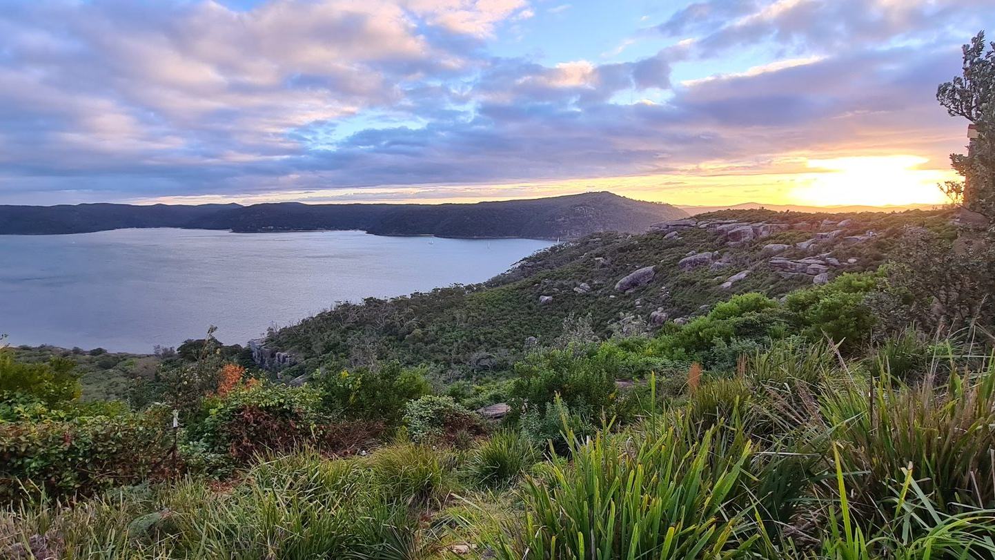
A relaxed Pittwater small-boat plan from Church Point and Scotland Island towards the western bays, with navigation maps, moorings and Barrenjoey cautions.
Sydney's sheltered alternative
Pittwater offers a boating escape with a different pace from Sydney Harbour. North of the metropolitan waterfront, it combines a broad tidal waterway, wooded western bays, settled shores and the distinctive outline of Barrenjoey near the entrance to Broken Bay. For a trailer boat, compact motor cruiser, sailing dinghy or modest keelboat, the attraction is that a genuinely rewarding day need not involve offshore miles. A short circuit can include views of Scotland Island, a pause near a permitted mooring and a return to a familiar launch or marina. But sheltered scenery does not mean a hazard-free lake. This is tidal coastal water with channels, shoals, ferry traffic, local restrictions and weather that can change quickly. Transport for NSW publishes a dedicated Pittwater boating map; that current official mapping is where any actual passage plan must begin.
Build the outing around the crew
Start with the capacity of the smallest person and the least experienced boater, not just the theoretical performance of the engine. An open runabout with young passengers needs a different weather limit and return time from a well-equipped small cruiser. Check the craft's loaded draft, fuel reserve, engine reliability, anchor, communications and lifejacket sizes. Make a modest loop rather than a string of distant promises: the scenery around Church Point and Scotland Island can fill a comfortable half-day, with western-shore views added only if conditions suit. Identify one safe alternative destination in case a breeze makes the exposed part of the route uncomfortable. Make sure a responsible person ashore understands the proposed area and return time. A crew that gets home warm, dry and content is much more likely to be enthusiastic about the next day afloat.
Read the Pittwater map properly
The official NSW 9A Pittwater map distinguishes navigable waters, hazards, aids to navigation, restrictions and boating facilities. It should be used with current local updates, not treated as a decorative overview of the coastline. Study the channels around Scotland Island and the western bays before departure, then keep a reliable way to check your position while under way. Some attractive edges are shallow or sensitive, and the appearance of a cove from the cockpit cannot confirm its depth. Work out an under-keel clearance appropriate for the boat and tide; slow down when depth is uncertain. Maps and electronic navigation systems are aids, not substitutes for looking ahead. A crew member can help by identifying marks and watching for approaching craft. Never let the desire to get closer to a beach override charted water or a posted restriction.
Church Point is an active waterfront
Church Point is a useful geographic reference for exploring Pittwater, with ferries and local commuter services serving communities across the water. Northern Beaches Council identifies its commuter wharf as an important connection for Scotland Island and the western foreshore. This makes the area interesting to observe but not a free berth for every leisure boat. A public commuter wharf may be needed by scheduled vessels, and a small boat should not occupy an operational landing without express permission. Check nearby marina or visitor-berthing arrangements before setting out if you hope to come ashore. Give ferries room to turn and approach, and anticipate passengers moving around jetties. A quiet, courteous transit past Church Point is a better introduction than searching for a vacant spot while obstructing regular water transport.
Scotland Island from a respectful distance
Scotland Island creates the feeling of an inhabited world that depends on the water. Boats carry people and supplies around a shoreline where land access differs markedly from a conventional suburb. That is part of the attraction for visiting crews, but the island's commuter wharves and private jetties are not casual sightseeing berths. Observe from a charted safe route, avoid cutting close to moored vessels and watch for small craft crossing between shore and island. Passengers can enjoy the architecture and the wooded backdrop without approaching individual homes. If planning a shore visit, obtain current permission and landing information beforehand. The boat's wake matters here: someone may be stepping aboard a dinghy or working on a line even when no one appears to be watching your approach. Slow, predictable movements are the considerate choice.
The western bays add a sense of wilderness
Across Pittwater, the green western shore and the bays near Ku-ring-gai Chase National Park give the route an unexpectedly secluded atmosphere. Some coves may have authorised facilities or mooring arrangements; others have sensitive shorelines or practical access limitations. The exact status of any place should be checked against NSW mapping, parks guidance and on-water notices. Do not invent a picnic landing merely because the beach appears empty. A boat that can sit safely in open, charted water and let the crew enjoy the forested slopes may deliver the same pleasure without the uncertainty of anchoring. Consider carrying binoculars and a camera with a modest lens rather than repeatedly steering towards wildlife. Let the shoreline remain a place to look at and respect, not a sequence of private spaces to claim.
Mooring colours have meanings
NSW's official mooring and anchoring guidance describes the different categories of mooring buoys. A vacant-looking buoy cannot automatically be used by a visitor: private, club, commercial and emergency moorings have separate purposes. Check whether a genuine public mooring is provided and whether size, time or other restrictions apply. Even where use is permitted, inspect the equipment and approach with the boat under control, keeping swimmers and other craft well clear. If anchoring instead, make sure the location is lawful, outside navigation channels and suitable for the holding ground and depth. Never anchor casually on sensitive vegetation or obstruct access to a wharf. A short outing rarely depends on using a particular buoy; a good skipper can often choose a different rest point or simply continue enjoying the water.
Barrenjoey and the open-water decision
The opening towards Broken Bay can feel irresistible on a sunny day, with Barrenjoey Head providing one of the area's recognisable landmarks. But moving closer to the entrance also changes the nature of the boating decision. Wind, swell, tidal streams and traffic may be markedly different from the more protected stretches farther south. A first-time visitor in an open boat should not mistake a clear sky over Pittwater for an offshore forecast. Check the conditions and charts for the actual area, including any bar or entrance considerations, and turn back well before anyone is committed to water beyond the boat's comfort and equipment. Enjoying the view of Barrenjoey from a safe position within Pittwater is a complete outing in its own right. There is no requirement to venture out simply because the passage appears nearby.
Seaplane and watercraft restrictions
Transport for NSW identifies a seaplane-related restricted area off Station Beach in Pittwater and publishes separate information on personal-watercraft restrictions. Those are specific operational rules, not optional suggestions. The official chart and current signs must be checked before entering an unfamiliar area or trying a personal watercraft there. Avoid assuming the same access applies to a runabout, sailing dinghy and jet ski. A seaplane operating area deserves especially generous attention, because a pilot approaching the water cannot manoeuvre like a small boat. Keep watch for aircraft and vessels, and obey any exclusion zone. This is a useful reminder that scenic water may be shared by several activities with very different stopping distances. An enjoyable route is one that leaves the required separation and never relies on last-second avoidance.
Waterfront life and the impact of wake
Pittwater's beauty comes partly from its lived-in waterways. Ferries, tender trips, paddlers, moored sailing boats, marina users and families in small craft all share the same narrow passages. Speed should be chosen not only for what the boat can do but also for the effect it has on others. Slow well before approaching a crowded jetty or mooring field, and keep enough distance that a passenger in another boat is not thrown against a rail by your wake. Avoid accelerating into narrow coves where waves will reflect from hard edges. Boats under twelve metres are numerous precisely because they are accessible, but that does not lessen their ability to disturb swimmers or damage poorly secured craft. A considerate skipper thinks about the second and third waves arriving after the boat has already passed.
Plan around summer and shoulder seasons
An Australian summer outing may bring long light and warm water temperatures, but it also brings busy launching facilities and the possibility of strong afternoon breeze or rapid weather change. Shoulder seasons can offer quieter views while requiring more attention to cold, wind and shorter daylight. Consult an up-to-date marine forecast and set a firm latest-return time before departure. Do not build the entire afternoon around a restaurant reservation if the weather is deteriorating or the tide has become awkward. Carry shade and drinking water when heat is a concern, and warm protective clothing when it is not. If swimming is planned, identify lawful and suitable places with clear water and no boat traffic. Nobody should enter the water merely because the boat is stopped in an attractive bay.
Keep the launch simple
Trailer-boat users should choose a ramp suited to the loaded vessel, towing vehicle and tide, checking current access and parking conditions through official local facilities information. Preparation should happen away from the ramp: fit the drain plug, check the battery and cooling system, set out fenders and secure loose luggage before moving into the launch queue. Have a plan for who controls the boat while the trailer is retrieved. On return, allow enough daylight to recover without rushing, especially if a breeze makes the ramp uncomfortable. Boats should not be tied to public access points longer than rules permit. If a familiar launch becomes unavailable or unsuitable, choose an alternative on land rather than forcing an unsafe manoeuvre. Good ramp manners make the day better for every other small-boat crew.
Two gentle itineraries
One sensible day begins near the southern Pittwater facilities, follows a charted route towards views of Scotland Island and leaves time for a sheltered rest before returning. Another can focus on the western bays, with careful attention to permissible moorings and a conservative limit on distance. These are deliberately broad themes, not navigational tracks; water depth, notices, traffic and weather must decide the actual course. A family with children might prefer a short morning on the water and a long shore lunch, while experienced sailors might stay out longer in suitable conditions. Both can experience the distinct character of the estuary. The key is having an easy exit from the plan: if the afternoon breeze rises, there should be no pressure to reach another landmark.
Why the quieter trip wins
A successful Pittwater visit is less about the number of coves entered than the way the crew experiences the estuary. Scotland Island brings a human story, the western shoreline offers quiet green space, and Barrenjoey reminds everyone that the open coast is close even while the boat is within sheltered water. The official NSW map, relevant restrictions and safe-mooring guidance provide the necessary discipline. Add courtesy around ferries and residential jetties, sensible weather limits and respect for nature. Then leave enough time simply to watch the light change over the water. Smaller leisure boats make places like Pittwater accessible, but they ask their skippers to plan honestly and travel with care. Returning early, happy and safe is not an unfinished outing; it is exactly the kind that encourages another.
Sources and picture credit
Primary official guidance: Transport for NSW Maritime. Further official references: reference 1; reference 2; reference 3.
Lead photograph: Pratyeka / Wikimedia Commons, CC BY-SA 4.0. Image resized and recompressed for web publication; original licence retained.

Source
Transport for NSW Maritime