
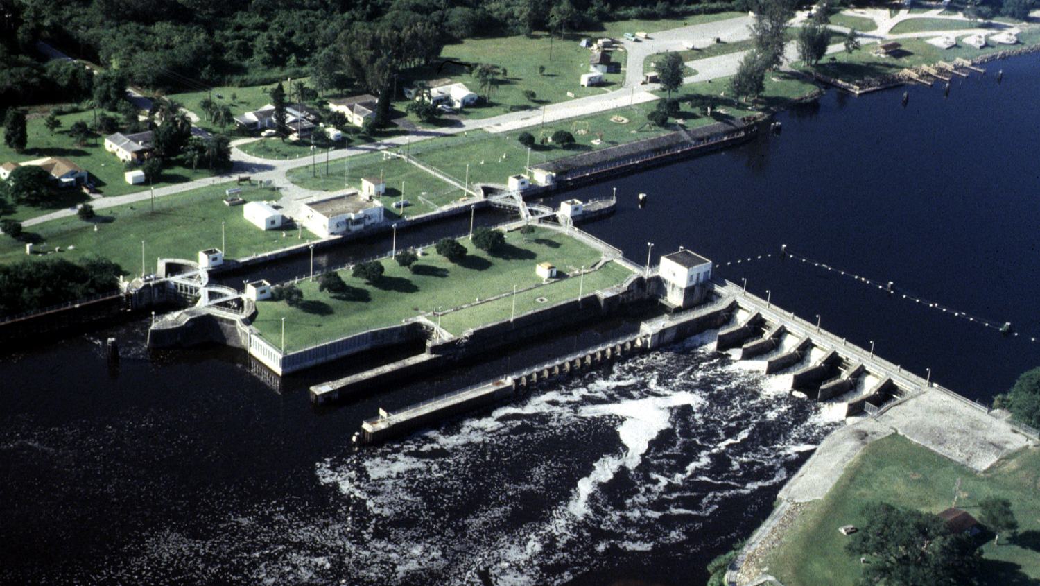
Navigate Florida's Okeechobee Waterway with official Corps guidance on five locks, launch sites, the lake crossing, 2026 depth advisories and safe boat handling.
A cross-Florida waterway made for deliberate cruising
Florida’s Okeechobee Waterway links the Atlantic and Gulf sides of the state through the St. Lucie Canal, Lake Okeechobee and the Caloosahatchee River. For a small powerboat owner, the appeal lies in seeing a quieter interior Florida of canals, river bends and expansive freshwater horizons. It is not simply a shortcut to be tackled at maximum speed: navigation locks, bridges, changing water levels and the broad lake crossing all require proper planning. A sensible voyage might focus on one river section or a lock experience rather than treating the whole journey as a single casual outing.
The U.S. Army Corps of Engineers maintains the navigation infrastructure and publishes both general boating guidance and site-specific Notices to Navigation. Its recreational information describes the choice between an open-water crossing of Lake Okeechobee and a longer route that follows part of the shoreline and rim canal. These alternatives differ in exposure and practicality, so the skipper must use current charts and local advice instead of relying on historical mileages as route instructions. A calm morning on the river cannot guarantee comfortable conditions across the lake.
For crews bringing a trailer boat, the waterway offers a chance to plan shorter outings with reliable access points, weather alternatives and more time to explore. The best choice for a family may be a launch near one of the Corps-managed recreation areas and a return to the same ramp, avoiding the logistical problem of repositioning a trailer across Florida. Whatever the plan, check ramp opening times, water depth and parking arrangements before towing. A safe, unhurried journey begins well before the engine starts.
The five-lock system and how it changes your day
The Corps identifies five principal navigation locks along the Okeechobee Waterway: St. Lucie, Port Mayaca, Julian Keen Jr. at Moore Haven, Ortona and W. P. Franklin. These structures control changes in water level and allow vessels to move between the canal, river and lake sections. The navigation-lock program accommodates recreational as well as commercial traffic, so small-boat operators should expect shared approaches, instructions from lock staff and occasional queues. Timing a passage around lock availability is far more realistic than assuming an uninterrupted run.
Official Corps guidance states that operators can be contacted on marine VHF channel 13 and publishes telephone numbers for individual locks. It also describes standard Okeechobee Waterway operating hours of 7 a.m. to 5 p.m., with the last lockage beginning at 4:30 p.m., subject to notices and changes. Treat these as a planning baseline, not a promise that every lock will be operational at a particular hour. Before departure, check the Corps Notices to Navigation and contact lock personnel when the day’s schedule or conditions are uncertain.
Inside a lock chamber the operator’s instructions take precedence over the helm’s preferred routine. Corps safety information calls for passengers to wear Coast Guard-approved lifejackets and engines to be turned off as directed for locking. Prepare suitable lines and fenders, brief the crew on avoiding fingers between boat and wall, and approach slowly enough to maintain control. A skipper unfamiliar with locks should study the official procedures beforehand and avoid a first transit when visibility, weather or passenger circumstances are already challenging.
Two routes across Lake Okeechobee
The Corps’ boating information describes an open-lake alternative and a longer shoreline-and-rim-canal route. The first can expose a small boat to broad stretches of wind-driven water, while the second may be more sheltered in parts but requires its own checks for depths, channel position and any current restrictions. Neither route is automatically safe merely because it appears shorter or closer to shore on a map. The decision should be made from the boat’s characteristics, present forecast, lake stage and up-to-date navigation data.
Lake Okeechobee is a large, relatively shallow inland waterbody, so rising wind can build difficult short waves and reduce visibility, especially for lower-freeboard craft. The boat should carry reliable navigation electronics plus backup means of locating the route, adequate fuel, working bilge pumping and appropriate safety equipment. Keep a reserve of daylight in case a lock queue or adverse weather slows progress. If conditions look marginal, staying on a calmer section of the canal is the better form of boating.
Approaching Moore Haven or Port Mayaca, resist the temptation to leave the marked navigation route simply to shorten the distance. Waterway conditions can change after storms, seasonal level adjustments and maintenance works. Watch the depth sounder, keep an appropriate lookout and give commercial craft room to maneuver. The official chart and current water-level information should be regarded as essential reference material, with recent local navigation advisories given priority over an old itinerary copied from elsewhere.
The scenic Caloosahatchee and St. Lucie sections
The Caloosahatchee side provides a different kind of boating day, winding through river scenery and communities between the lake and the Gulf coast. The Corps highlights the old river’s off-channel oxbows as part of its recreational appeal. A smaller boat can enjoy selected stretches at a relaxed pace, but the operator needs to know where speed restrictions, shoals and privately owned shorelines limit access. Pulling into an unmarked side channel is not advisable simply because it looks peaceful from the main route.
On the east side, the St. Lucie Canal joins the route towards Stuart. It offers a strong contrast with the open expanse of Lake Okeechobee, with lock approaches, bridge considerations and narrower waters placing greater emphasis on careful speed control. A day built around one lock and a suitable scenic section can deliver much of the waterway’s character without committing to a full trans-Florida passage. Guests should enjoy the change in landscape while the helm remains attentive to navigation.
The Corps lists recreational access and ramps in several areas near its lock and recreation facilities, including St. Lucie South, Ortona and W. P. Franklin. Availability, opening arrangements, local conditions and any ramp fees should be checked directly before arrival. A boat owner should also plan how to retrieve the trailer if the intended journey is one-way. For many visitors, a return-to-start daytrip is both more efficient and more enjoyable than a hurried end-to-end challenge.
What 2026 navigation notices mean for boaters
This waterway is actively managed and subject to operational interruptions. In a 2026 notice, the Corps reported that a lightning strike had temporarily disabled the St. Lucie Lock; an update dated 19 August said the lock was operational again but could need intermittent repairs. That distinction matters when researching an apparently alarming headline: the first closure notice is not the entire current status. Travelers should still ask the lock master about live availability rather than assuming the August update guarantees an uninterrupted transit on any future day.
Another 2026 Corps notice warned of lower-than-normal channel depths on stretches of the Caloosahatchee River between lock sites. These conditions are particularly important for a small cruiser with passengers, gear and a draft that may be greater than a basic fishing skiff. Water levels can affect approaches to docks and marinas as well as the channel itself. Consult the latest lock notices, actual lake stage and the operator on duty before deciding whether to depart, and never substitute a nominal project depth for present under-keel clearance.
Conditions can change after the article is published, so the waterway’s official notice page belongs among the skipper’s saved links. Record the lock telephone contacts, monitor the designated VHF frequency and allow time for a detour or postponed crossing. A planned overnight stop or a safe turnaround point should be part of a longer journey. These preparations allow the trip to retain its pleasure even when a mechanical problem or water-management decision alters the timetable.
An easy-paced itinerary for a small powerboat
Start with a single section matched to the launch location rather than trying to see the whole route at once. On day one, inspect the intended ramp and ask locally about water depth, trailer parking and current navigation restrictions. A short shakedown run allows the crew to confirm fuel use, handling, electronics and the comfort of the passengers. If a lock is part of the outing, observe the approach and make sure everyone understands the line-handling and lifejacket briefing before attempting transit.
On a second day, choose a modest river excursion or a suitable portion of the lake only if the weather supports it. Leave enough time for sightseeing from the boat, a break at a permitted facility and a relaxed return before any late-afternoon deterioration. Where the route approaches locks or narrower channels, slow down early and communicate clearly with crew. Simple pleasures—a peaceful riverbank, changing birdlife and the rhythm of a lock passage—are often the most rewarding parts of the waterway.
A skipper who dreams of the full Atlantic-to-Gulf transit should plan it as a genuine voyage with separately confirmed overnight stops, bridge clearances, lock availability and current route depths. Boat height, draft, fuel range and accommodation requirements vary too widely for a generic timetable to be reliable. Breaking the crossing into manageable legs makes it safer and more enjoyable, while preserving room for delays. There is no merit in racing a lock’s closing time or proceeding onto exposed lake water to save a day.
Safety and environmental responsibilities
A properly prepared boat carries sufficient lifejackets, navigation lights and communications equipment, as well as first-aid supplies, drinking water and a working means of recovering someone from the water. Respect marked speed controls near structures and other craft, and avoid creating a wake that damages banks or endangers anglers. A lookout should also be alert for floating vegetation, debris and changing traffic. The natural appeal of the waterway depends on boaters traveling without disturbing its shorelines.
Florida waterways can be affected by harmful algal blooms and other water-quality advisories. Check current public-health and environmental notices before swimming or letting pets contact the water, and avoid visibly discolored or scummy areas. Do not assume a pleasant appearance guarantees safe water. Dispose of waste ashore at approved facilities, keep bilges and fuel systems maintained, and leave no fishing line or plastic behind at launches or rest stops.
The Okeechobee Waterway is at its best when approached with patience and good information. Official Corps lock guidance, current navigation notices and a realistic view of lake exposure turn a complicated route into a series of manageable decisions. A small boat can experience an unexpectedly rich section of Florida, from river bends to the wide horizon of the lake, without taking unnecessary risks. Plan the passage conservatively and let the waterways—not an ambitious stopwatch—set the pace.