
Lovells Island has wooded trails, beaches and a layered maritime history, including Fort Standish, early range lights and a freedom seeker's escape, but no current camping programme.
A small island with a large maritime history
Lovells Island lies near the outer approaches to Boston Harbor, beyond Georges Island and close to the routes used by vessels entering the port. It offers a surprisingly rich combination of dunes, woodland, former military positions and views towards Boston Light. For recreational boaters, the island can be a rewarding destination, but the National Park Service makes clear that the old visitor camping programme is not currently operating and that the remains of Fort Standish are not open for unrestricted exploration.
The island is managed by the Massachusetts Department of Conservation and Recreation as part of Boston Harbor Islands National and State Park. Its high-water area is approximately 119 acres, including tidal spaces, while three forested hills connect through marshy low ground. The landscape appears natural from a boat, yet much of its present form reflects centuries of agriculture, coastal defence, erosion and attempts to restore vegetation.
Lovells is not one of the islands on the ordinary 2026 public ferry timetable, which focuses on Georges, Spectacle and Peddocks. Visitors should therefore plan any trip around legal private-vessel access and current park information rather than assume a passenger ferry will depart from downtown Boston. The island has no ordinary marina services, drinking-water supply or routinely staffed visitor centre, making a self-sufficient day outing the sensible approach.
Beaches, wooded hills and changing tides
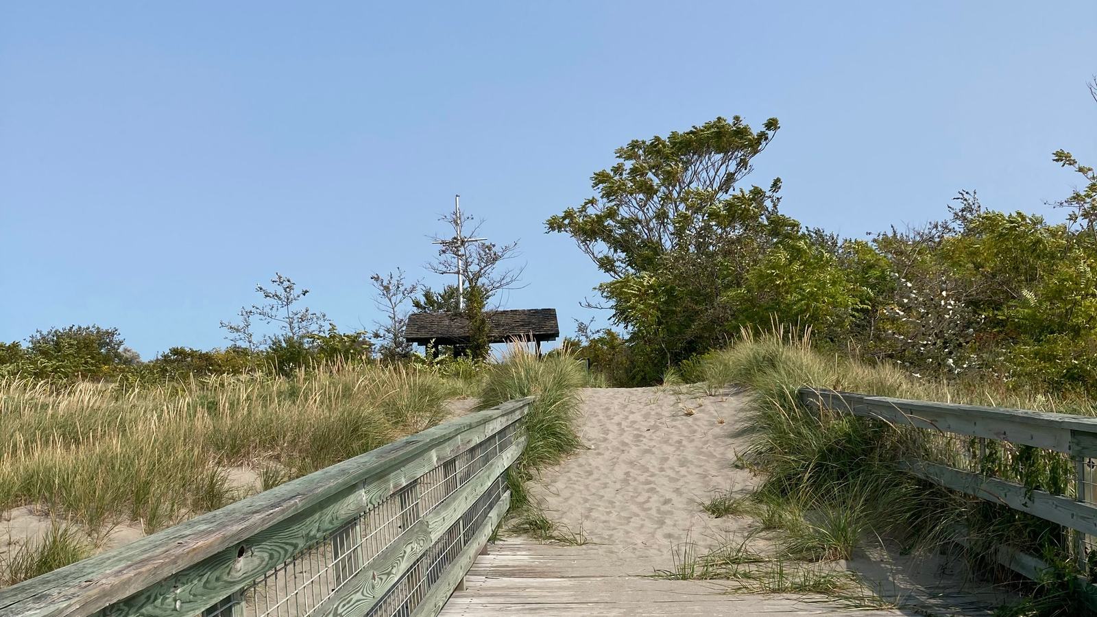
The National Park Service describes a rocky beach, windswept dunes, pine woods and informal trails across Lovells Island. A walk can lead from the landing area towards the remains of older military installations and viewpoints overlooking the surrounding islands. The island's mixed habitats can appeal to photographers and natural-history enthusiasts, particularly when birds use the protected spaces away from the busiest harbour traffic.
The Civilian Conservation Corps planted trees and shrubs during the 1930s in an effort to restore a more wooded landscape. Some of those plantings were later cleared when the military expanded its facilities, and the vegetation has continued to recover after the fort's abandonment. The resulting mixture of planted pines, shrubs and newer growth is part of the island's layered story. It is not simply an untouched piece of coastline preserved without human intervention.
Shoreline conditions vary with the tide, and open-water weather can be substantially different from conditions at a sheltered marina. A family taking a small boat to the island should carry enough drinking water, suitable shoes and protection from wind or sun. The beach is not a supervised swimming facility, and lifeguards should not be expected. Visitors need to make independent decisions about sea conditions and the safety of entering the water.
Fort Standish and the defence of Boston Harbor
Fort Standish became one of Boston Harbor's significant coastal defence sites, with construction starting at the end of the nineteenth century and major batteries ready in the early twentieth century. The installation was named for Myles Standish and was intended to protect approaches used by shipping and potential hostile vessels. Its position reflects the strategic value of controlling the narrow routes into a major Atlantic port.
By the Second World War the garrison included hundreds of service personnel and a network of training and observation facilities. New anti-motor-torpedo-boat guns supplemented earlier batteries, although some of the oldest heavy weapons had become obsolete. The complex was later declared surplus and the island was acquired by Massachusetts in 1958, giving its military landscape a new role within public conservation and recreation.
Many of the fortifications are deteriorating, with exposed concrete, holes, rusty fittings and steep drops. The National Park Service identifies Fort Standish as not open to the public, and a visitor should not enter closed batteries or climb onto damaged structures. It may be possible to observe some remnants from lawful paths, but the absence of a fence at every location is not permission to explore a dangerous ruin. The historic significance is best appreciated without entering restricted ground.
Range lights, shipwrecks and an escape to freedom
Lovells Island also played a role in the history of navigational aids. A pair of range lights was installed in the early twentieth century to help mariners keep to the South Channel. The lights worked together: when the two towers appeared aligned from a vessel, the captain could follow a safer approach. They were later removed as Fort Standish expanded, and today only limited traces of the station survive.
The island's waters witnessed notable maritime incidents long before modern chartplotters and radar. The French warship Magnifique was wrecked off Lovells in 1782, an event reflecting the hazards of navigating this part of Boston Harbor. Local navigation was also tied to the movement of commercial and naval vessels during the American Revolution and later periods of conflict, giving the island significance beyond its small size.
In 1858, a freedom seeker named Philip Smith reached Lovells Island after escaping from a vessel in Boston Harbor. He had been discovered aboard a ship from Wilmington, North Carolina, and swam to the island in cold conditions before obtaining help from another vessel and abolitionists in Boston. The National Park Service preserves this account as part of the wider Maritime Underground Railroad history, adding a deeply human dimension to a shoreline often discussed mainly through military structures.
Private boats and the current camping restrictions
Historic island guides list tent sites, picnic areas, composting toilets and a dock, but the National Park Service expressly warns that camping and visitor services are not currently offered on Lovells Island. A prospective visitor should not treat old campsite counts or photographs as evidence that an overnight permit is available today. The current rules of the park operator and any additional access restrictions must be confirmed before departing.
Private boat operators should also verify their approach and the permitted use of any landing. The National Park Service's older facts sheet lists no dedicated visitor boat slips or moorings, and the wider park partnership warns that not every island has a safe anchorage. A current chart, tide information and suitable local knowledge are important, while any plan to leave a vessel unattended should be evaluated independently from the availability of a shore landing.
Lovells Island provides an unusually varied coastal heritage experience within sight of a major city. Its dunes and wildlife sit alongside the remains of a defensive fort, a lost lighthouse station and the history of a man seeking freedom. That richness is best enjoyed through a cautious day visit that respects closed structures, avoids unsupported overnight plans and leaves the island's natural and cultural features undisturbed.