
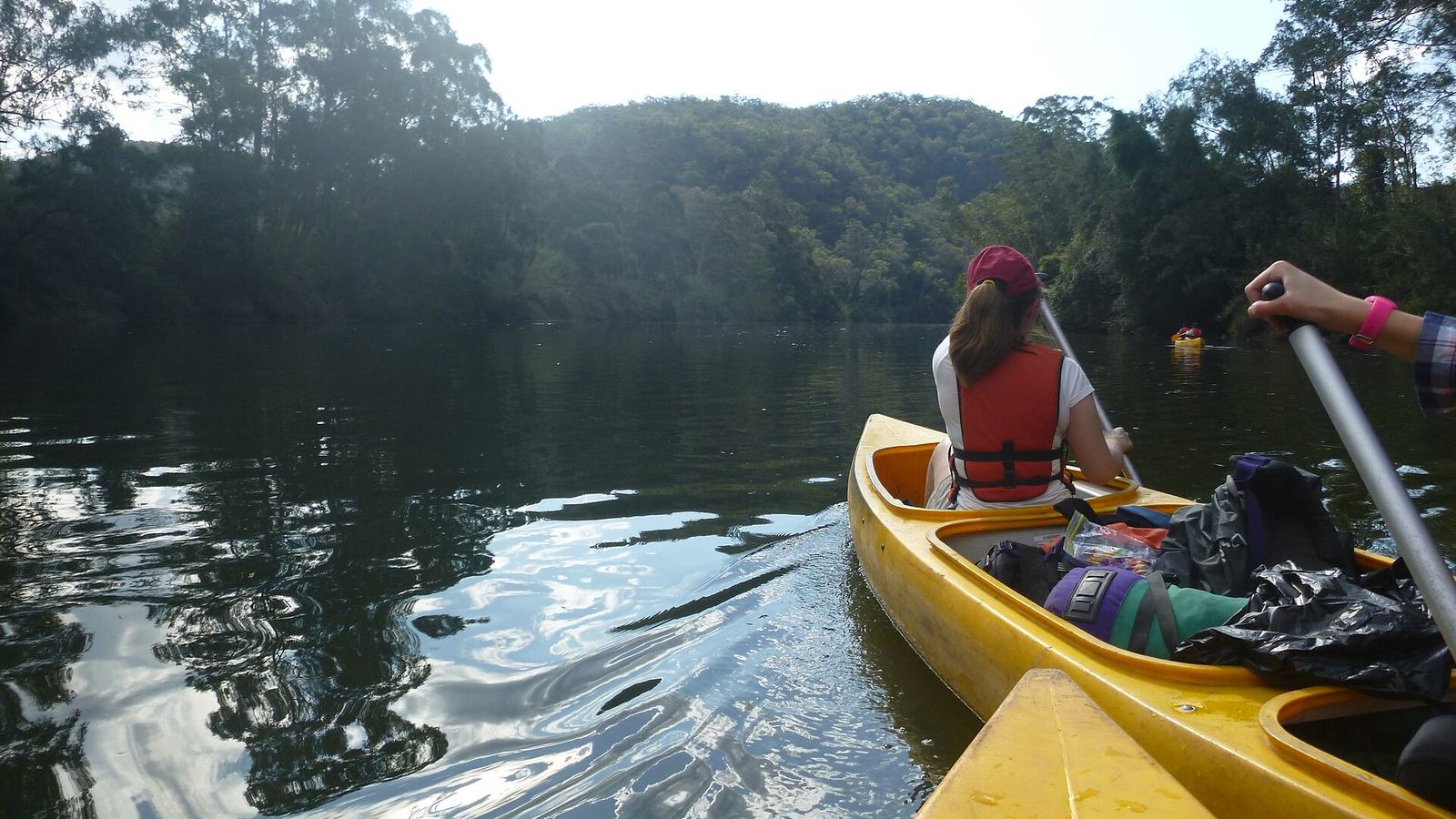
A small-boat guide to the Hawkesbury River in New South Wales, with Windsor access, official navigation maps, flood debris and enclosed-water safety advice.
A river of different boating moods
The Hawkesbury River is one of New South Wales’ evocative waterways because its character changes as the landscape and tides change. A modest runabout, open fishing boat or kayak can experience a wooded reach that feels far removed from nearby urban life, yet the water also has real operational demands. The Hawkesbury is not a uniformly sheltered lake. It includes tidal sections, river traffic, bends, variable depths and the possibility of debris after floods. A sensible small-boat outing chooses one reach to understand rather than promising a hurried journey from Windsor towards Broken Bay. The attractions are in the waterway’s scale, shore history and quiet sections, not a distance record.
Windsor as a defined starting point
Hawkesbury City Council identifies a formal launching ramp at Governor Phillip Park, Windsor, giving boaters a clear public access reference. Its rivers information also links to local water-quality and river-amenity resources. Start there if that reach matches the craft and itinerary, but verify present access, parking and ramp conditions before arrival. A published facility listing cannot guarantee a ramp is clear of silt or suited to every trailer after weather events. Organise ropes, paddles and safety gear away from the slope, then launch efficiently. In a narrow river setting, the first minutes are for checking steering, traffic and current, not accelerating towards the next bend.
Consult the correct NSW boating map
Transport for NSW provides official boating maps of the Hawkesbury and Broken Bay area. They divide the system into different sheets, including 9B for lower and middle reaches and 9C for the upper Hawkesbury and Colo Rivers. Use the sheet covering the actual trip; a generic regional image is not a navigation plan. Read chart notes and symbols for restricted waters, facilities and cautions, then compare them with the latest notices. If cruising from a launch far upstream, there is little benefit in carrying only a map focused on the coastal entrance. Download appropriate references before losing mobile reception and keep a paper or offline alternative when practical.
A river trip is not a straight line
A reach that appears short on a road map may include substantial bends, narrow sections and changes in current. Travel time depends on speed limits, traffic, conditions and the craft, not just kilometre markings. Choose a turn-around point that remains comfortably within fuel or paddling reserves. Do not use a bridge or prominent bank as a promise of safe landing; verify public access separately. Running too close to the inside of a bend can bring shallow water, while drifting across the outside can expose the boat to traffic. Maintain room to manoeuvre and avoid shortcuts whose depth is uncertain.
Floods leave a different river behind
NSW maritime notices have repeatedly warned about flood-related timber, debris and shallowing on parts of the Hawkesbury. Historical notices demonstrate the type of hazard, but do not establish the live status of a particular reach in November 2026. Check current restrictions and incident information immediately before departure. A floating branch can damage an outboard, and a submerged log can be worse because it may be invisible in turbid water. After rain, slow down, keep a sharp lookout and be ready to abandon an itinerary that no longer feels predictable. Do not assume that a familiar route is unchanged simply because the river has returned to a normal-looking level.
Tides and currents still matter upstream
Unlike an enclosed freshwater lake, substantial parts of the Hawkesbury form a tidal estuary. Direction and strength of flow can change the practical journey, particularly for low-powered dinghies and paddle craft. Consult appropriate tide and current information for the relevant reach, not a tide table selected merely because its station is geographically close on land. Wind against current can steepen short waves in exposed sections. A novice who travels down-current with little effort can face a difficult return. Build the timetable around both legs of the journey and leave a margin for unexpected delays at a launch or landing.
Enclosed-water rules do not mean no risk
NSW’s official guide classifies rivers such as the Hawkesbury among enclosed waters for equipment and preparation purposes, but that category is not a declaration that conditions are always benign. The legal requirements depend on the craft, where it is operating, the people aboard and applicable zones. Check the state’s current safety-equipment guidance and confirm whether lifejackets, communications or other gear are required for your exact trip. A river bend can hide fast traffic, and an apparently quiet bank can become exposed to wind. An appropriate small-boat safety plan includes a route, shore contact and a decision point for turning back.
Paddling beside powerboats
The Hawkesbury offers attractive sections for kayaks and canoes, yet paddlers are low in the water and harder to see from a helm. Wear conspicuous clothing where appropriate and avoid stopping in the middle of a navigation channel. Powerboat skippers should leave plenty of room and reduce wake early, especially where a paddler is negotiating a narrow bank or passing beneath an obstruction. Neither group should assume the other has noticed them. If traffic is heavy, a sheltered side reach may be preferable to forcing a scenic route through constant wake. The right small-boat experience depends as much on respectful interaction as on the scenery.
Water quality deserves its own check
Hawkesbury City Council identifies local water-quality monitoring and links visitors to state information about recreational water conditions. That is particularly relevant to families planning swimming as part of a boating day. A picturesque river surface does not reveal microbial risks or the effect of recent rain. Check current advice before swimming or allowing children to play in the shallows. Do not anchor beside a bank simply because it looks sheltered; the location may be unsafe, polluted or private. If the trip’s central attraction is swimming, be willing to change the plan when official water-quality information advises against it.
Fishing is a separate set of responsibilities
A small boat makes the river attractive to anglers, but fishing does not suspend the obligations of navigation. Check the correct NSW fishing licence, bag, size and location rules and any sanctuary-zone requirements. Keep lines clear of passing boats and never anchor across a navigable narrow section. Store hooks where passengers cannot accidentally step on them, and monitor the current rather than focusing entirely on a float or sounder. If the anchor drags, the first task is safe boat handling. Be cautious of low branches and submerged obstructions near banks. The calmest-looking fishing spot may still require active seamanship.
Historic settlements and a shore stop
The river has towns, bridges and ferry crossings that form part of its cultural character. A useful small-boat day may combine a short, familiar stretch of river with a visit ashore, but a photographed wharf or ferry landing is not necessarily public or suitable for visiting vessels. Plan shore access only at recognised facilities and obey local signs. If the crew wants a longer town visit, parking the boat safely at the original launch and going by road may be simpler. The river’s history is best enjoyed without creating a hazard at a working landing or restricting other people’s access to the water.
Wildlife, banks and wake
Riverbanks can be vulnerable to erosion, and a powerful wake can damage moored craft or disturb people on shore. Keep speed and wash down near narrow banks, other boats and places where birds are feeding. Do not pull into vegetated margins merely to secure an unusual photograph. Discarded fishing line is especially harmful in waterways with birdlife and boating traffic. Carry rubbish back to shore and inspect the propeller or paddle for tangled material when safely ashore. A quieter approach lets a small boat experience more detail: changing light beneath trees, a waterbird at a distance and the different textures of riverbanks.
A sensible Windsor-based family plan
For a first visit, begin at Governor Phillip Park after checking the council’s access listing, current maps, weather, river notices and water quality. Choose a modest upstream or downstream reach appropriate to the boat and local conditions. Watch traffic at the launch, travel conservatively and turn around while everyone still has energy and daylight in reserve. A family with very young children may prefer an even shorter outing and longer picnic ashore. If recent flooding has left debris, do not try to prove that the trip can be completed anyway. The ability to stop early is a sign of competence, not lack of adventure.
Navigation notices are time sensitive
The official NSW boating-map service includes navigation information, but individual notices may concern temporary hazards or restrictions that change. Older flood notices should not be quoted as if still in effect; their proper role is to explain why pre-trip checks matter. Consult current Marine Notices and the latest chart information, and follow directions from authorised safety officers. Keep a clear plan for contacting assistance and make sure the crew knows where it is. Do not rely on a mobile connection being available around every bend. It is worth recording the launch name, exact stretch and intended return time with someone on shore.
The river rewards a shorter journey
The Hawkesbury is large enough to invite ambitious maps and long cruising days, but a modest boat can find satisfaction in a carefully chosen bend or a quiet reach. The water changes with tide, weather, traffic and season, so the winning itinerary is one that can adapt. Start with an official launch, use the correct map and watch for flood-related hazards. Leave room for swimming only if water-quality advice permits it. Come back with daylight, fuel and patience to spare. That approach makes the Hawkesbury feel like a real place rather than another line on a navigation screen.
Sources and photograph credit
Verified sources: Primary source: Hawkesbury City Council; NSW boating maps for the Hawkesbury; NSW enclosed-water safety guidance; NSW historical flood-debris notice, for context only. Photograph: Hawkesbury River - reflections of clouds + canoeing.JPG, Yxrulz, Wikimedia Commons, CC BY-SA 4.0. Archival photograph resized for the website.

Source
Hawkesbury City Council