
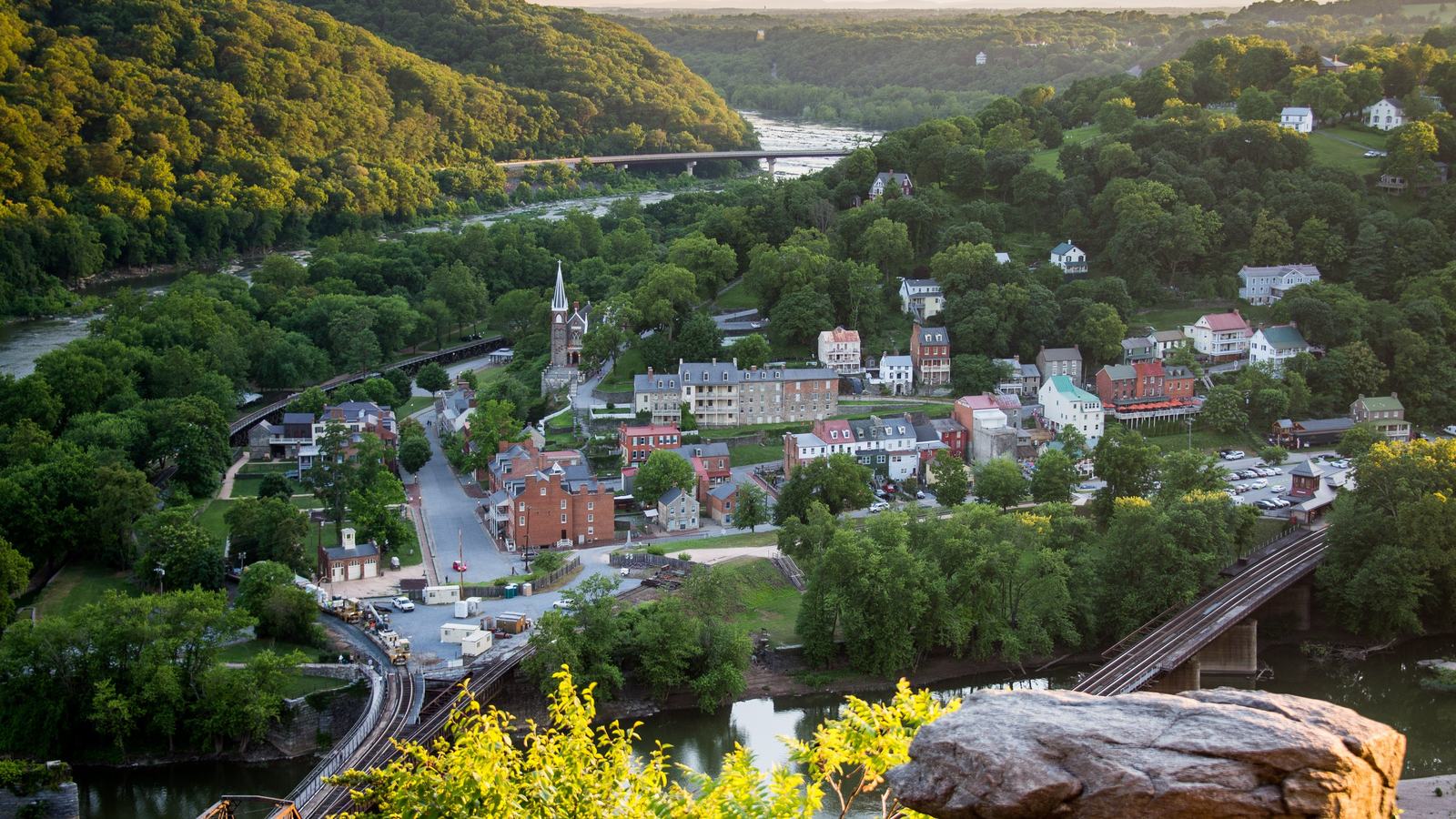
At Harpers Ferry, the Shenandoah and Potomac meet beneath dramatic historic hills. The National Park Service identifies a specific kayak launch and warns that calm-looking water can be hazardous.
Historic scenery and serious moving water
Harpers Ferry is best known for the dramatic meeting of the Shenandoah and Potomac rivers and the history preserved in the town above their banks. For boaters, the junction can also be an enticing place to imagine a day on the water. But the same currents that shaped this landscape are capable of creating swift, dangerous conditions. The National Park Service stresses that the rivers can appear calm even when strong and unpredictable hazards lie beneath the surface.
This is a destination where a pedestrian sightseeing route and a boating route must be planned separately. Visitors walking between historic exhibits and overlooks can observe the water without understanding its depth, submerged obstacles or undercurrents. A kayak trip demands a known legal launch, a suitable downstream take-out and an assessment of conditions for the entire watercourse. Neither the confluence view nor the convenience of a town-centre car park provides those answers.
A boater should begin by separating the landscape’s appeal from personal ability. Strong currents, submerged strainers, cold water and sudden changes in depth can challenge even competent paddlers. The National Park Service advises appropriate Coast Guard-approved flotation and warns against swimming in the area. The attractive riverside setting is not permission to improvise a launch from whichever bank happens to be nearest the historic centre.
Know the designated kayak launch
The National Park Service identifies the River Access Parking Lot at the junction of Highway 340 and Shenandoah Street as a place to access the Shenandoah with a personal canoe or kayak. The actual river access is beneath the Highway 340 bridge, roughly 200 yards from the parking area. This detail matters when carrying a heavy boat, paddles and dry bags. A planned launch must account for moving the equipment on foot as well as getting a vehicle into the lot.
Parking at the designated river access is limited, and the park advises visitors to arrive early because spaces may fill. Check current charges, restrictions and notices before setting out. Do not assume that an entrance ticket guarantees a space or that a nearby roadside verge is an acceptable substitute. A group whose parking plan fails should be prepared to change plans, since forcing access at a prohibited location can create both a legal problem and a safety problem.
The park does not describe every visible shoreline as an authorised launch. Follow the current park rules on river access and never haul a kayak through protected historic or natural areas to save a walk. If the designated lot is full, find an alternative authorised facility outside the park only after verifying its rules and the exact intended paddle route. A legal starting point is just the first part of a safe outing; the take-out needs equal attention.
Why apparently quiet water is deceptive
In its visitor advice, the park specifically warns about cold water, deep holes, changes of depth and swift undercurrents. Those dangers can remain present throughout the year, including on a pleasant, sunny day. The current near a bend or obstruction may behave very differently from the flat surface visible from a bridge. Do not judge suitability from a photograph or a brief look at the water beside the parking area.
Strainers are particularly dangerous in moving rivers: water passes through branches or debris while a person or craft can be trapped. Floating debris and sudden river rises can make even a familiar section difficult. Review recent weather across the upstream watershed and seek local conditions before launching. Where there is uncertainty about rapids, water level or route features, a qualified local guide is preferable to guessing or relying on an unverified route drawn online.
Everyone in the craft should have the required approved flotation device and should wear it throughout the paddle. Secure a phone and emergency equipment in waterproof storage, and do not plan a journey that relies on an immediate rescue. The NPS strongly discourages swimming in both rivers and identifies drowning hazards and possible submerged debris. A rescue attempt by an untrained person can create a second emergency, so the crew needs deliberate emergency procedures.
A careful way to enjoy the rivers
The best boating plan begins with an experienced leader checking the launch rules, current park alerts and the river conditions for the specific reach. Select a legal and realistic downstream take-out and arrange transport before committing to the put-in. Explain to every participant where the group intends to stop and which circumstances will end the trip early. Leave the itinerary and expected return time with someone on shore who can raise the alarm if necessary.
Harpers Ferry can be equally rewarding without putting a boat onto the water. The historic park offers a different way to appreciate the meeting of the rivers, with views of the landscape and opportunities to explore its history on foot. If weather, river level, crowding or experience make kayaking inappropriate, choosing a land-based visit is not a failed outing. It may be the most responsible way to enjoy the site on that particular day.
For paddlers with the right skills and properly verified route, the waterways around Harpers Ferry offer an unusual pairing of heritage and natural setting. Their power, however, should shape every stage of preparation. Use the authorised access, respect parking and shoreline restrictions, wear flotation and accept that tranquil-looking water can still be perilous. Sound planning keeps the emphasis where it belongs: a memorable journey with everyone returning safely.
Primary planning source: National Park Service Harpers Ferry river access frequently asked questions. Consult the original National Park Service guidance and current notices before departure.