
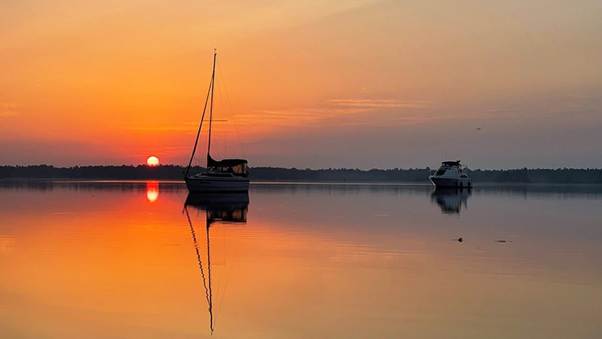
A practical, richly researched small-boat escape through Ontario’s Georgian Bay Islands, covering Beausoleil's dock rules, permits, trails, weather and an adaptable two-day itinerary.
An island park entered from the water
Georgian Bay Islands National Park changes the usual idea of a weekend break. The mainland road journey ends around Honey Harbour in Ontario; the memorable part begins when a boat threads through sheltered passages towards islands of pine, exposed granite and clear freshwater. Parks Canada describes a park of 63 islands, but Beausoleil Island is the visitor hub with docks, trails and accommodation. For owners of trailerable cruisers, small cabin boats and sailing craft, that distinction is crucial: there are many islands to admire, but not an unlimited selection of managed landing places.
The area is part of a vast freshwater archipelago on the eastern edge of Georgian Bay, a landscape whose polished stone, windswept trees and broad horizons make an unusual boating holiday. It can seem close to civilisation on a chart and remote once the shoreline vanishes behind headlands. Our itinerary focuses on the practical arrival at Beausoleil rather than promising access to every rock and channel. The best reward is a measured day afloat, a legal and considerate place to stop, then time to explore the island on foot.
Start with Honey Harbour, not a guessed landing
Parks Canada identifies Honey Harbour as the normal gateway to the park, about 166 kilometres north of Toronto. Visitors bringing their own boats need to arrange launching at a private marina or facility in the surrounding area; the national park itself does not provide a boat launch. A sensible first task is therefore to establish where the vessel will launch, whether the ramp can handle its size and trailer, where the vehicle can remain, and how late recovery is possible. Those mundane details decide whether a day feels relaxed.
Boaters should resist planning a departure solely by straight-line distance on a phone screen. Islands conceal turns, rock shoals and constricted channels, while an unfamiliar crew may progress much more slowly than the boat's maximum speed suggests. Parks Canada explicitly directs private-boat visitors towards Canadian Hydrographic Service chart 2202 for this stretch of eastern Georgian Bay. Use a current chart, proper position-fixing and the notices that apply to your chosen route; a recreational destination article cannot replace navigation instructions or identify a safe track for a particular draught.
Five named docks and a first-come system
Beausoleil has several boat-oriented docks, including Frying Pan Bay North and South, Ojibway Bay, McCabe Rock, Wana Keta and Tobey Dock at Cedar Spring Campground. Their names are useful planning landmarks, but naming a dock is not a promise that a berth will be available. Parks Canada's operating rule is first come, first served, and spaces cannot be reserved or saved. During busy summer weekends many locations are full for much of the day. The crew should arrive with a second plan that does not depend on occupying a particular pier.
At many dock locations visitors can expect a self-registration point, park information and basic waste or toilet facilities, but services vary rather than forming a uniform marina package. This is a park stop, not a full-service hotel harbour: do not assume there will be fuel, shore power, potable water at the berth or staff ready to catch lines. Carry the supplies you need aboard, budget time for self-registration and retain enough daylight and fuel to return to your launch point if every preferred dock is occupied.
Anchoring is an alternative, with limits
Parks Canada notes water lots adjacent to the island for boaters who cannot secure dock space. Cedar Spring, Frying Pan Bay and Honeymoon Bay are identified among the waters relevant to mooring and anchoring visits. This is not permission to anchor indiscriminately: suitability depends on the charted water, local conditions, the vessel's gear and rules for the park. The skipper must assess depth, holding, swing room and traffic without relying on descriptions written for a different boat in different weather.
One easily missed rule concerns tenders. Dinghies and other tender vessels are not permitted to occupy the park docks, although they may be beached with a valid permit. Parks Canada also forbids securing a vessel to shoreline trees, vegetation or park signs, even where landing alongside rock appears convenient. Those restrictions deserve attention before the anchor is dropped. A considerate skipper who protects vegetation, keeps emergency access open and leaves room for neighbours helps preserve the very quiet the park is known for.
The permits that belong in the cruising budget
Private boat visits involve more than the cost of fuel. Parks Canada lists day and overnight mooring charges, daily admission and relevant beaching or dinghy permits, with the applicable fee depending on the intended stop. Since 2025 the park has required a daily admission fee in addition to other charges, and its 2026 guidance says the Canada Strong Pass free-admission period ended on 7 September. Anyone planning an autumn visit should use the current fee page rather than older summer promotions or a previous season's receipt.
Registration at the docks is self-service in many locations, and Parks Canada asks boaters to pay on arrival. Travellers should have the required payment means and allow a few minutes for the process instead of treating the dock as a free lunchtime berth. Seasonal mooring permits can be obtained through designated park points such as Honey Harbour or the Cedar Spring visitor centre, but terms and availability should be checked directly. Making the cost visible is useful: a realistic boat day budget includes park access, ramp or marina charges, transport, provisions and a weather contingency.
Cedar Spring and the easier shore day
The southern part of Beausoleil around Cedar Spring is the park's most developed visitor area. Parks Canada describes a welcome centre, interpretive activity, picnic areas, swimming beaches and more accessible trails, as well as opportunities for mountain-biking where facilities operate. For a family arriving by a small cruiser, this is the logical part of the island to investigate when the priority is a walk, a picnic and a gentle afternoon rather than a strenuous expedition. It also provides a useful contrast to the remoter-feeling northern landscape. As of 25 October 2026, Parks Canada's main park page reports Cedar Spring Visitor Centre temporarily closed until May 2027; do not expect its staffed services during this period.
Land-based amenities do not remove marine responsibilities. The boat must still be legally and securely moored, children need supervision beside the water and every crew should know when to be back aboard. Check the site's operating hours and current notices; facilities and programmes can be seasonal, particularly after the main summer period. A low-pressure visit might combine a short interpretive walk, a shaded picnic and time to watch the water rather than racing between five attractions that demand different landing arrangements.
Northern trails, rock and long views
Beausoleil's northern area offers a contrasting experience, where granite surfaces and forested slopes open towards distant islands. Parks Canada's visitor descriptions point to the Chimney Bay and Fairy Lake area as a more demanding walking environment: exposed bedrock can be slippery, ground is uneven and elevation changes are noticeable. It is attractive for active adults who have the footwear, mobility and time, but it should not automatically be chosen for a visitor with limited mobility or young children who tire easily.
An island shore trip is especially satisfying when it does not overreach. Check trail information and the conditions before leaving the vessel, take drinking water and clothing suitable for rapid weather changes, and give the person staying aboard a clear return time if the party splits. The setting has strong associations with the Canadian Shield landscapes that inspired artists of the Group of Seven. Yet the best photograph is not worth stepping onto a fragile edge, scrambling in poor visibility or leaving the boat exposed as a breeze freshens.
Weather can redraw the itinerary within an hour
Georgian Bay's protected-looking passages can create false confidence. Parks Canada warns that conditions change rapidly: wind direction, building waves on open water and the hazard of rocky shoals all deserve an explicit assessment. A forecast that permits a calm morning transit does not guarantee the same return crossing after lunch. Review the marine forecast, observations and expected trend before launching, then look for a sheltered alternative or cancel if the weather margin narrows.
Approach planning should match the boat rather than the calendar. An open dayboat with a short freeboard and novice crew has different limits from a well-equipped cabin cruiser, and both differ from a shallow-draught sailboat. Keep personal flotation devices readily available and worn as appropriate, understand how your engine and communications work, and carry independent navigation and emergency means. The route home must be navigable by the least experienced reasonable scenario, including a delayed departure, wet crew or loss of phone coverage.
Swimming, wildlife and the water's edge
Clear freshwater and inviting rock shelves are part of the destination, but visual clarity does not establish that swimming is safe. Parks Canada says it does not monitor water quality at Beausoleil Island, and there are no lifeguards at its beaches. It advises against entering water that is cloudy, discoloured or unusually odorous, or after heavy rain. This is particularly important to visiting families who may assume that a recognised national-park beach receives the same monitoring as an urban bathing beach.
Wildlife protection is similarly practical. Keep food and cooking supplies secured on the boat or under direct control ashore; unattended meals attract animals. Use designated waste facilities where provided and take litter away if bins are unavailable. Do not remove plants, rocks or wood from the forest. Even a short lunchtime stop has consequences if visitors leave behind food scraps, plastic line, damaged vegetation or a badly positioned anchor. The reason to travel here is the landscape, so the visit should leave that landscape intact.
Quiet hours and responsible overnight stays
For a boat remaining overnight, the atmosphere after sunset is a large part of Beausoleil's appeal. Parks Canada sets quiet hours between 11 pm and 8 am, including generators, and discourages excessive noise at any time. Sound travels surprisingly far across sheltered water, so cockpit music and an idling generator can affect campers and vessels well beyond the next slip. Good seamanship includes arranging batteries, meals and lighting so that the crew can settle down without disturbing the island.
Overnight plans also require a realistic safety margin. Check the mooring location and weather after the last daylight shore excursion; confirm lights, alarms, bilge condition and the vessel's swing or berth lines. Shore accommodation is available through separate camping, cabin and oTENTik arrangements, but a boat berth does not itself secure any of those places. In autumn, enquire about what remains open rather than assuming peak-season facilities will be staffed. A short, properly prepared overnight stay is richer than an ambitious plan built on unavailable services.
A practical two-day outline
On the first day, arrive at the launch early enough to check the weather again before paying and unloading. Once afloat, follow the charted approach without taking shortcuts across apparently empty water. Head for one appropriate Beausoleil docking or mooring location, and if it is full, use only a legal alternate that your chart and the conditions support. Complete admission and mooring payment, make a modest shore walk, and return aboard before any expected afternoon weather change. If the conditions deteriorate, shorten the visit; that is a successful boating decision, not a failed holiday.
For an overnight stay, build the second day around a different texture rather than a greater number of miles. A quiet breakfast afloat, an unhurried shore trail and a return passage timed for the forecast can be more memorable than an improvised circuit of the archipelago. Leave buffer time for towing or launch-ramp queues, equipment checks and the car journey. If weather or dock availability removes the overnight option, retain the plan as a single excellent day trip instead of forcing the original schedule.
What to confirm before casting off
Before travelling, consult Parks Canada's Georgian Bay Islands pages for current bulletins, seasonal hours, admission and mooring fees, eligible landing sites and any temporary closures. Its main page carried a notice for a training-related area closure on 21 October 2026; although that date has passed, the example illustrates why an archived guide cannot substitute for checking alerts on the actual day. Use the park's own boating information for the names and rules at docks, and the safety page for the latest advice on weather and swimming.
Then turn to the operational checklist: a current official nautical chart and notices, reliable weather information, a launch booking if needed, fuel reserve, safety and communication equipment, an anchor suitable for the boat, food secured against wildlife and the correct payment arrangements. No article can promise a berth or safe conditions on a particular date. Georgian Bay rewards crews who treat the journey as part of the destination—slow enough to navigate the rocks carefully, ready to change their minds, and willing to give the island the time it deserves.