
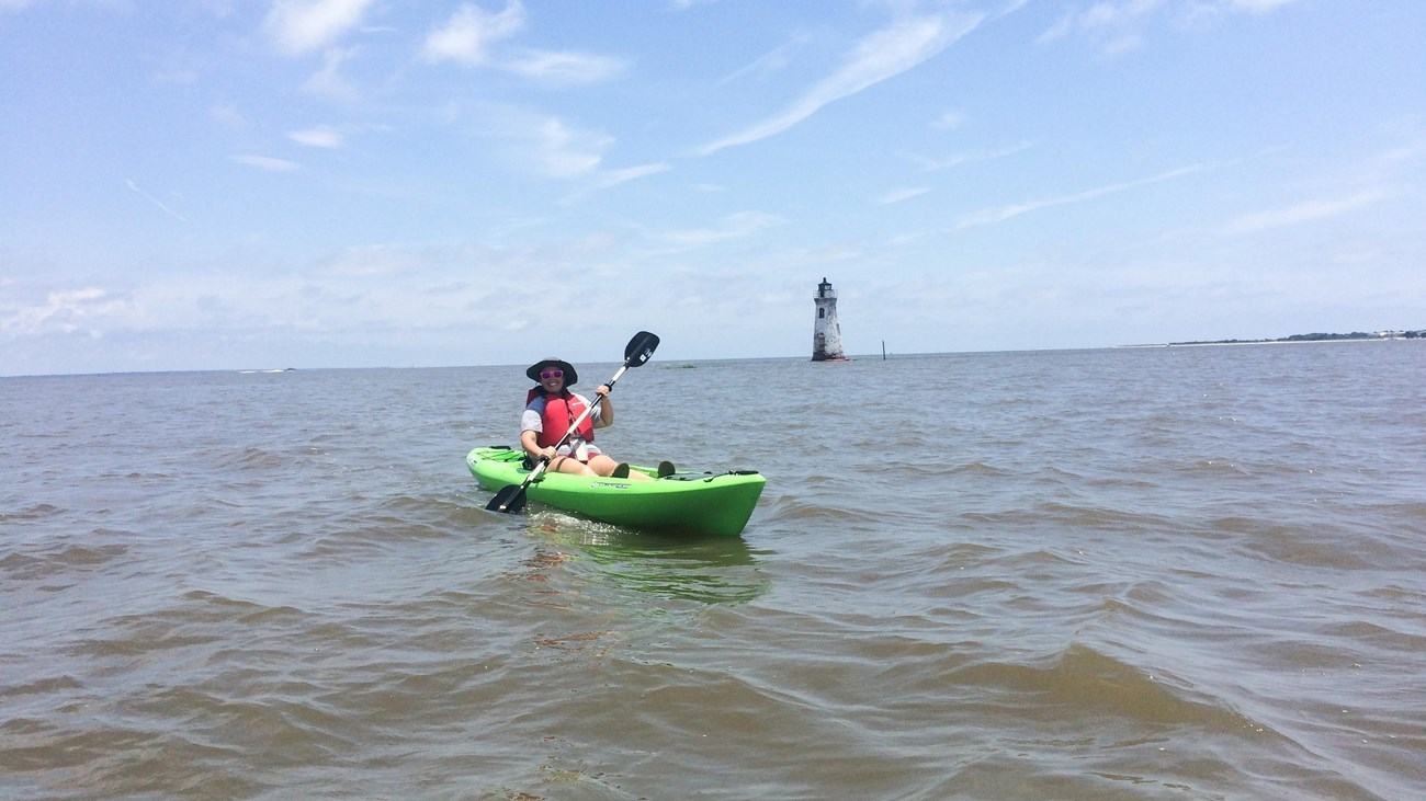
Georgia's Fort Pulaski National Monument can be approached from the water, but the permitted routes and landings are tightly defined. Here is how to plan a responsible paddle.
The fort looks different from the water
Fort Pulaski National Monument is usually introduced through its masonry fort, historic setting and coastal Georgia landscape. A kayak gives the surrounding geography greater prominence, placing the fort's islands, tidal channels and salt marshes at the centre of the experience. The attraction is not necessarily a long-distance expedition; it is the chance to understand why water and difficult terrain mattered so much to this place.
The National Park Service identifies two contrasting small-boat environments: the South Channel of the Savannah River and the marsh-lined Oyster Creek. The first has open-water character while the second winds through vegetation and is best approached with careful attention to water levels. Neither should be mistaken for a place where every visible creek or beach is accessible.
One launch point within the monument
Lazaretto Creek Boat Ramp is the only approved place to launch boats and kayaks within Fort Pulaski's park boundary. From there, paddlers can reach the South Channel and Oyster Creek by travelling through Lazaretto Creek. This restriction is important when planning a route from an online map, because a seemingly convenient roadside bank does not become a lawful launch by virtue of being close to the water.
The park requires boats to proceed at idle speed and without a wake within one hundred feet of existing dock structures. Airboats and personal watercraft cannot be launched at the park ramp and are prohibited in Oyster Creek. Visitors should read the current federal and Georgia boating requirements before arrival rather than relying on habits learned at an unrelated marina.
Oyster Creek rewards tidal awareness
At high tide, Oyster Creek can offer a sheltered-feeling passage through the marsh. At low water, parts of the creek become inaccessible, and the banks and adjoining flats can expose paddlers to grounding. The park warns that even shallow marsh areas covered at high tide can trap a boat when the water falls, so judging the return route is as important as choosing the moment to set off.
A marsh paddle is best treated as an observation of an ecosystem from a permitted watercourse. Entering the park's marshlands on Cockspur or McQueen Island is prohibited, including at high tide. In other words, a tide that floats a kayak across vegetation does not confer permission to explore it; remain within lawful waterways and leave fragile habitat alone.
Keep lighthouse views on the water
Cockspur Island Lighthouse is a distinctive landmark visible during a suitable outing, and it gives the South Channel a memorable focal point. Yet the lighthouse's island is closed to public access, including beaching or landing any craft. A photograph from the water is the appropriate ambition, not a landing beside the structure or a walk across the island.
Cockspur Island also has restrictions against anchoring or beaching along its shoreline. The fort's moat, feeder canals and historic dike system are closed to all boating. These rules protect historic features and sensitive habitats, while making route planning much clearer for visitors willing to respect the boundary between public water access and protected ground.
The North Channel is not a shortcut
One of the park's strongest safety warnings concerns the North Channel of the Savannah River. The National Park Service explicitly tells small-boat users not to enter it: the currents are powerful, and the channel serves oceangoing cargo ships that cannot readily stop or manoeuvre around a kayak. The proximity of shipping to quiet-looking tidal scenery can be deceptive.
Stay with an itinerary in the South Channel or Oyster Creek that matches current conditions and the crew's abilities. Check forecast winds, storms, tide predictions and daylight well before launching. Sandbars and oyster beds add hazards in shallow water near the islands, while the same tide that provides access early in a trip may make a creek impassable later.
Make the day's purpose observation
There is no need to make this trip a race between landmarks. Watching the line of marsh against the horizon, hearing coastal birdlife and seeing the lighthouse across the water can fill a morning when the route is well chosen. A quiet paddle also makes it easier to appreciate how the coastline differs from a standard visit to the fort on foot.
Bring personal flotation devices, water, protection from sun and insects, and a way to communicate if the plan changes. If the forecast deteriorates or the timing of the tide is uncertain, visiting the monument ashore can still offer a satisfying day. Good small-boat judgement includes being willing to leave the kayak on its rack.
The waters around Fort Pulaski are also a reminder to distinguish a park's scenic opportunities from its visitor facilities. Launch availability, tide depth and permitted landings are separate questions, and all three need a satisfactory answer before a small crew can treat a route as workable.
Current access details, conditions and regulations should be checked with National Park Service — Boating at Fort Pulaski before a visit. The photograph is credited to NPS/J. Cadoff, kayak near Cockspur Island Lighthouse.