
Cuyahoga Valley National Park offers a changing river landscape and an Ohio Water Trail, but access, conditions and portages require careful advance checks.
A river whose story is still changing
The Cuyahoga River has a history unlike many picturesque paddling destinations. Once heavily polluted, it became internationally associated with burning industrial waterways, yet recent decades have brought major improvements in water quality and access. Cuyahoga Valley National Park now sits alongside a river increasingly enjoyed by canoeists and kayakers, offering a chance to appreciate both the natural scenery and the long process of restoration.
The National Park Service describes the river as an Ohio Water Trail designated in 2019, with the lower section also forming part of the National Water Trail system. That recognition does not mean every stretch is suitable for beginners, nor does it transfer all safety responsibilities to park staff. Paddlers must select a reach appropriate to their abilities and assess real conditions before leaving the bank.
Planning access points along the valley
The park publishes access information for locations including Lock 29 at Peninsula, Boston Store, Red Lock and Station Road Bridge. These stops allow experienced paddlers to structure trips around river miles rather than assuming a continuous journey is the only option. Some access points link to walking trails and the Cuyahoga Valley Scenic Railroad, though transport connections and operating schedules should be checked separately.
The starting and finishing locations should be agreed before the first kayak touches the water. A river current can make paddling back upstream difficult, and there may be no suitable place to leave a car at an unplanned take-out. Local rules and parking restrictions also vary. A short, well-organised outing is more enjoyable than a long journey ending with an unexpected logistical problem.
Historic dams and remaining obstacles
River restoration has involved the removal of obsolete dams, helping improve oxygenation and the movement of fish. Nevertheless, the NPS lists specific remaining hazards around the water trail, including remnants of a low-head dam near Lock 29. A section that looks navigable from a distance may contain submerged bedrock or a difficult current, and portaging around an obstacle is not always easy.
The park also documents timber groynes, old metal structures and large woody debris on certain reaches. These can catch a kayak or block what previously was a clear channel. Visitors need the current hazard notices rather than a map from an old guidebook. A paddler should never assume that a previous safe passage proves the same route is open after high water or construction.
Construction can close an entire reach
The National Park Service has issued a river-wide closure around the Alexander/Pleasant Valley Road bridge during bridge demolition and construction. This is not a mere suggestion to proceed carefully: paddlers must follow the signed diversion and portage arrangements. Barriers, cables and work areas create conditions unsuitable for improvisation.
Because works can begin, move or finish, the latest official notice must be consulted immediately before a trip. Route instructions should be checked against the river mile markers and not simply copied from a previous year's travel account. Responsible paddlers respect closures and change their plans when the safe line cannot be established.
Rain and water levels change the difficulty
The NPS emphasises that paddlers use the Cuyahoga at their own risk and should understand both water level and weather. A period of rainfall can change currents, raise floating debris and make riverbanks more difficult to use. Low water may expose hard obstacles and reduce the space needed to manoeuvre a kayak around trees or shallows.
Some woody obstructions become easier to pass at one level and harder at another, meaning that a generic rule about high or low water is insufficient. Local guidance and a realistic view of the crew's skills are essential. Beginners should select a short reach with straightforward access instead of tackling a complex section merely because the river is close to a national park visitor centre.
An encounter with restored nature
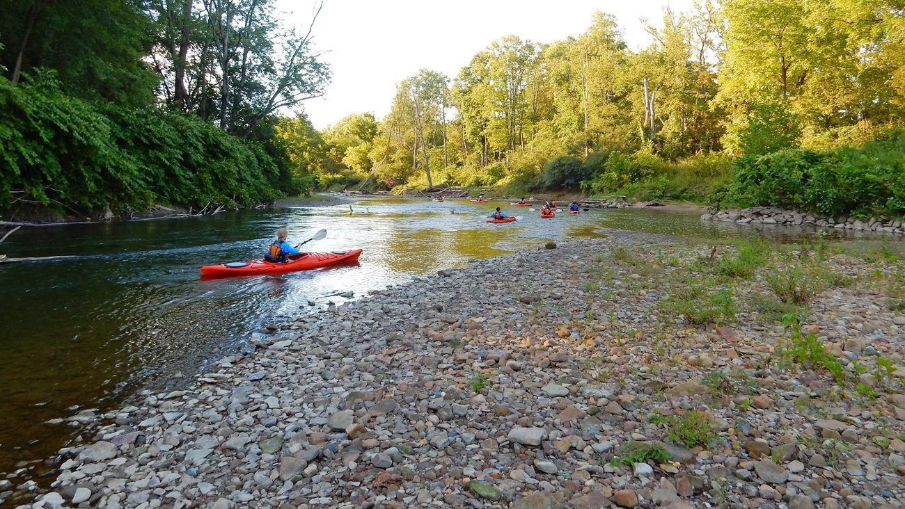
On a calm, suitable stretch, paddling offers an intimate perspective on riverside vegetation, birds and the wider valley. A small boat moves quietly enough for visitors to notice details that are missed from roads or trails. The official park photograph by D.J. Reiser shows actual kayakers travelling a bend in the Cuyahoga, connecting this story directly to the place rather than using generic paddling artwork.
The restored river is also part of a populated landscape, so paddlers may encounter roads, bridges, other recreational users and areas where the legacy of industry remains visible. That mixture is central to the destination's interest. It illustrates how conservation, infrastructure and recreation interact instead of pretending that the valley has never been altered by people.
Safety is a personal responsibility
The National Park Service does not maintain the Cuyahoga for recreational navigation, and paddlers must arrive with their own appropriate equipment. A correctly fitted personal flotation device, useful route information and a way to communicate are basic preparations. A group should know where it intends to leave the river and tell somebody ashore when to expect its return.
Solo paddling is discouraged by the park. Travelling with a capable companion makes it easier to respond if a boat becomes damaged or a person needs help at a difficult bank. Proper footwear, clothing suited to the water temperature and experience with river currents also matter. The ability to stop and turn around safely can be more important than covering a certain number of miles.
A holiday rooted in a recovery story
The Cuyahoga is not a destination defined by dramatic sea caves or distant offshore islands. Its appeal lies in the chance to paddle through an evolving river corridor where restoration has made recreation more practical. Visitors who combine a modest river outing with time on the valley's trails can appreciate that transformation from more than one perspective.
The most worthwhile experience will come from choosing a current, officially permitted reach, checking hazards and allowing the day to unfold without unnecessary pressure. The park's online paddling guidance should be reviewed shortly before any launch because changes to the river can be significant. The reward is an Ohio waterway whose modern recreational life tells a compelling story.