
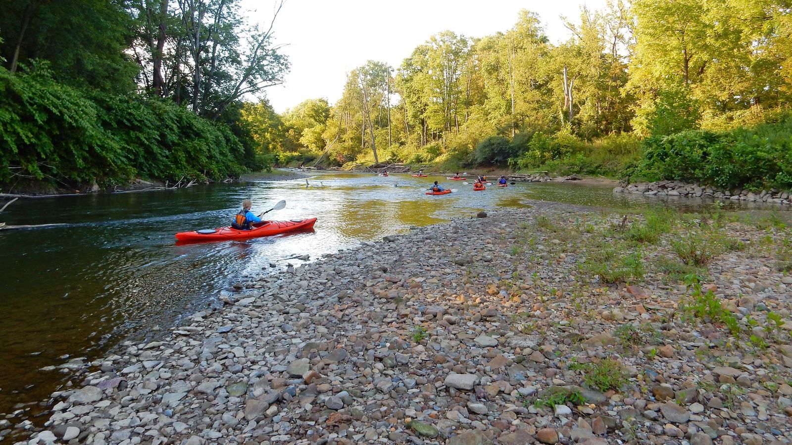
Ohio’s Cuyahoga River has become a recognised water trail, but paddlers must check bridge-work closures and changing debris conditions before setting off.
A river with a remarkable second chapter
Ohio’s Cuyahoga River is renowned for a history of industrial pollution, but it now supports a recognised paddling route through Cuyahoga Valley National Park. The National Park Service describes roughly 26 miles of the river within the park, part of a larger Cuyahoga River Water Trail network. Its transformation gives small-craft visitors a distinctive way to experience the valley landscape.
The waterway is not maintained as a conventional recreational canal. Fallen trees, currents and construction works can change the route with little warning. That makes it essential to study current conditions, particularly in 2026 when the park reports a river-wide closure near a bridge work site. The appeal is real, but so is the responsibility to plan carefully.
The 2026 construction closure
The park’s current guidance identifies a closure around river mile 17 associated with the Alexander and Pleasant Valley Road bridge demolition and construction zone. Barrier cables and marker buoys extend across the river, and paddlers are directed to use a signed portage upstream of the Fitzwater Road bridge. The specified exit is on river left, with relaunch on river right.
Construction boundaries can shift as work progresses. Do not rely on a description printed months earlier, and never attempt to pass a barrier simply because the current appears calm. Before travelling, check the park’s latest alerts and the water trail safety information. If the route or portage cannot be confirmed, choose a different launch and take-out combination.
Seven park access points and a downstream plan
The National Park Service maps seven main river access points within the park, including Northampton Point, Lock 29, Boston Store, Red Lock, Station Road Bridge, Fitzwater and Lock 39. They provide different combinations of parking, toilets and trail connections. The spacing is useful for designing a shorter outing, provided the chosen reach remains open and appropriate for the group.
A good itinerary identifies a definite take-out, avoids known work sites and allows enough time for river current to vary. Driving directions to the put-in are only half the logistical problem. Canoes and kayaks usually travel one way, so a second vehicle, trusted shuttle or other lawful transport plan is needed before the first boat enters the river.
Fixed hazards even when the water is low
The park warns about a bedrock shelf and remnants of a low-head dam immediately upstream of Lock 29. It advises less experienced paddlers to consider starting at Lock 29 and travelling towards Boston rather than approaching that hazard from upstream. Farther downriver, old metal pylons and timber groynes near Lock 39 can collect large amounts of woody debris.
Log jams and strainers are particularly dangerous because the current can force a boat or person into an obstruction that water passes through but bodies cannot. Hazards can appear between official updates. If a passage looks uncertain, take out at a safe place and portage if that is legal and practicable. Trying to squeeze through an obstruction is never a sensible way to save time.
The CUYAC conditions tool
A useful 2026 development is CUYAC, a map-based river safety conditions tool launched by Cuyahoga River Water Trail partners in the summer. The National Park Service describes it as combining credible river and weather information into colour-coded risk levels for public sections. It can help a visitor identify conditions that deserve attention before leaving home.
Digital guidance remains only one source of evidence. A phone can lose signal in a valley and a map may not know about a tree that fell an hour ago. Cross-check CUYAC with current water levels, weather forecasts and park notices. Keep an alternative plan available, including a land-based day if heavy rain or pollution alerts make the intended trip unwise.
Water quality, equipment and regulations
After heavy rain, combined sewer overflows and storm runoff can raise bacterial levels in the Cuyahoga. The park refers users to current monitoring information and discourages swimming in the river. Paddlers should also follow Ohio boating requirements, including appropriate registration and approved flotation devices. The precise rules for children and visiting craft should be checked against the latest official guidance.
Carry a suitable boat, a well-fitted life jacket, footwear with grip, a whistle, drinking water and a dependable means of summoning help. Tell someone ashore your route and expected return. The park recommends paddling with others, and that advice is particularly sound on an urban-rural waterway with variable flow and occasional large obstacles.
A rewarding route when the details align
The Cuyahoga is a water trail worth celebrating, both for the valley scenery and for the improvement in river health over recent decades. Its recognised status should not be mistaken for a promise of uninterrupted access. In 2026, bridge work and woody debris make current route checks more important than the most attractive map or itinerary.
Choose a reach that matches the group’s ability, stay informed about the closure and do not overcommit on distance. When the conditions are favourable, the river offers a rare perspective on Cuyahoga Valley National Park. Responsible paddling is part of respecting the recovery that has brought people back to this remarkable waterway.