
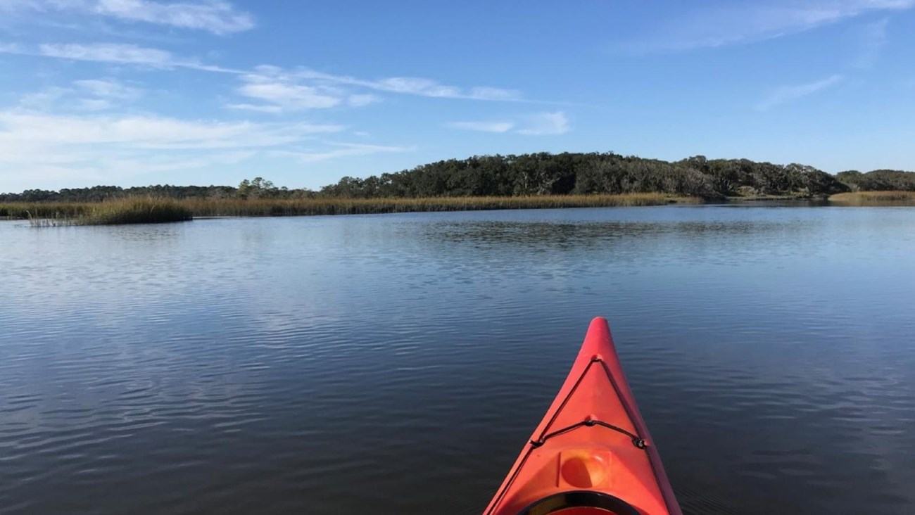
For many visitors, the passenger ferry is the practical way to reach Cumberland Island National Seashore. Experienced coastal paddlers may be attracted instead by the possibility of approaching this Georgia barrier island in a kayak, travelling through a landscape shaped by salt marsh, channels, wooded shores and the daily movement of tidal water.
An island approach with a maritime character
For many visitors, the passenger ferry is the practical way to reach Cumberland Island National Seashore. Experienced coastal paddlers may be attracted instead by the possibility of approaching this Georgia barrier island in a kayak, travelling through a landscape shaped by salt marsh, channels, wooded shores and the daily movement of tidal water.
This is a distinct undertaking from a casual paddle along a protected lake. A route that looks relatively modest on a map can become strenuous or hazardous if its timing is poor. The National Park Service's guidance emphasises the distance, tidal currents, weather and choice of launch sites. Treat this as inspiration and a planning guide, not a recommendation to attempt an island crossing without appropriate preparation.
Understand the tide before choosing the dates
Around Cumberland Island, tidal movement is central to the character of the water. The park describes a tidal range of roughly six to nine feet, or about 1.8 to 2.7 metres, and currents that can make progress demanding. A high tide prediction alone is not enough to understand when the current at a particular location will favour or oppose the direction of travel.
Use appropriate local tide and current predictions for both departure and arrival areas. The park identifies stations including St Marys, Sea Camp Dock, Harriet's Bluff and Cumberland Dividings as relevant starting points. Study the route and seek experienced local advice so that the timing is evaluated for the actual channels to be used. Do not transfer a prediction from one location uncritically to another.
Compare the mainland departure points
Two possibilities identified in the park's information are launches from St Marys and Crooked River State Park. They offer different routes to the island and require different tidal planning. Cumberland Sound and the associated passages add complexity to a journey from St Marys. A paddler should be prepared to evaluate the specific conditions rather than simply choose whichever departure point is most convenient by road.
The park describes a distance of about seven miles from St Marys to the Dungeness Dock and eight miles to Sea Camp Dock. Crooked River State Park is approximately six miles from Plum Orchard by the described route. These are one-way estimates, not sailing directions or guarantees of the actual distance travelled. The return trip deserves the same careful consideration as the outbound journey.
Plum Orchard and the longer wilderness option
Plum Orchard is one of the destinations associated with kayaking from Crooked River State Park. A properly planned trip can bring visitors into contact with the island's historic and natural landscape in a distinctive fashion. Verify landing arrangements and any applicable access restrictions before leaving the mainland, rather than assuming that a dock visible on a map is available for every type of use.
The park also describes longer journeys to Brickhill Bluff. Its published estimate of around 11 to 12 miles from Crooked River State Park makes the importance of endurance, equipment and timing apparent. A crossing should not be selected simply because the group has reserved a campsite. The party needs enough margin to cope with a change in conditions and the willingness to use a safer alternative if the intended route becomes unsuitable.
A touring kayak rather than an impulse rental
The park suggests touring or ocean kayaks for the exposed water and gusts that visitors may encounter. A suitable boat must still be matched to a paddler who is competent to control it and recover from a capsize in the conditions anticipated. The comfort of a recreational kayak on a pond should not be confused with suitability for an open-water journey in tidal channels.
If hiring equipment, ask a knowledgeable provider about the route, kayak characteristics and appropriate immersion protection. Establish whether the group meets the experience requirements and what instruction or guiding options are available. It is better to recognise a mismatch at the planning stage than to encounter it in a choppy sound. Beginners should consider more sheltered, instructor-led outings or travel to the island by ferry.
Wind and weather can change a passage
The marshes can offer some protection from the wind, but open water around the island may still become gusty and choppy. Consult forecasts relevant to the marine area, including the Jacksonville National Weather Service information to which the park directs visitors. Consider the effect of the predicted wind direction on both legs of the journey, together with the tide and the experience of the crew.
Do not assume that a pleasant outbound passage guarantees an equally comfortable return. Conditions can change while the paddlers are ashore, and the opposite direction may expose them to a different combination of wind and tide. Build an appropriate contingency into the plan. A visitor who is not confident evaluating these interactions should seek qualified local guidance rather than attempt to resolve uncertainty after launch.
Navigation, flotation and essential equipment
A well-prepared coastal paddler needs more than a boat and paddle. Carry and wear an appropriate life jacket and use equipment suited to the route and water temperature. Suitable navigation tools and the ability to use them independently matter in an environment where inlets and marsh channels can appear similar. The park also mentions the usefulness of having a way to remove water that enters the kayak.
Arrange appropriate communications and rescue equipment for the environment, and make sure the people travelling together understand how to use it. Leave a detailed float plan with someone reliable ashore, including the intended landings and agreed action if the party is overdue. Practise relevant skills in suitable conditions beforehand. A new piece of equipment is not a substitute for familiarity with it.
Camping is an additional commitment
The National Park Service requires reservations for those planning to camp on the island and advises kayakers to carry a printed permit. Establish the actual camping arrangements, access conditions and places where boats may be taken ashore before arranging to stay overnight. The park identifies options at Plum Orchard, Sea Camp and Brickhill Bluff, subject to current instructions.
Camping increases the load carried by a small boat. Food, drinking water, clothing and other essentials occupy space and change the handling of the kayak. Test the proposed arrangement on a suitable practice outing before attempting a longer trip. Confirm overnight parking arrangements at the mainland launch, and plan a land-based alternative if the weather or tides do not allow access to the reserved campsite safely.
Respect the island and shoreline
The attraction of arriving in a small boat is the opportunity to appreciate the relationship between the coast and the island's habitats. Observe wildlife without crowding it and protect the vegetation along the shore. Follow current landing and storage instructions. Do not allow a kayak, paddle or loose equipment to become a hazard to other visitors using a landing.
Visitors should also verify current park entrance fees and how they apply to people arriving independently by boat. Rules for pets, access, camping and protected areas may differ from those applying at the mainland launch. Consult the park's current information directly. The independence that a kayak provides comes with responsibility for understanding the conditions attached to its use.
Choosing the most rewarding way to visit
A sea-kayak approach to Cumberland Island can be a memorable component of a Georgia coastal holiday for suitably experienced and equipped paddlers. It is not a necessary test of dedication to the island or of boating ability. The ferry may be the most appropriate option for many visitors, particularly if their main interests are walking, history or observation ashore.
Plan an independent paddle only after obtaining current park information, route-specific tide and weather guidance, suitable equipment and a realistic assessment of the group's skills. If the route is beyond those skills, a guided coastal outing elsewhere may make a better addition to the holiday. The most rewarding maritime journey is the one that leaves the crew able to appreciate the destination and return without compromising good judgment.
Official source: National Park Service visitor information. The bow of a kayak looking towards the salt marsh at Cumberland Island National Seashore; National Park Service photograph. Public-domain federal agency photograph.
No claim to original U.S. Government works.
Source
National Park Service