
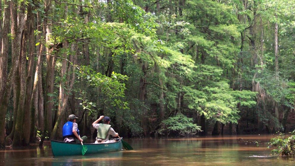
A canoe can reveal Congaree National Park in a way that a walking trail cannot. On Cedar Creek, the water slips between big trees, mirrored branches and the dark edge of a broad floodplain forest. The sounds are often smaller than the scenery: a paddle blade dipping bes
Slow travel beneath ancient trees
A canoe can reveal Congaree National Park in a way that a walking trail cannot. On Cedar Creek, the water slips between big trees, mirrored branches and the dark edge of a broad floodplain forest. The sounds are often smaller than the scenery: a paddle blade dipping beside the hull, birds in the canopy and occasional movement along the bank.
The National Park Service identifies a marked canoe route of approximately fifteen miles, beginning at Bannister's Bridge and eventually reaching the Congaree River. That is a description of the full waterway, not a recommended length for every visitor. A short out-and-back trip from a suitable landing may be much more rewarding for people who simply want to experience the forest at an unhurried pace.
Choose the kind of outing that suits the crew
Canoes provide space for equipment and a companion, while a kayak may be easier for an individual who prefers a lower seat and independent handling. Both require basic paddling ability, appropriate life jackets and a willingness to deal with branches or shallow sections. Congaree does not operate a general public canoe or kayak rental counter, though authorised local outfitters can arrange rentals or guided trips.
For a family or a visitor unfamiliar with floodplain waterways, a guided trip is often the more practical option. An experienced guide can plan around available access points and conditions. A self-guided group should know precisely where it intends to launch, how it will return and whether the route requires a shuttle vehicle. No one should assume that a mapped trail will be clear of obstructions.
Read the water before entering it
Water levels in Cedar Creek change substantially, and fallen trees can create passages that require a lift-over or portage. The park's separate canoe-trail advice warns that markers may be difficult to see at some stages. A waterproof map and navigation plan remain essential even when the day's journey is short. Check current conditions with park staff rather than relying on a photograph or last season's trip description.
The forest also supports wildlife, including turtles, deer, river otters, wading birds and occasional alligators. Observation is a pleasure, but giving wildlife ample space is an important part of paddling responsibly. Keep food secure, carry drinking water and avoid treating the trip as a swimming or wildlife-approach excursion.
Enjoy the forest on its own terms
An ideal Congaree day has a light agenda. Arrive with time to prepare, paddle slowly enough to notice the transition between trees and open stretches, and turn back before fatigue becomes a problem. The best reward might be a view into the canopy or a reflection in still water that would be invisible from a road.
Paddling here combines simple equipment with serious respect for conditions. With the correct launch plan and a realistic distance, Cedar Creek offers an unusually intimate way to understand one of the eastern United States' remarkable lowland landscapes. The park's website is the starting point for present-day trail, access and safety notices.
Source and photograph: US National Park Service — Congaree National Park. See the official visitor information for current conditions and rules.