
A detailed Cedar Keys small-boat guide covering federal wildlife-refuge access, seasonal island restrictions, the Seahorse Key lighthouse and responsible paddling.
An Old Florida island day that begins on the water
Cedar Key sits on Florida's Gulf coast, where shallow estuaries, low islands and a working waterfront create a quieter kind of boating destination. The Cedar Keys National Wildlife Refuge protects a scattered group of offshore islands that boaters can approach by kayak, charter boat or private vessel. Its charm lies in a sense of scale: the islands are close enough to feel inviting, but the tides, wildlife and access restrictions require serious attention.
The U.S. Fish and Wildlife Service explains that the refuge comprises thirteen islands, with a history reaching back to First Peoples who used the area as fishing camps. The protected landscape is now valued for coastal birds and other wildlife as well as public recreation. Anyone visiting should approach it as a refuge first and a boating playground second, letting the animals and their habitats set the pace.
Unlike a resort island with a marina, the experience centres on a modest craft, an informed route and time spent observing the coastal environment. A satisfying day can include a legal beach landing, a view of the old lighthouse on Seahorse Key from permitted areas and a patient period of birdwatching. It should never depend on entering closed habitat or treating every visible island as open to visitors.
How to reach the refuge
The gateway is the town of Cedar Key, reached by road on Highways 24 or 347, according to the refuge's visitor information. From there, visitors need a vessel to reach the islands, whether a kayak, tour boat or properly equipped private craft. The federal refuge does not provide an all-purpose passenger ferry linking every island, so make boat arrangements and verify the operating conditions before planning the day around an offshore visit.
For paddlers, this is an appealing destination precisely because a small boat can move quietly and allow close observation of the shore from the water. That does not make the environment benign. Shallow areas, tidal change, offshore wind and the exposed passage between keys require local knowledge and a conservative assessment of the weather, especially for an inexperienced crew.
Arrange an appropriate launch and return plan rather than assuming that every landing shown on a map is public. Some neighbouring islands are privately owned, and refuge boundary signs matter. A local outfitter or recognised guide can help a visitor interpret conditions and route choices, but each operator's current availability and safety practices should be confirmed separately.
Atsena Otie Key and the legal landing question
Access rules are central to responsible travel at Cedar Keys. The Fish and Wildlife Service identifies all of Atsena Otie Key as open to visitors, while only sandy beach areas of certain other refuge islands may be entered. Interior and vegetated areas of North Key, Snake Key, Deadmans Key, Live Oak Key, Scale Key, Cedar Point and Seahorse Key are closed without permission.
This distinction is easy to overlook when a quiet island appears empty. A beach may be accessible while shrubs, nesting habitat or the interior beyond it remain protected. Land lightly, check refuge signs and map boundaries before moving inland, and resist the temptation to cut through vegetation for a better photograph or a private picnic spot.
Seasonal restrictions can extend to the water itself. The refuge manager states that waters within roughly one hundred metres of Snake Key are closed to entry from March through June, and warns that restrictions may also be imposed near Seahorse Key if birds nest there again. Treat those as live management rules: consult the current federal refuge notice before departure, even if a previous trip or old guide described more permissive access.
Seahorse Key lighthouse: history across the water
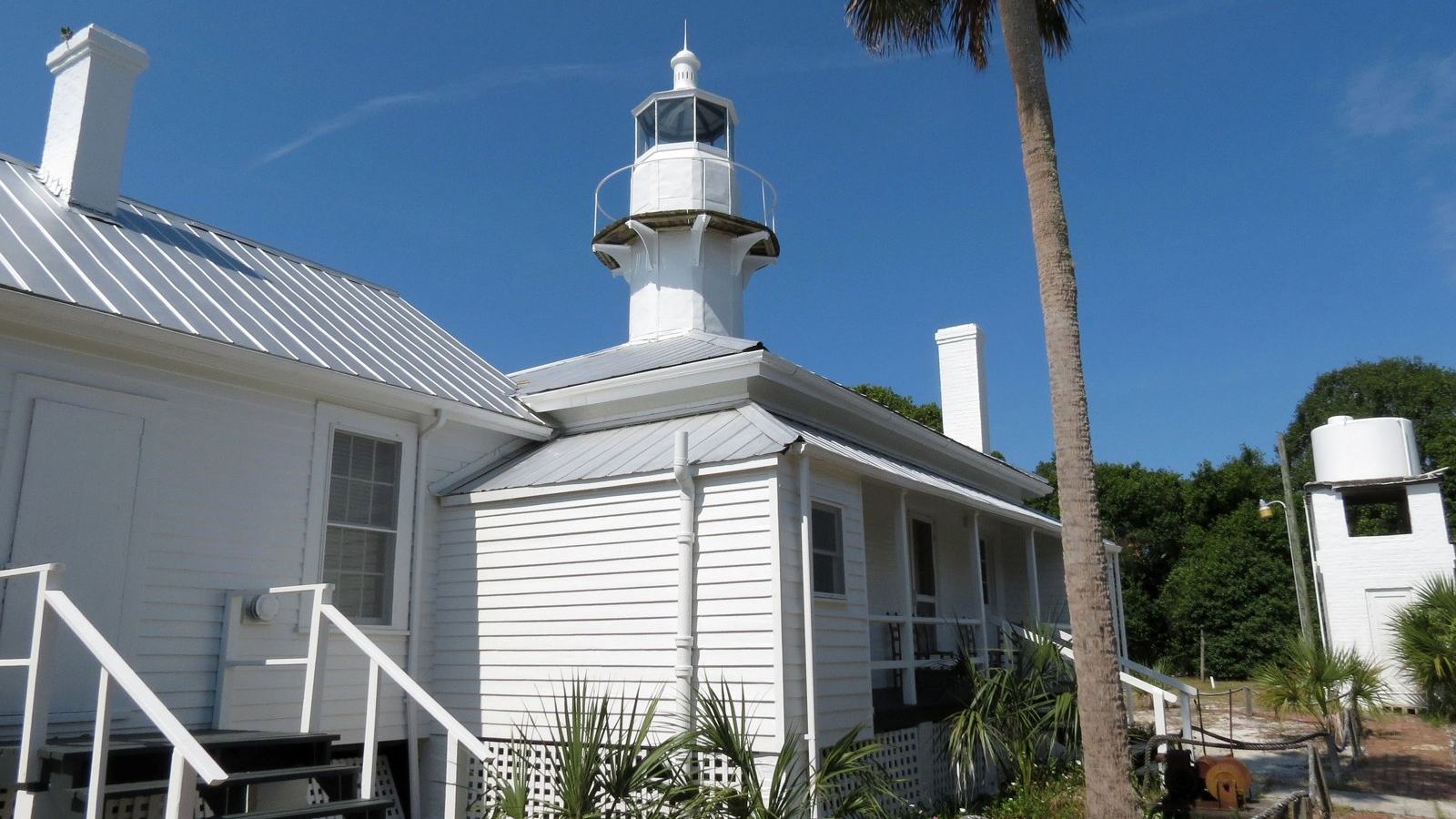
The nineteenth-century lighthouse on Seahorse Key is one of the area's most recognisable heritage features. Federal images of the tower show a coastal landmark associated with generations of navigation in the Gulf. Its interest is both architectural and maritime: the lighthouse belongs to the older system of visual aids by which crews found their way through low islands and changing weather.
A lighthouse view can make an excellent centrepiece for a small-boat itinerary, but the monument is not an invitation to enter restricted island vegetation. The Fish and Wildlife Service lists the vegetated interior of Seahorse Key among closed areas, and access may be further limited when wildlife protection demands it. Enjoy the structure from locations that are legally available and leave any specialised entry arrangements to the appropriate authorities.
The federal image accompanying this guide was taken by Larry Woodward for the U.S. Fish and Wildlife Service and is marked public domain in the agency's own media record. That provenance matters: a responsible boating publication should treat photographs with the same care it gives the protection of the place itself. The lighthouse has visual appeal without the need for an invented or generically substituted image.
Birdlife, quiet observation and responsible photography
Birdwatching is an important part of the refuge experience. The agency describes nesting and roosting wildlife that can include egrets, night herons, brown pelicans, white ibis, cormorants and more colourful visitors such as roseate spoonbills. The islands are not a guaranteed wildlife show on demand, however; movement, season and temporary closures influence what any individual paddler might see.
Bring binoculars or a telephoto lens and let distance do the work. A photograph that requires an animal to take flight or abandon its resting place is not worth making, especially around a nesting colony. If birds show signs of alarm, increase the separation and continue quietly, leaving the refuge as you found it.
Small-boat operators have a special opportunity to reduce disturbance through thoughtful speed and route decisions. Avoid racing past resting birds, landing repeatedly to change camera position or bringing unnecessary noise into a calm inlet. The most memorable observations often come after sitting still for a few minutes, allowing movement in the marsh and along the shoreline to reveal itself.
What is prohibited and why it matters
The refuge's published rules prohibit fires, camping, dogs off leash and collecting plants, animals, shells or artefacts. Those restrictions protect fragile habitats and irreplaceable evidence of earlier human activity. Travellers accustomed to gathering a few shells as souvenirs should make a conscious change here: photographs and notes are the appropriate keepsakes from a protected refuge.
Access is generally during daylight hours, from sunrise to sunset. Build a return margin into the day instead of lingering offshore until the last possible light. A falling tide, freshening wind or navigation mistake can become more consequential when the crew is tired and daylight is fading, particularly in unfamiliar shallow coastal waters.
The refuge is managed alongside the Lower Suwannee National Wildlife Refuge, and the agency provides current notices, visitor information and contact details on its official website. Use those resources to resolve uncertainty about a landing, activity or boundary before making a trip. Regulations are not a nuisance separate from the destination; they are part of the reason its wildlife persists.
Practical preparation for a kayak or small motorboat
Prepare for the trip as a genuine coastal outing. Check a current marine forecast, tide predictions and suitable charts, then match the proposed route to the craft and crew's experience. Wear a properly fitted personal flotation device and carry communication and navigation equipment appropriate for the distance from the mainland. Do not assume that a mobile phone alone will solve every problem.
Sun protection is important throughout the year, even in the milder seasons the refuge recommends for visits. Bring drinking water, sensible clothing and a way to pack out all litter. A basic plan shared with somebody ashore, including departure point, intended route and return time, is a simple precaution that can make a significant difference if conditions change.
An overnight stay on a refuge island is not part of the permitted experience, so do not base a cruising itinerary on anchoring and camping ashore. If travelling in a larger recreational boat, plan berthing and overnight arrangements outside the refuge using current local information. The refuge makes an excellent daylight excursion when all parties understand that shore access is deliberately limited.
The appeal of a place left undisturbed
A day at Cedar Keys can be visually modest compared with a famous tropical archipelago, yet its rewards are unusually durable. The low shoreline, birds, old lighthouse and shifting light offer a rich landscape for photographers and naturalists who do not need constant activity. The pleasure comes from moving at the speed the place allows.
The best itinerary might consist of little more than an early departure, a quiet paddle or boat ride, a permitted stop and a careful return to town. That apparent simplicity hides thoughtful decisions about access, tide, weather and wildlife. For small-boat owners, those decisions are part of the craft of travelling well, not obstacles to enjoying the day.
Before every visit, review the current Cedar Keys refuge page and public-use map, particularly the manager's notice about open islands, closed vegetation and seasonal water restrictions. Arrive ready to change plans if protected birds or conditions require it. A destination that remains healthy after visitors depart is one worth returning to.