
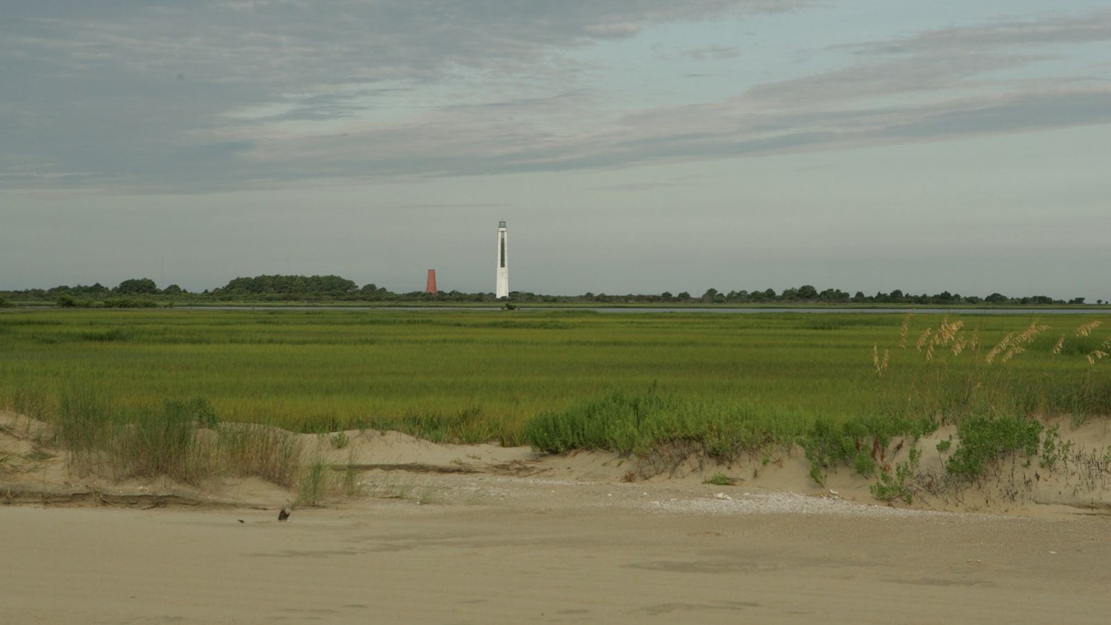
Cape Romain National Wildlife Refuge rewards careful small-boat trips to Bulls Island and the historic lights, with tidal planning and wildlife access rules at the heart of a safe day.
A barrier-island trip that begins with a tide table
Cape Romain National Wildlife Refuge runs along a remarkable stretch of the South Carolina coast north of Charleston. Marsh creeks, tidal flats and barrier islands form a landscape that is easiest to understand from the water, yet it is not a place to treat as an unrestricted beach-hopping playground. The US Fish & Wildlife Service says the refuge’s islands and estuaries are accessible only by boat, and the public can launch a private vessel from Garris Landing. That makes this a compelling day excursion for a small-boat owner with local knowledge and a realistic respect for changing tidal depth.
The attraction is the mixture of natural and maritime history. Bulls Island offers walking and wildlife observation, while Lighthouse Island is associated with a pair of historic coastal lights. From the boat, routes through the estuary reveal the meeting of salt marsh, maritime forest and open Atlantic shore. The refuge is also an important place for nesting birds, and its posted closure boundaries change when conservation needs change. A skipper can have an excellent day by planning for one legal landing and treating the rest of the coastline as scenery to observe at a distance.
Garris Landing and the approach by private boat
For boaters arriving with their own craft, Garris Landing is the straightforward mainland starting point identified by the refuge. Check launch access, tide and current before departure rather than assuming a particular creek will carry enough depth at every stage of the day. A chartplotter is useful, but shifting sand and broad mudflats still demand cautious visual navigation where conditions allow. Bring the ordinary coastal essentials: properly fitted personal flotation devices, reliable communication, weather information, anchor gear and a way to return before the refuge closes at sunset.
Travel distances can appear modest on a map while the actual route follows winding channels around shallow areas. Set a conservative fuel and daylight reserve that leaves room for a delayed landing or slower return in a headwind. The refuge does not advertise itself as a marina network with fuel, repairs or guaranteed berths scattered across its islands. Independent visitors should plan from a mainland base that can supply the vessel. If the day’s tide, weather or crew experience does not suit an exploratory route, the scheduled refuge concession trips are a practical alternative to taking an unfamiliar boat into a marsh maze.
Bulls Island: walk, observe and leave the landscape intact
Bulls Island is one of the most inviting destinations for visitors who want time ashore, combining beach scenery, maritime habitats and wildlife-watching opportunities. It is also a conservation area with regulations that differ from an ordinary public beach. The US Fish & Wildlife Service permits bicycles only on the island’s service roads, not on its beach or designated hiking trails. Camping is prohibited across the refuge. Visitors should carry water, sun protection and insect repellent; much of the appeal lies in being outdoors without the shops and services that normally support a busy coastal destination.
A landing plan should begin by finding out where the public may disembark on that particular day, including any restrictions around service facilities. The refuge expressly prohibits fishing from or into the service-area docking facilities on Bulls Island. Posted signs and staff instructions matter more than an old online itinerary or a remembered anchorage. Wildlife encounters are most rewarding when people keep their distance, move quietly and resist the temptation to pursue birds for a photograph. The best experience is often a slow shoreline walk in which the landscape is allowed to set the pace.
The two Cape Romain lighthouses tell a changing coastal story
The historic lighthouses on Lighthouse Island are among the area’s best visual landmarks. The older light dates from 1827 and the later tower from 1857, reflecting the long effort to make a difficult section of coast legible to mariners. Their value to the modern visitor is cultural as well as navigational: they illustrate an era when coastal trading routes depended on fixed landward references, crews’ judgement and changing shoals. A small-boat passage can frame the towers beautifully against the surrounding low island landscape without treating the structures themselves as an open-access attraction.
The geography has changed recently. The refuge notes that Lighthouse Island was divided by a breach in 2023, leaving north and south portions with separately managed closure areas. At the southern tips of South Lighthouse and North Lighthouse, refuge notices identify restrictions on landing or entry; other shore sections may also be marked. Do not navigate towards a beach simply because a lighthouse is visible beyond it. The responsible way to enjoy the lights may be from a safe, lawful position afloat, using binoculars or a long lens and leaving fragile shorelines to recover without foot traffic.
Bird nesting and refuge rules shape the itinerary
Cape Romain’s protective rules are not decorative. The Fish & Wildlife Service identifies Marsh Island and White Banks Islands as closed between 15 February and 15 September to protect nesting birds. Other closures affect parts of Lighthouse Island and Cape Island, and the refuge says boundaries may change with bird activity. The relevant information is the current sign, rope or flag in front of the skipper, not merely a seasonal date read before a journey. Choosing an alternative open shoreline is part of responsible access, especially when low-water conditions put birds and people closer together.
Pets are prohibited on refuge islands and on the Garris Landing pier, although the service says pets may remain aboard boats in estuary waterways. The refuge is open from sunrise to sunset and does not permit overnight camping, so it should be planned as a daylight outing rather than a casual overnight anchoring itinerary. Rules also cover collecting shells and commercial recreation; operators charging for tours or other services may need a special-use permit. Private visitors should not assume that a commercial charter’s permissions transfer automatically to their own activities.
Wildlife watching from the boat
A quiet vessel can be a particularly useful observation platform where landings are prohibited or unwise. The refuge’s mosaic of salt marsh, ponds, forest and beaches supports many kinds of birdlife, and the Fish & Wildlife Service describes the area as home to more than 293 bird species. That is a refuge-wide figure, not a guarantee that a visitor will encounter any particular species on a single outing. Slow travel, a sensible viewing distance and time spent drifting or holding position where safe can be more rewarding than racing between named beaches.
A skipper should take special care in narrow channels, where other small craft, fishing activity and shallow banks may limit manoeuvring room. Engine noise, wake and repeated close approaches can disrupt wildlife even when no landing is attempted. Give shorebird groups and nesting areas a generous buffer, follow posted closures and avoid blocking established routes. Photography is possible without edging into restricted habitats: long lenses and a patient crew are often the better tools. The aim is to leave no trace of the visit beyond good memories and images made from an appropriate distance.
A practical, flexible day rather than a rigid circuit
Begin with the latest refuge guidance, local marine forecast, tide information and a route that suits the boat’s draft. Select a primary shore visit only where access is explicitly open, then identify sheltered fallback waters and a turnaround time that returns everyone to the mainland well before sunset. Pack drinking water, food and dry bags for electronics, and brief passengers about why an apparently idyllic strip of sand may be closed. In a place shaped by tides, the willingness to abandon a landing is a sign of good seamanship rather than a failed holiday.
Cape Romain rewards restraint and preparation. Bulls Island, the historic lights and the surrounding creeks offer a rich combination of coastal scenery, wildlife and maritime heritage, but the refuge exists first to protect the places and species that make the trip worthwhile. With a suitable boat, current official rules and an understanding of the tide, visitors can enjoy its character without putting wildlife or themselves at unnecessary risk. For those without the right local experience, an authorised boat excursion offers another way to discover the same landscape responsibly.
Source
US Fish & Wildlife Service