
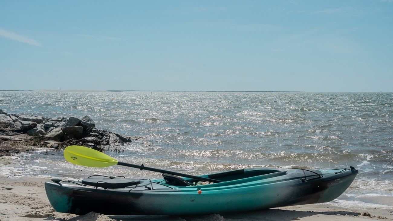
Cape Lookout offers barrier-island and salt-marsh kayaking along North Carolina's coast, where tides, wind and boat traffic demand careful preparation.
A coast made for exploring at paddling speed
Cape Lookout National Seashore in North Carolina protects a landscape of barrier islands, sandy shores and salt marshes. For kayakers, the attraction is not a single dramatic monument but the variety of waterways and views encountered when moving slowly near the islands. A small craft can reveal quiet marsh edges and stretches of beach that feel very different from a busy waterfront.
The National Park Service encourages paddlers to research the area carefully because coastal conditions change rapidly. The presence of shallow water does not automatically make an outing safe, and a route that looks easy at one state of the tide may become awkward when currents strengthen. Proper planning is part of the experience, not merely an administrative formality.
Starting from a familiar shore
The seashore includes several possible approaches for visitors using their own craft or an authorised local operator. Access depends on the intended route, the tide and how the kayak will be transported to the starting point. A first-time visitor should inspect the proposed launch or obtain reliable local guidance before committing to an itinerary.
A practical route begins with understanding where the paddler can return if the weather changes. Some marsh areas have soft or unstable banks, and a convenient beach may disappear or become difficult to reach at a different water level. Choosing a modest outing from a straightforward launch is preferable to becoming dependent on an unplanned landing.
The tide controls more than the water depth
Cape Lookout's paddling guidance places particular emphasis on tidal timing. The NPS explains that a large proportion of the tidal movement can occur during the strongest-flowing hours, when apparently calm passages may develop powerful currents and breaking conditions. Reading a tide table helps paddlers avoid working against the most difficult flow and choose suitable departure and return times.
Tide information needs to match the precise area being visited. Predictions at an ocean-side station or a nearby inlet may differ from conditions inside the marsh or beside another island. A paddler should use appropriate local data and recognise that wind can change the observed movement of the water. There is no universal departure time suitable for every route.
Wind and traffic create their own hazards
Powerboats may pass through channels used by kayaks, producing wake and making the low-profile craft harder to detect. Wind can also push a paddler away from the intended route or create waves on an open sound. Maintaining visibility and a predictable course is important, especially when rounding a bend or approaching a busy crossing.
Motorboat operators should moderate speed and give small craft room, while kayakers should avoid lingering where larger vessels need to manoeuvre. A group should plan how to communicate if passengers become separated by a wake or strong current. Appropriate equipment and a conservative route offer better protection than assuming other boaters will always notice the kayak in time.
Safety gear for a coastal paddling trip
The Park Service advises every paddler to carry a properly fitted US Coast Guard-approved personal flotation device and strongly encourages wearing it throughout the outing. It is difficult to put one on after an unexpected capsize. Clothing should also protect against cold-water exposure and the possibility of rapid changes in the weather.
A waterproofed communication device and suitable marine radio may be useful, though range and reception can vary. The group should understand how to contact assistance and avoid relying on a phone as its only safety measure. Drinking water, sun protection and a practical method of navigating are important even when the itinerary seems short.
Marsh navigation is less simple than it looks
A salt marsh may appear as open, navigable water at high tide but reveal extensive mud or vegetation as the level falls. Maps do not always show these changes in a way that is obvious to a newcomer. The NPS warns that some areas depicted as land may be submerged at certain times, complicating the task of recognising the route.
Moving slowly and observing the surroundings can be rewarding, but the crew should resist the temptation to enter every narrow channel. A passage that is easy to paddle into may become difficult to leave when the flow reverses. Keeping an accessible route back to more open water is a sensible approach.
Wildlife is best appreciated from a distance
The barrier islands and marshes support birds and other coastal animals, many of which are sensitive to repeated human disturbance. A kayak can approach quietly, but that advantage should be used responsibly rather than to surprise wildlife. Binoculars and a patient viewpoint help visitors enjoy the environment without pressing into protected resting or nesting areas.
Landing restrictions, seasonal closures and rules about camping should be checked with the Park Service before departure. An appealing strip of sand is not automatically available for a tent or picnic. Visitors can contribute to conservation by leaving rubbish behind in proper facilities, avoiding sensitive vegetation and following designated access arrangements.
A real kayak on the seashore
The official NPS photograph selected for this article shows an actual kayak resting on a Cape Lookout beach with coastal water in the background. It illustrates the type of small craft and environment involved, rather than substituting a fictional image or an unrelated destination. The photograph also reinforces that every kayaking journey involves practical decisions about where and how to land.
For travellers considering Cape Lookout, the best first step is the Park Service's current paddling and tide guidance, followed by discussion with a reliable local outfitter if needed. A well-chosen short route can provide a memorable experience among the islands without demanding advanced expedition skills. The reward is a close encounter with coastal scenery while treating the environment and fellow water users with care.