
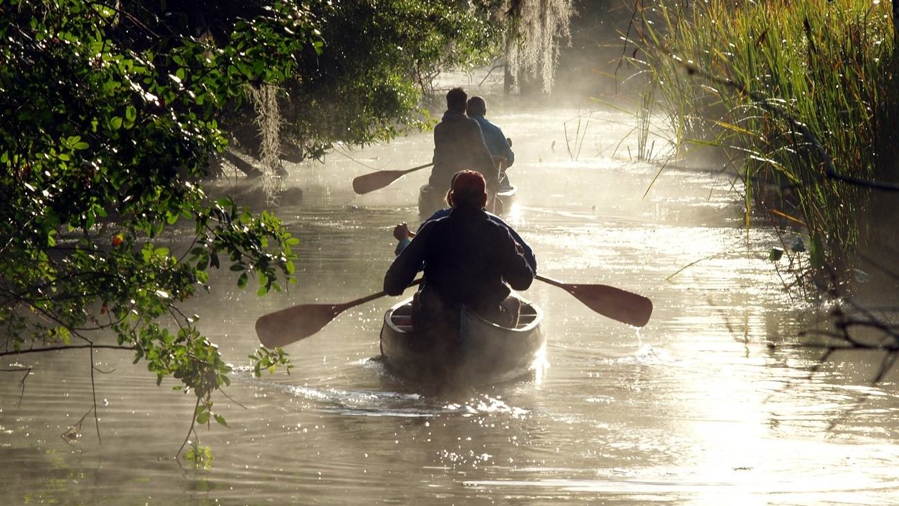
Big Cypress National Preserve offers Florida visitors challenging canoe and kayak routes through cypress forest, sawgrass and tidal mangroves, provided closures, tides and conditions are checked.
A paddle through South Florida's hidden waterways
Big Cypress National Preserve gives small-boat visitors a different view of southern Florida from the familiar roads through the wetlands. Its canoe and kayak routes pass through cypress strands, sawgrass country and coastal mangroves, sometimes linking freshwater landscapes with tidal water close to the Gulf. The National Park Service describes a series of one-day trips near the boundary with Everglades National Park, with journeys that can take several hours depending on conditions.
This is not a network of permanently calm canals. Routes can narrow beneath branches or open onto stretches affected by wind and tides, while remote takeout points complicate the return journey. Visitors who treat paddling as a relaxing way to observe a landscape should still give the trip the respect of a planned excursion. The most rewarding route is one that matches the group's experience, the season and the latest trail advice.
Turner River combines several habitats
The Turner River Paddling Trail is one of the preserve's defined outings. National Park Service route information lists it as approximately 9.93 miles, with an estimated duration of four and a half to seven hours. The described starting point is the paddling access on U.S. 41 west of Turner River Road, with a takeout at Chokoloskee Island or the park's Gulf District Ranger Station. This is classed as a moderate outing rather than a short beginner circuit.
Along the route, the surroundings change from cypress and sawgrass toward intertidal mangrove habitat. The transition is part of the attraction, revealing how South Florida's gently sloping waters connect inland and coastal environments. Paddlers also need to watch for other traffic, including airboats through lower prairie stretches and powered craft nearer the destination. A long journey with several different water types merits an early launch and a realistic time allowance.
Choose a trail that is actually open
Big Cypress lists several named routes, but the current trail guidance is not a promise that all are fully passable. The preserve warns that Halfway Creek and the Lefthand Turner River trail are not fully passable at present and advises visitors to contact the park. The Halfway Creek route is described as about 7.28 miles, while the shorter Lefthand Turner route is listed at approximately 3.65 miles, with tides important to planning.
The Sandfly Island Loop offers a different option. The park gives its distance as about 3.73 miles and an estimated three to five hours from the Gulf District Ranger Station in Everglades City, with additional time possible in wind or unfavourable tides. A relatively short number of miles can therefore involve a substantial day on the water. Choosing a currently usable trail is more important than selecting the shortest distance printed on an old map.
Seasons, tides and water levels change the trip
The National Park Service identifies November through March as the usual paddling season, when lower water levels, temperatures and fewer biting insects can make outings more manageable. It also says the routes may be accessible outside that period. That is not an assurance that summer journeys will feel comfortable, especially when a headwind, an incoming tide or strong sunshine slows a group.
Some routes are connected to tidal creeks, so the direction of travel can make a considerable difference to effort and timing. Before departure, paddlers need to assess forecasts, tides and current park conditions together. A mild start to the day does not guarantee the same conditions at the takeout. The preserve's advice is to avoid overestimating ability or assuming that a route will take the minimum time on its published estimate.
Plan the landing and transport before launch
Several Big Cypress trips are one-way paddles rather than simple loops. The National Park Service recommends arranging a second vehicle at the takeout where necessary, with the Turner River route ending around Chokoloskee or the Gulf District Ranger Station. Those places need to be treated as precise destinations, not interchangeable names for the same car park. The distance between road access points can make a missed shuttle arrangement a serious nuisance.
A route plan should also include time for loading boats, checking equipment and finding the correct trail entrance. Visitors may need to navigate narrow channels where signs are less obvious than on a land trail. It is sensible to bring the relevant park map and confirm local launch conditions with staff.
Watch the living wetland without disturbing it
Cypress stands, grassy openings and mangrove passages are the defining sights on these trails. A canoe or kayak travels low in the water, allowing visitors to observe vegetation, reflections and birdlife without the noise of a conventional engine. Much of the attraction lies in moving slowly enough to notice how the character of the landscape changes from one section to the next.
Quiet travel still calls for care. Wildlife needs room, and entering vegetation or forcing a boat through unsuitable shallows can damage the places visitors came to experience. The park's route descriptions identify airboat and powerboat traffic in specific areas, so keeping watch is also important. Visitors should use established landings, avoid obstructing channels and view animals from a respectful distance rather than moving toward them for a photograph.
Carry equipment for a full day afloat
The preserve describes these trips as requiring intermediate canoeing or kayaking skills. That recommendation is worth taking seriously where routes pass through tidal water or long stretches without a convenient road exit. A properly fitted buoyancy aid, drinking water, sun protection and a means of communicating a change of plans are practical basics. The weather can make an apparently straightforward outing much harder than its distance suggests.
Florida thunderstorms deserve special attention, particularly in warmer months. The National Park Service advises checking forecasts and seeking suitable shelter before a storm reaches the route. Paddlers should also leave a trip plan with someone ashore and make a clear decision about when to turn back if progress is too slow. These precautions are not a reason to avoid the water; they help make a memorable journey manageable.
A distinctive alternative to a busy coastal day
Big Cypress offers a kind of boating holiday built around landscapes rather than speed or marina facilities. The Turner River and Sandfly Island routes show how much can change over relatively few miles, from enclosed cypress waterways to open coastal channels. Published route times provide a starting point, while the current condition notices and visitor guidance determine what can sensibly be attempted on a particular day.
Visitors should begin by choosing an open route, checking the tide and weather, and organising the return journey. A local ranger can help clarify trail conditions before a group commits to a launch. Travelling patiently through these waters provides the best chance to enjoy the scenery without damaging it. In this part of Florida, careful preparation makes room for the quiet experience that attracts paddlers in the first place.