
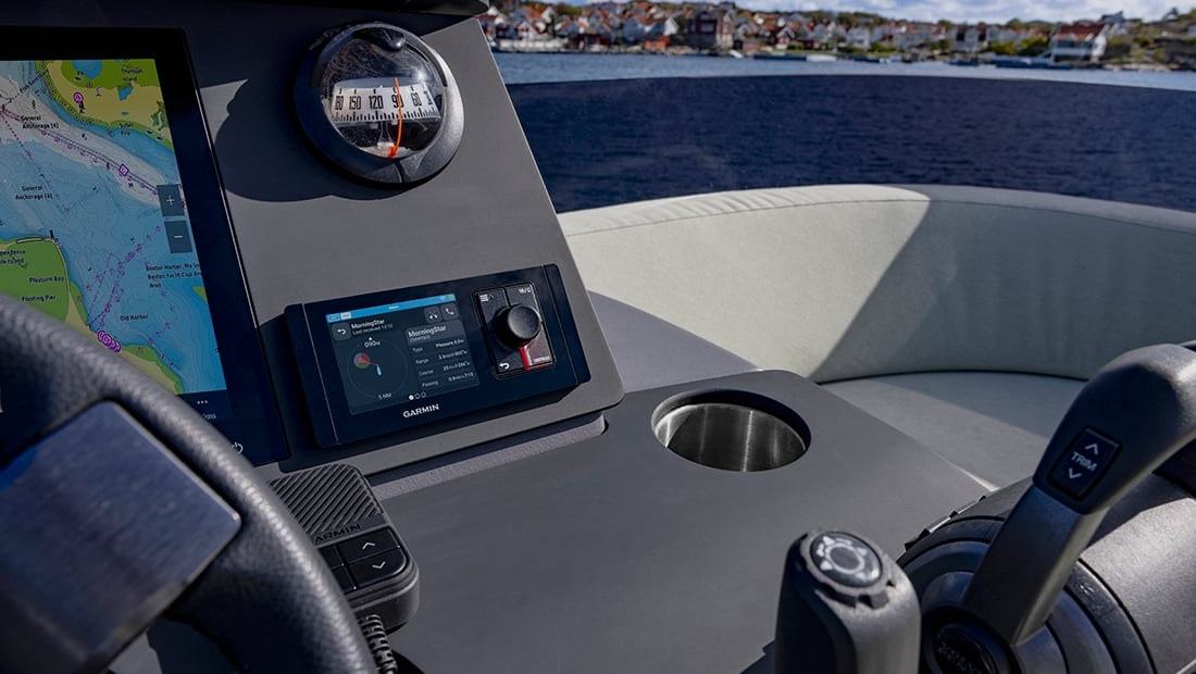
Automatic Identification System data can help small-boat crews interpret the traffic around them. Its benefits are real, but AIS information needs context and should support, not replace, a continuous lookout.
What an AIS display adds to the day
A moving boat can be difficult to judge by sight alone, especially on a busy estuary or around commercial shipping. Automatic Identification System, or AIS, is a radio-based way for suitably equipped vessels to exchange identification and movement information. Garmin's July 2026 marine-safety article explains that receiving AIS data can reveal vessel names, reported positions, speed and course. For recreational crews, these extra details can help build a fuller picture of traffic before a possible crossing becomes uncomfortable.
An AIS symbol is not a promise that the displayed information is correct or complete. Some small boats have no transmitter, some installations are switched off and equipment can fail. People in kayaks, swimmers, unmarked obstructions and many other hazards will never appear as a reliable target. AIS is therefore most useful as one input alongside eyesight, hearing, radar where fitted, the chart and sensible speed. The international collision-prevention rules still require a proper lookout and appropriate action, regardless of what a screen suggests.
Receiving is different from transmitting
One practical distinction is whether the fitted equipment receives other vessels' data or also sends the boat's own information. Garmin describes the Signal VHF 220 as a receive-capable marine radio, while products including the Signal VHF 400 and compatible Cortex and dedicated AIS transceiver systems can support transmitting. Buyers should verify the exact model, antenna arrangements, licensing requirements and regional rules. A chartplotter displaying targets does not necessarily mean the boat itself is visible to other AIS users.
Correct identification data also matters. A transmitting installation needs the appropriate vessel information programmed and maintained. A ship's reported course and speed can be useful for assessing a developing situation, but they are not a guarantee of its future manoeuvre. On a short coastal run, the skipper should know what the symbols and vectors mean before traffic becomes dense. Reading a manual at speed is a poor substitute for familiarisation at the berth.
Reading an alert in context
Compatible systems may highlight a target when its predicted track could intersect the boat's own course. Garmin outlines graded visual warnings on connected displays, helping the helm distinguish more distant traffic from a vessel requiring attention. Alarm thresholds are configurable on some equipment and should reflect the operating situation. Too many warnings can be distracting, while thresholds set too narrowly may fail to prompt attention with enough time to respond.
An alarm is a prompt to reassess the whole situation, not an instruction to make a particular turn. Confirm the target visually if possible, check for nearby craft, consider the current rules and act in good time. A course alteration that avoids one AIS target may create a problem with another unseen boat. Share any observations with crew, but maintain clear command at the helm. In crowded waters, repeated scanning of the horizon and instruments remains more important than watching one red symbol.
Communications can support good seamanship
VHF communication may help clarify an uncertain situation, provided it follows local radio regulations and does not delay the action required by the collision rules. Some integrated Garmin systems allow the operator to select an AIS target and obtain information useful for initiating a call. Digital selective calling can also connect communication and identification features when correctly configured. This convenience should not create overconfidence: not every vessel carries compatible equipment, and a call may go unanswered.
A sensible routine is to keep the radio ready, monitor the proper channel and know how to make a clear, concise transmission. Crew should be trained to give the vessel's position and nature of a problem without searching through unfamiliar menus. The skipper must still be prepared to manoeuvre safely whether or not anyone answers. Technology can make communication quicker, but it cannot replace a shared understanding of the boat's route, the traffic and the action required.
Equipment can serve wildlife protection too
Garmin also describes collaboration with the Whale and Vessel Safety Taskforce to help AIS-equipped boaters recognise North Atlantic right whale management areas. Certain compatible equipment can display warnings related to relevant zones or marked objects. This is a helpful example of navigation technology extending beyond boat-to-boat traffic. It does not remove a skipper's obligation to obey current restrictions, look out for wildlife and slow down when required.
Wildlife can surface unexpectedly and may be present outside any electronic zone. The best practice is to consult official conservation notices for the cruising area and maintain a careful visual watch. Electronic information might draw attention to a relevant area but should not be treated as a live, exhaustive map of animal locations. Awareness of local seasonal rules is particularly important when visiting a new coast, where protections and speed limits may differ substantially from the home harbour.
Make AIS part of a layered routine
Before a busy passage, confirm that the receiver or transceiver powers up, the antenna and connections are sound and targets are appearing where expected. Check the display's symbol legend and alarm settings while stationary. If the boat also has radar, understand where the two tools agree and where their coverage differs. A chartplotter may combine data in one view, but each layer originates from a different sensor or service and has its own potential errors.
For new boaters, the most useful habit is regular movement between looking outside and interpreting the instruments. AIS makes sense when it supports that rhythm rather than taking the skipper's eyes away from the water. Practise on an easy day with an experienced operator, and record any settings worth retaining. As Garmin's guidance shows, better information can genuinely improve awareness, provided the crew remembers its limits and continues to navigate the boat rather than the display.
Editorial source: Garmin. This original leisure-boating feature is based on information from the named source; check current local navigation requirements and the equipment manufacturer before departure.
Source
Garmin